0 Barnett Ridge Rd Unit HK25000782 Sawyer, KY 42834
Estimated payment $3,958/month
Highlights
- 336.5 Acre Lot
- Creek On Lot
- Lot Has A Rolling Slope
- Mature Trees
About This Lot
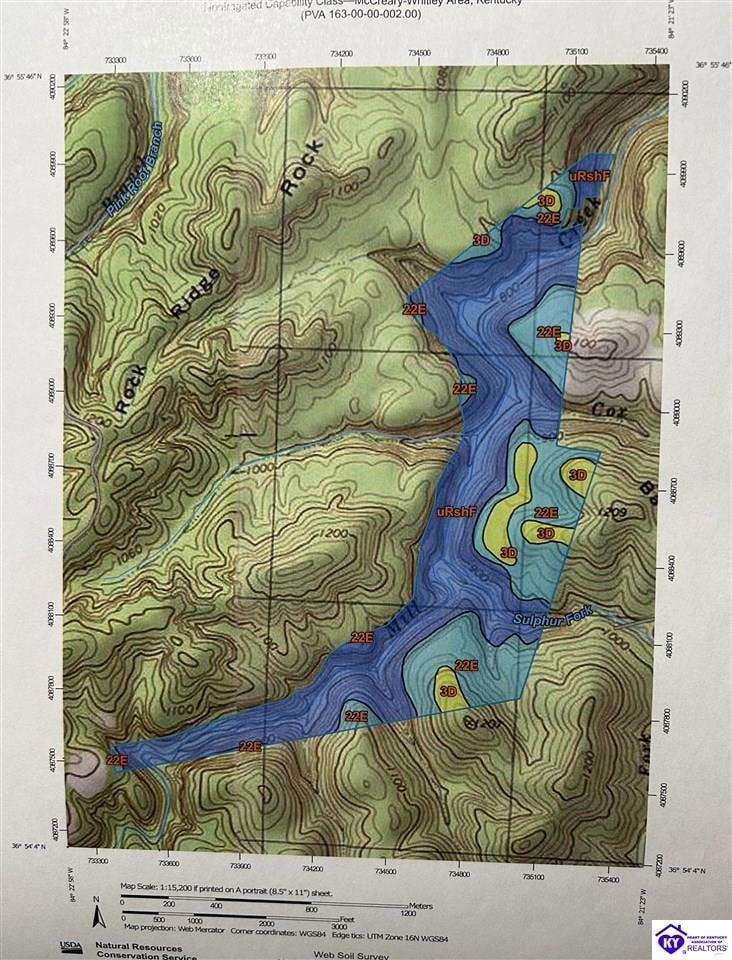
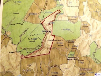
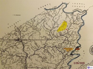
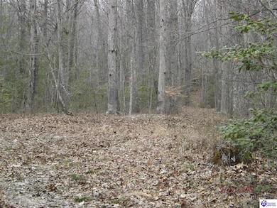
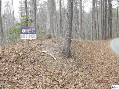
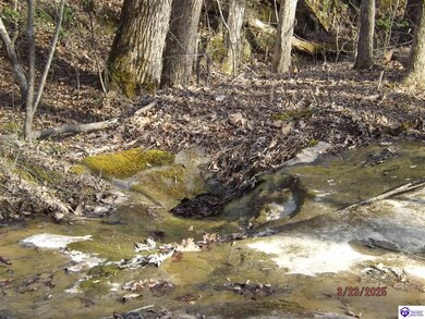
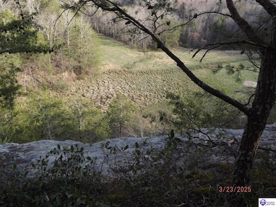
Don't miss this rare opportunity to own a private retreat with timber investment potential. This 336.5-acre parcel is completely surrounded by the Daniel Boone National Forest, offering unmatched solitude and natural beauty. Mill Creek runs the entire north-south length of the property, with stunning cliffside views along the western edge. The land features multiple natural springs, and existing logging roads provide interior trails for easy access. The property has not been timbered in 10 years, and a recent appraisal shows that 48% of the timber inventory consists of various oak species. Located west of Cumberland Falls State Resort Park and just south of the Cumberland River, this tract is only 45 minutes from Somerset, KY. It sits in McCreary County, which contains the largest portion of Daniel Boone National Forest. The county lies on the Tennessee border, west of I-75. Access is available from the east side of the property via sloping (not steep) terrain. A special use permit from the U.S. Forest Service for access may be available for one-year or 20-year terms. USFS Road 5250 (Barnet Ridge) runs near the property and can be seen on maps. At the end of Forest Service Rd., park your car along the side. Then walk or ATV to the property. The coordinates for the property are 36°54'53.0"N 84°21'53.0"W (36.914721, -84.364732). Property is subject to a special permit for road use. Approximately 25 miles from Burnside, KY and 35 miles from Corbin, KY. Data and acreage is believed to be accurate but not guaranteed. Buyer to verify information prior to offer. All map boundary representations are approximate and not intended for legal use or as a survey. Gather your friends and invest in land in 2025!
Last Listed By
AMERICANA REAL ESTATE AND AUCTIONS License #184251 Listed on: 03/04/2025
Property Details
Property Type
- Land
Lot Details
- 336.5 Acre Lot
- Lot Has A Rolling Slope
- Mature Trees
- Heavily Wooded Lot
Outdoor Features
- Creek On Lot
- Spring on Lot
Utilities
- Electricity Not Available
- Water Not Available
- Sewer Not Available
Listing and Financial Details
- Assessor Parcel Number 1630000002.00
Map
Home Values in the Area
Average Home Value in this Area
Property History
| Date | Event | Price | Change | Sq Ft Price |
|---|---|---|---|---|
| 03/04/2025 03/04/25 | For Sale | $600,000 | -- | -- |
Source: Heart of Kentucky Association of REALTORS®
MLS Number: HK25000782
Disclaimer: Certain information contained herein is derived from information provided by parties other than Homes.com. All information provided is deemed reliable, but is not guaranteed to be accurate and should be independently verified.
![]() IDX information is provided exclusively for personal, non-commercial use, and may not be used for any purpose other than to identify prospective properties consumers may be interested in purchasing. Information is deemed reliable but not guaranteed.
IDX information is provided exclusively for personal, non-commercial use, and may not be used for any purpose other than to identify prospective properties consumers may be interested in purchasing. Information is deemed reliable but not guaranteed.
- 1665 Clark Bottom Rd
- 4520 Mill Creek Rd
- 35 Clark Bottom Rd
- 0 Off Ky-896 Noe's Dock
- 1111 Cumberland Falls Rd
- 150 Punch's End
- 1045 John Hyden Rd
- 4091 Bee Creek Rd
- 4050 Bee Creek Rd
- 353 Jasper Lake Dr
- 278 John Dr
- 9999 Bee Creek Rd
- 2141 Blue John Rd
- 8888 Highway 90
- 2092 Vanover Ridge Rd
- 235 Lake Dr
- 2557 Bee Creek Rd
- Tract # Moonbow Falls
- 15660 Kentucky 192
- 10553 Sandhill Rd
