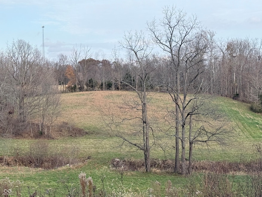
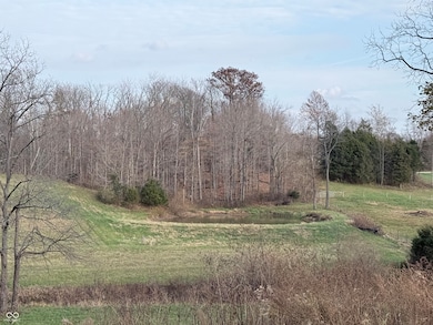
0 Cr 850w Glenwood, IN 46133
Estimated payment $319/month
About This Lot
Sellers prefer buyer to purchase both parcels that are listed.
Property Details
Property Type
- Land
Est. Annual Taxes
- $344
Lot Details
- 9 Acre Lot
Community Details
- No Home Owners Association
Listing and Financial Details
- Tax Lot 21-07-34-100-001.000-012
- Assessor Parcel Number 210734100001000012
Map
Home Values in the Area
Average Home Value in this Area
Property History
| Date | Event | Price | List to Sale | Price per Sq Ft |
|---|---|---|---|---|
| 11/18/2025 11/18/25 | For Sale | $55,000 | -- | -- |
Source: MIBOR Broker Listing Cooperative®
MLS Number: 22073271
Disclaimer: Certain information contained herein is derived from information provided by parties other than Homes.com. All information provided is deemed reliable, but is not guaranteed to be accurate and should be independently verified.
![]() Based on information submitted to the MLS GRID. All data is obtained from various sources and may not have been verified by broker or MLS GRID. Supplied Open House Information is subject to change without notice. All information should be independently reviewed and verified for accuracy. Properties may or may not be listed by the office/agent presenting the information. Some IDX listings have been excluded from this website.
Based on information submitted to the MLS GRID. All data is obtained from various sources and may not have been verified by broker or MLS GRID. Supplied Open House Information is subject to change without notice. All information should be independently reviewed and verified for accuracy. Properties may or may not be listed by the office/agent presenting the information. Some IDX listings have been excluded from this website.
- 203 N Durbon St
- 103 S Kendall St
- 7746 W Co Road 50 N
- 4665 E Base Rd
- 8232 W Cr 400 Rd S
- 303 S County Road 550 W
- 9444 N 550 W
- 7519 E 500 N
- 8345 W Co Rd 300 N
- 4267 W State Road 44
- 579 S County Road 400 W
- 5265 W Coletrane Hill Rd
- 5397 W Coletrane Hill Rd
- 3368 W Serenity Pkwy
- 2092 N 250 E
- 2324 E 200 N
- 4151 E 550 N
- 5864 S Garrison Rd
- 0 S Co Road 375 W
- 3600 S Co Road 375 W
- 3600 Western Ave
- 100 W Main St Unit Apartment 3
- 340 N Adams St
- 201 W Warrick St
- 1001 W Colonial Dr
- 2900 S Memorial Dr
- 1311 S 17th St
- 1218 S 18th St Unit 2
- 300 S Washington St
- 300 S Washington St
- 300 S Washington St
- 921 S 14th St Unit Half
- 1628 A Ave
- 509 S 18th St
- 2225 Broad St
- 302 S 12th St
- 302 S 12th St
- 325 S 12th St Unit 1
- 925 Broad St Unit .5
- 116 E Chestnut St Unit 120 Chestnut apt 8
