
0 Cty Rd Ss Rd Unit 1924788 Webster, WI 54664
Estimated payment $2,920/month
Total Views
206
60
Acres
$8,773
Price per Acre
2,616,649
Sq Ft Lot
About This Lot
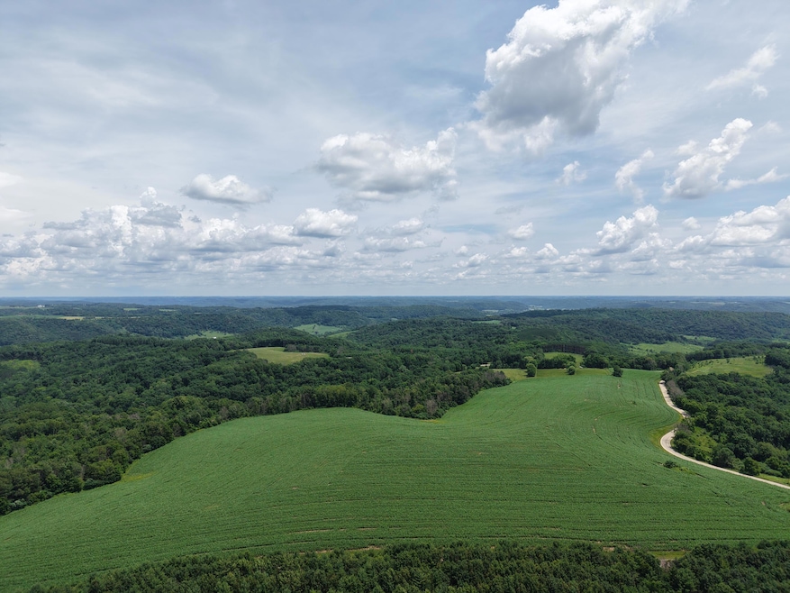
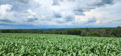
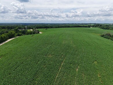
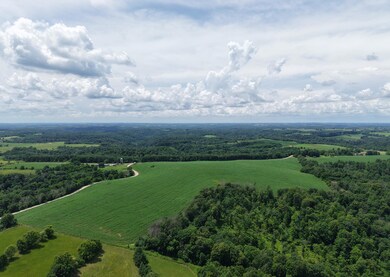
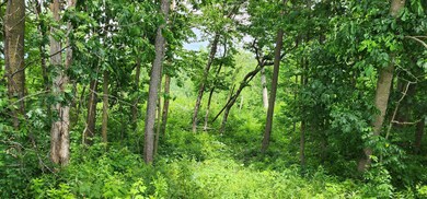
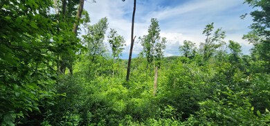
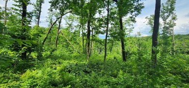
The beautiful property sits up high and offers panoramic views in all directions. There are approximately 45-acres of ridgetop cropland & 14-acres of wooded land w/ mature trees. Located between Viroqua and La Farge, this could be your ideal spot to build a home, recreate, hunt, or farm your own land in the beautiful Driftless Region. Located just across the street is the an access point to Tunnelville Cliffs nature preserve. This Mississippi Valley Conservancy land provides an additional 1271 acres to explore and enjoy. Schedule a showing today. This won't last long. The property is located on the corner of Cty Rd SS and Tunnelville Rd. (The wooded 14-acres are required by the DNR to be withdrawn from the MFL program upon being transferred to a new owner.
Listing Agent
United Country - Oakwood Realty, LLC License #55133-90 Listed on: 07/01/2025
Property Details
Property Type
- Land
Est. Annual Taxes
- $286
Schools
- La Farge Elementary And Middle School
- La Farge High School
Additional Features
- 60.07 Acre Lot
- Horses Allowed On Property
Listing and Financial Details
- Assessor Parcel Number 038006230000
Map
Create a Home Valuation Report for This Property
The Home Valuation Report is an in-depth analysis detailing your home's value as well as a comparison with similar homes in the area
Home Values in the Area
Average Home Value in this Area
Tax History
| Year | Tax Paid | Tax Assessment Tax Assessment Total Assessment is a certain percentage of the fair market value that is determined by local assessors to be the total taxable value of land and additions on the property. | Land | Improvement |
|---|---|---|---|---|
| 2024 | $57 | $2,500 | $2,500 | $0 |
| 2023 | $56 | $2,600 | $2,600 | $0 |
| 2022 | $63 | $2,600 | $2,600 | $0 |
| 2021 | $62 | $2,600 | $2,600 | $0 |
| 2020 | $65 | $2,500 | $2,500 | $0 |
| 2019 | $57 | $2,400 | $2,400 | $0 |
| 2018 | $50 | $2,400 | $2,400 | $0 |
| 2017 | $50 | $2,400 | $2,400 | $0 |
| 2016 | $52 | $2,400 | $2,400 | $0 |
| 2015 | $64 | $2,400 | $2,400 | $0 |
| 2014 | $58 | $2,500 | $2,500 | $0 |
| 2013 | $59 | $2,600 | $2,600 | $0 |
Source: Public Records
Property History
| Date | Event | Price | Change | Sq Ft Price |
|---|---|---|---|---|
| 07/01/2025 07/01/25 | For Sale | $527,000 | -- | -- |
Source: Metro MLS
Purchase History
| Date | Type | Sale Price | Title Company |
|---|---|---|---|
| Interfamily Deed Transfer | -- | None Available |
Source: Public Records
Similar Property in Webster, WI
Source: Metro MLS
MLS Number: 1924788
APN: 038-00623-0000
Disclaimer: Certain information contained herein is derived from information provided by parties other than Homes.com. All information provided is deemed reliable, but is not guaranteed to be accurate and should be independently verified.
![]() IDX information is provided exclusively for personal, non-commercial use, and may not be used for any purpose other than to identify prospective properties consumers may be interested in purchasing.
IDX information is provided exclusively for personal, non-commercial use, and may not be used for any purpose other than to identify prospective properties consumers may be interested in purchasing.
IDX listing data provided by Multiple Listing Service, Inc. Information is supplied by seller and other third parties and has not been verified.
Copyright 2025 – Multiple Listing Service, Inc. – All Rights Reserved.
Nearby Homes
- Lt0 S Elk Run Rd
- 637 N Mill St
- 504 W Main St
- 621 N Mill St
- 415 N Gold St
- 206 S Silver St
- 249 S State St
- E12967 Maple Ridge Rd
- S5712 N Illusion Dr
- 00 River Rd
- 0000 River Rd
- S5978 County Rd S
- 114 W York Rd
- 211 N Main St
- 217 W Commercial St
- 12824 River Dr
- E10992 Wisconsin 56
- 13622 Ames Dr
- 2.089 Ac Cushman Rd
- 0000 County Road P