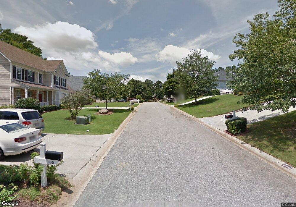
0 Dalston Way Unit 73 8054915 Peachtree City, GA 30269
Estimated Value: $508,966 - $584,000
--
Bed
3
Baths
2,246
Sq Ft
$242/Sq Ft
Est. Value
About This Home
This home is located at 0 Dalston Way Unit 73 8054915, Peachtree City, GA 30269 and is currently estimated at $543,492, approximately $241 per square foot. 0 Dalston Way Unit 73 8054915 is a home located in Fayette County with nearby schools including Crabapple Lane Elementary School, Booth Middle School, and McIntosh High School.
Ownership History
Date
Name
Owned For
Owner Type
Purchase Details
Closed on
Oct 30, 1998
Sold by
Magnus Homes
Bought by
Parviz Tahir and Parviz Samina
Current Estimated Value
Home Financials for this Owner
Home Financials are based on the most recent Mortgage that was taken out on this home.
Original Mortgage
$149,300
Outstanding Balance
$32,761
Interest Rate
6.65%
Mortgage Type
New Conventional
Estimated Equity
$510,732
Create a Home Valuation Report for This Property
The Home Valuation Report is an in-depth analysis detailing your home's value as well as a comparison with similar homes in the area
Home Values in the Area
Average Home Value in this Area
Purchase History
| Date | Buyer | Sale Price | Title Company |
|---|---|---|---|
| Parviz Tahir | $165,900 | -- |
Source: Public Records
Mortgage History
| Date | Status | Borrower | Loan Amount |
|---|---|---|---|
| Open | Parviz Tahir | $149,300 |
Source: Public Records
Tax History Compared to Growth
Tax History
| Year | Tax Paid | Tax Assessment Tax Assessment Total Assessment is a certain percentage of the fair market value that is determined by local assessors to be the total taxable value of land and additions on the property. | Land | Improvement |
|---|---|---|---|---|
| 2024 | $2,653 | $188,200 | $28,500 | $159,700 |
| 2023 | $2,163 | $180,460 | $28,500 | $151,960 |
| 2022 | $2,582 | $147,860 | $28,500 | $119,360 |
| 2021 | $2,516 | $128,900 | $28,500 | $100,400 |
| 2020 | $2,569 | $124,100 | $28,500 | $95,600 |
| 2019 | $2,639 | $126,180 | $28,500 | $97,680 |
| 2018 | $2,526 | $118,940 | $28,500 | $90,440 |
| 2017 | $3,691 | $117,020 | $28,500 | $88,520 |
| 2016 | $3,490 | $106,780 | $28,500 | $78,280 |
| 2015 | $3,312 | $99,820 | $28,500 | $71,320 |
| 2014 | $3,167 | $93,940 | $28,500 | $65,440 |
| 2013 | -- | $91,780 | $0 | $0 |
Source: Public Records
Map
Nearby Homes
- 308 Dalston Way
- 103 Ardenlee Dr
- 231 Clifton Ln
- 404 Las Brasis Ct
- 249 Clifton Ln
- 206 Las Brasis Ct
- 152 Ardenlee Dr
- 512 Las Brasis Ct
- 100 Leisure Trail
- 132 Sea Island Dr
- 105 Farmington Dr
- 413 Silverbell Ct
- 120 Red Maple Dr
- 325 Caledonia Ct
- 115 Cottage Grove
- 510 Cunninghame Ct
- 125 Red Maple Dr
- 223 Sweetbay Ct
- 718 Avalon Way
- 308 Corrigan Trace
- 0 Dalston Way Unit 8627773
- 0 Dalston Way Unit 8512190
- 0 Dalston Way Unit 8664812
- 0 Dalston Way Unit 8796472
- 0 Dalston Way Unit 8797924
- 0 Dalston Way Unit 8837773
- 0 Dalston Way Unit 3199129
- 0 Dalston Way
- 310 Dalston Way Unit 73
- 310 Dalston Way
- 312 Dalston Way
- 115 Ardenlee Dr
- 306 Dalston Way
- 314 Dalston Way
- 117 Ardenlee Dr
- 117 Ardenlee Dr Unit 90
- 113 Ardenlee Dr
- 113 Ardenlee Dr Unit 88
- 305 Dalston Way
- 119 Ardenlee Dr
