
Seller's Agent in 2021
Grace Pond
Roberts Realty Group Inc
(251) 232-8903
126 Total Sales
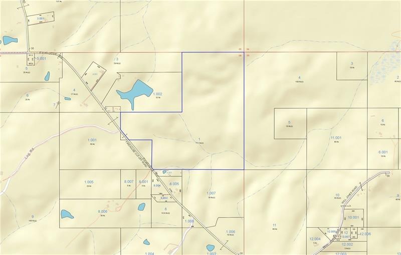
This 111 acre tract of beautiful rolling land has a good mix of sloping and level topography and is priced at less than $1,350 an acre. This is a perfect investment for hunting, timber and/or outdoor activities. It is located just off Hwy 45, in Vinegar Bend on Firehouse Road which is about 40 miles north of Mobile, west of Deer Park and east of the Mississippi State line. Alabama has a reputation for having some of the best wildlife populations, and this area will not disappoint. A portion of this property has been cleared and is ready for new crops and/or timber. The southern most section of the property has a conversion of a couple of stream beds which would make a perfect site for a lake. Don’t let this 111 acre parcel get SOLD before you have an opportunity to see it for yourself.
Property Type
Est. Annual Taxes
Lot Details
Farming
Listing and Financial Details
| Date | Event | Price | Change | Sq Ft Price |
|---|---|---|---|---|
| 04/15/2021 04/15/21 | Sold | $130,000 | -- | -- |
| 11/24/2020 11/24/20 | Pending | -- | -- | -- |
| Year | Tax Paid | Tax Assessment Tax Assessment Total Assessment is a certain percentage of the fair market value that is determined by local assessors to be the total taxable value of land and additions on the property. | Land | Improvement |
|---|---|---|---|---|
| 2024 | $188 | $16,530 | $16,530 | $0 |
| 2023 | $188 | $15,630 | $15,630 | $0 |
| 2022 | $183 | $15,630 | $15,630 | $0 |
| 2021 | $435 | $14,240 | $14,240 | $0 |
| 2020 | $435 | $14,240 | $14,240 | $0 |
| 2019 | $172 | $14,760 | $14,760 | $0 |
| 2018 | $170 | $5,420 | $0 | $0 |
| 2016 | $223 | $7,160 | $0 | $0 |
| 2014 | $223 | $7,340 | $7,340 | $0 |
| 2013 | $223 | $6,940 | $6,940 | $0 |
Seller's Agent in 2021
Grace Pond
Roberts Realty Group Inc
(251) 232-8903
126 Total Sales
Source: Gulf Coast MLS (Mobile Area Association of REALTORS®)
MLS Number: 0646123
APN: 340308000000100000
Disclaimer: Certain information contained herein is derived from information provided by parties other than Homes.com. All information provided is deemed reliable, but is not guaranteed to be accurate and should be independently verified.
![]() IDX information is provided exclusively for personal, non-commercial use, and may not be used for any purpose other than to identify prospective properties consumers may be interested in purchasing. Information is deemed reliable but not guaranteed.
IDX information is provided exclusively for personal, non-commercial use, and may not be used for any purpose other than to identify prospective properties consumers may be interested in purchasing. Information is deemed reliable but not guaranteed.