
Seller's Agent in 2025
Elena Nouri
Davis R. Chant Honesdale
(570) 751-6100
138 Total Sales
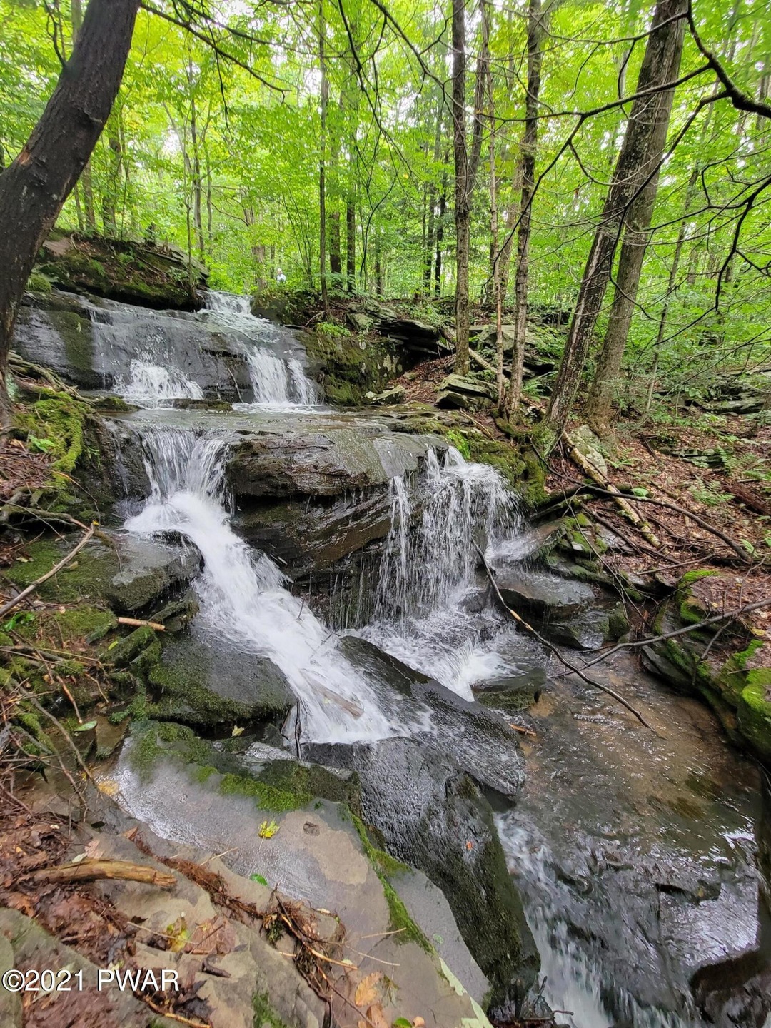

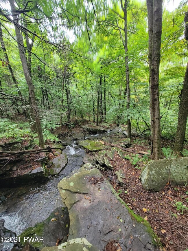


74 ACRES - STREAM - FALLS - Picturesque wooded tract of land with abundance of township road frontage. Features private yet convenient location, numerous building or camping sites, stream with cascading waterfall, and trails traversing property.
Last Agent to Sell the Property
Davis R. Chant Honesdale License #AB028683A Listed on: 09/15/2021
Property Type
Est. Annual Taxes
Lot Details
Utilities
Listing and Financial Details
| Date | Event | Price | Change | Sq Ft Price |
|---|---|---|---|---|
| 04/01/2025 04/01/25 | Price Changed | $595,000 | +693.3% | -- |
| 02/19/2025 02/19/25 | Sold | $75,000 | -6.1% | -- |
| 01/22/2025 01/22/25 | Pending | -- | -- | -- |
| 09/04/2024 09/04/24 | For Sale | $79,900 | -91.2% | -- |
| 08/11/2024 08/11/24 | For Sale | $905,000 | +389.2% | -- |
| 10/08/2021 10/08/21 | Sold | $185,000 | +23.3% | -- |
| 09/21/2021 09/21/21 | Pending | -- | -- | -- |
| 09/15/2021 09/15/21 | For Sale | $150,000 | +257.1% | -- |
| 03/23/2021 03/23/21 | Sold | $42,000 | -77.2% | -- |
| 02/26/2021 02/26/21 | Sold | $184,000 | +308.9% | -- |
| 02/11/2021 02/11/21 | Pending | -- | -- | -- |
| 01/13/2021 01/13/21 | Pending | -- | -- | -- |
| 10/02/2020 10/02/20 | For Sale | $45,000 | -75.4% | -- |
| 04/09/2019 04/09/19 | For Sale | $183,000 | +238.9% | -- |
| 12/28/2012 12/28/12 | Sold | $54,000 | -45.2% | -- |
| 11/22/2012 11/22/12 | Pending | -- | -- | -- |
| 06/01/2012 06/01/12 | For Sale | $98,500 | -- | -- |
Seller's Agent in 2025
Elena Nouri
Davis R. Chant Honesdale
(570) 751-6100
138 Total Sales
Buyer's Agent in 2025
Carly Seana
Pocono Mountain Lakes Realty
(570) 241-8314
10 Total Sales
D
Seller's Agent in 2024
Daniel Penetar III
The Penetar Group
(570) 343-1141
J
Seller's Agent in 2021
John Schmitt
Davis R. Chant Honesdale
(570) 253-4191
138 Total Sales
T
Seller's Agent in 2021
The Phillips Team
RE/MAX
Buyer's Agent in 2021
Laura Wielebinski
Point W Real Estate
(570) 785-3515
51 Total Sales
Source: Pike/Wayne Association of REALTORS®
MLS Number: PWB213709
Disclaimer: Certain information contained herein is derived from information provided by parties other than Homes.com. All information provided is deemed reliable, but is not guaranteed to be accurate and should be independently verified.
![]() IDX information is provided exclusively for personal, non-commercial use, and may not be used for any purpose other than to identify prospective properties consumers may be interested in purchasing. Information is deemed reliable but not guaranteed.
IDX information is provided exclusively for personal, non-commercial use, and may not be used for any purpose other than to identify prospective properties consumers may be interested in purchasing. Information is deemed reliable but not guaranteed.