NOT LISTED FOR SALE

0 Highview Cir Unit Lot 29 20-1029 Trinidad, CO 81082

35 Acres
-- Price per Acre
1,544,202 Sq Ft Lot

Last Sold November 17, 2020

Last sale price $53,500

2 Days on Market

Highlights

  • View of Trees or Woods
  • 35.45 Acre Lot
  • Adjacent to Bureau of Land Management Land

About This Lot

As of November 2020

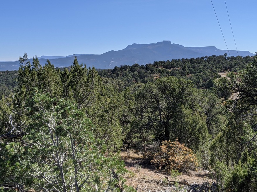
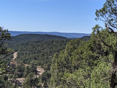
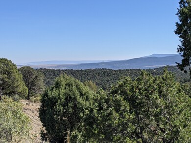
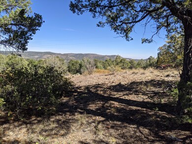
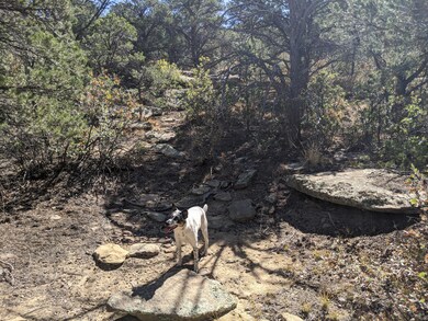
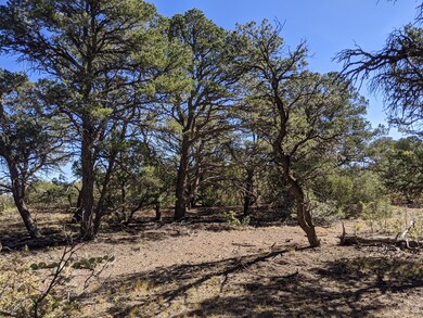
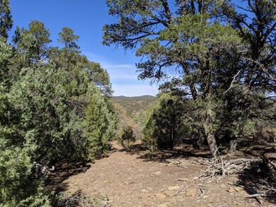
Fabulous 35 acre parcel just outside of Trinidad within a gated community and no restrictions. Multiple areas for possible building sites, good views of Fisher's Peak, the eastern plains and all the way into NM. Good maintained roads make this a great year round location. Power is at the road. Bring your camper, set up camp or get ready to build your new home. BONUS ALERT - this property backs up to over 1100 acres of state land and BLM. Call me today before it's gone!

Last Listed By

Sarah Manshel

Bachman & Associates License #FA.100067471 Listed on: 10/22/2020

Property Details

Property Type

  • Land

Est. Annual Taxes

  • $386

Lot Details

  • 35.45 Acre Lot

Property Views

  • Woods
  • Mountain
  • Valley

Location

  • Borders State Land
  • Adjacent to Bureau of Land Management Land

Community Details

  • Fishers Peak Ranch Subdivision

Listing and Financial Details

  • Assessor Parcel Number 12234800

Property Details

Property Type

Land

Est. Annual Taxes

$386

Lot Details

0

Listing Details

  • Directions: Call office or Sarah for gate code, which changes every month. ----- From Trinidad, take Atchison to CR 67.7, at ''T'' take a right, enter gate (with code), follow to Highview Circle and take a hard left follow to my sign on the left.
  • Earnest Money Fee: 1000.00
  • Listing Member Name: Sarah Manshel
  • Listing Office Short Id: bchn
  • List Type: Exclusive Right To Sell
  • Open House Office I D: 20030124163528360548000000
  • Prop. Type: Land
  • Restrictions: No
  • Selling Member Short Id: sarah M
  • Selling Office Short Id: bchn
  • Assessor Parcel Number: 12234800
  • Ernst Money Payable: Title Company TBD
  • Suitable Use: Recreat. / 2nd Home, Resid. Single Family
  • Special Features: None
  • Property Sub Type: LotsLands

Interior Features

  • Amenities: Borders BLM, Borders State Land
  • Legal Description: FISHER PEAK RANCH LOT-29- CONT-35.45 ACRS M/L (LOCATED IN PT-SW4-34-32-64 & PT-NW4-03- & PT-NE4-04- -33-64)

Exterior Features

  • Road: Gravel
  • Views: Mountain, Trees/Forest, Valley

Fee Information

  • Taxes: 386.36

Lot Info

  • Lot Acres: 35.45
  • Unit/Lot Number: Lot 29

Tax Info

  • Year: 2019

Range of Values:

Collateral Analytics

Collateral Analytics Collateral Analytics AVMs (Automated Valuation Model) employ a number of statistical approaches combined with neighborhood-specific comparable selection guarantees the most up-to-date and precise valuations.

Not Available

Collateral Analytics does not have data for the current month. Please view the chart for historical values.

ICE

ICE Mortgage Technology ICE Mortgage Technology’s AVM (Automated Valuation Model) is a state-of-the-art online residential property valuation tool that provides a quick and accurate estimate of the value of almost any home in the U.S.

Not Available

ICE Mortgage Technology does not have data for the current month. Please view the chart for historical values.

First American

First American First American Data & Analytics’ next-generation AVM combines unrivaled data assets with a blended ensemble of valuation models to produce highly accurate, reliable valuations you can trust.

Not Available

First American does not have data for the current month. Please view the chart for historical values.

Quantarium

Quantarium Quantarium’s valuation service, repeatedly proven the industry’s most accurate and comprehensive, is supercharged with a self-learning and auto-tuning AI engine that continually becomes smarter and more accurate as it processes daily inputs from the industry’s leading RE data lake.

Not Available

Quantarium does not have data for the current month. Please view the chart for historical values.

Average Value
Not Available
List Price
Sold Price
Create a Home Valuation Report for This Property
The Home Valuation Report is an in-depth analysis detailing your home's value as well as a comparison with similar homes in the area

Home Values in the Area

Source: Public Records

Average Home Value in this Area


Source: Public Records

Property History

Date Event Price Change Sq Ft Price
11/17/2020 11/17/20 Sold $53,500 -- --
10/24/2020 10/24/20 Pending -- -- --
Source: Spanish Peaks Board of REALTORS®

Tax History Compared to Growth

Source: Public Records

Agents Affiliated with this Home

See All Agents

Map

Source: Spanish Peaks Board of REALTORS®

MLS Number: 20-1029

Spanish Peaks Board of REALTORS®