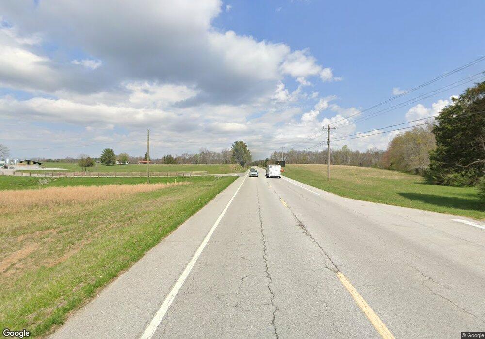
0 Hwy 127 S & (S Pond Rd ) Unit RTC2967274 Crossville, TN 38555
--
Bed
--
Bath
--
Sq Ft
20.83
Acres
About This Home
This home is located at 0 Hwy 127 S & (S Pond Rd ) Unit RTC2967274, Crossville, TN 38555. 0 Hwy 127 S & (S Pond Rd ) Unit RTC2967274 is a home located in Cumberland County with nearby schools including Frank P. Brown Elementary School and Cumberland County High School.
Ownership History
Date
Name
Owned For
Owner Type
Purchase Details
Closed on
Jul 12, 2019
Sold by
Campbell Marshall E
Bought by
Fox Jones Jeremy Birl and Fox Jones Jessica Marie
Home Financials for this Owner
Home Financials are based on the most recent Mortgage that was taken out on this home.
Original Mortgage
$84,000
Outstanding Balance
$73,712
Interest Rate
3.9%
Mortgage Type
New Conventional
Purchase Details
Closed on
Jan 24, 2008
Sold by
Campbell Marshall E
Bought by
Campbell Marshall E
Create a Home Valuation Report for This Property
The Home Valuation Report is an in-depth analysis detailing your home's value as well as a comparison with similar homes in the area
Home Values in the Area
Average Home Value in this Area
Purchase History
| Date | Buyer | Sale Price | Title Company |
|---|---|---|---|
| Fox Jones Jeremy Birl | $120,000 | None Available | |
| Campbell Marshall E | -- | -- |
Source: Public Records
Mortgage History
| Date | Status | Borrower | Loan Amount |
|---|---|---|---|
| Open | Fox Jones Jeremy Birl | $84,000 |
Source: Public Records
Tax History Compared to Growth
Tax History
| Year | Tax Paid | Tax Assessment Tax Assessment Total Assessment is a certain percentage of the fair market value that is determined by local assessors to be the total taxable value of land and additions on the property. | Land | Improvement |
|---|---|---|---|---|
| 2024 | $106 | $9,325 | $9,325 | -- |
| 2023 | $106 | $9,325 | $0 | $0 |
| 2022 | $106 | $9,325 | $9,325 | $0 |
| 2021 | $127 | $8,125 | $8,125 | $0 |
| 2020 | $127 | $8,125 | $8,125 | $0 |
| 2019 | $127 | $8,125 | $8,125 | $0 |
| 2018 | $127 | $8,125 | $8,125 | $0 |
| 2017 | $127 | $8,125 | $8,125 | $0 |
| 2016 | $95 | $6,250 | $6,250 | $0 |
| 2015 | $94 | $6,250 | $6,250 | $0 |
| 2014 | $94 | $6,255 | $0 | $0 |
Source: Public Records
Map
Nearby Homes
- 11981 Highway 127 S
- 145 Whitson Ln
- 91 Whitson Ln
- 0 Browns Gap Rd Unit RTC2900043
- 0 Browns Gap Rd Unit 1303270
- Lot 16 Browns Gap Rd
- 0 Old Highway 28 S Unit RTC2883659
- 5843 Dunbar Rd
- 627 Clint Lowe Rd
- 82 Browns Gap Rd
- 326 Breckenridge Dr
- 0 Hinch Mountain Rd Unit RTC2987064
- 0 Hinch Mountain Rd Unit 1288632
- 00 Ashford Dr
- 12897 Highway 127 S
- 22 Kelly Dr
- 817 Hillendale Rd
- 103 Dublin Dr
- 8267 Highway 127 S
- 106 Guiness Dr
- 0 Hwy 127 S & (S Pond Rd ) Unit RTC2967464
- 0 Hwy 127 S & (S Pond Rd ) Unit 986564
- 0 S Hwy 127 S (South Pond Rd ) Rd Unit RTC2967020
- 0 S Hwy 127 S (South Pond Rd ) Rd Unit 1072549
- S Hwy 127 S (South Pond Rd ) Rd
- 10802 Highway 127 S
- 10802 Highway 127 S
- 1213 Rhea Rd
- 10485 Highway 127 S
- 1070 Rhea Rd
- 10574 Highway 127 S
- 10429 Highway 127 S
- 1010 Rhea Rd
- 10381 Highway 127 S
- 900 Rhea Rd
- 11000 Highway 127 S
- 0 Crest Vale Unit 659072
- 10345 Highway 127 S
- 10374 Highway 127 S
- 0 Rhea Rd
