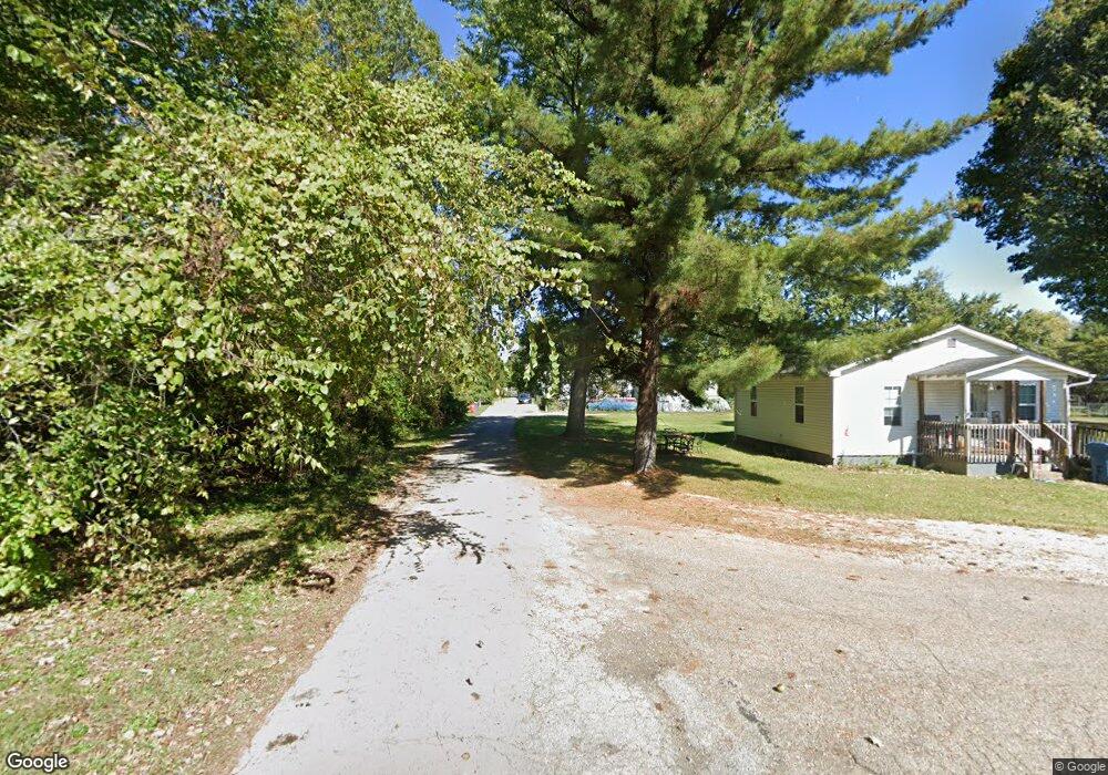
0 Lisle Ave Columbus, OH 43207
Obetz-Lockbourne NeighborhoodEstimated Value: $83,000 - $196,000
--
Bed
--
Bath
--
Sq Ft
4,443
Sq Ft Lot
About This Home
This home is located at 0 Lisle Ave, Columbus, OH 43207 and is currently estimated at $142,000. 0 Lisle Ave is a home with nearby schools including West Elementary School, Hamilton Elementary School, and Hamilton Intermediate School.
Ownership History
Date
Name
Owned For
Owner Type
Purchase Details
Closed on
Jun 8, 2025
Sold by
Ford Connie J
Bought by
Ford Connie J and Ford Dakota A
Current Estimated Value
Purchase Details
Closed on
Aug 3, 2007
Sold by
Ford Derek W
Bought by
Ford Connie J
Purchase Details
Closed on
Oct 24, 1995
Sold by
Boyer Mary
Bought by
Miller Pearl M and Miller Ralph
Home Financials for this Owner
Home Financials are based on the most recent Mortgage that was taken out on this home.
Original Mortgage
$30,000
Interest Rate
7.68%
Mortgage Type
New Conventional
Purchase Details
Closed on
May 22, 1989
Create a Home Valuation Report for This Property
The Home Valuation Report is an in-depth analysis detailing your home's value as well as a comparison with similar homes in the area
Home Values in the Area
Average Home Value in this Area
Purchase History
| Date | Buyer | Sale Price | Title Company |
|---|---|---|---|
| Ford Connie J | $195,200 | None Listed On Document | |
| Ford Connie J | -- | Attorney | |
| Miller Pearl M | $40,000 | -- | |
| -- | -- | -- |
Source: Public Records
Mortgage History
| Date | Status | Borrower | Loan Amount |
|---|---|---|---|
| Previous Owner | Miller Pearl M | $30,000 |
Source: Public Records
Tax History Compared to Growth
Tax History
| Year | Tax Paid | Tax Assessment Tax Assessment Total Assessment is a certain percentage of the fair market value that is determined by local assessors to be the total taxable value of land and additions on the property. | Land | Improvement |
|---|---|---|---|---|
| 2024 | $442 | $9,450 | $9,450 | -- |
| 2023 | $440 | $9,450 | $9,450 | $0 |
| 2022 | $68 | $1,230 | $1,230 | $0 |
| 2021 | $69 | $1,230 | $1,230 | $0 |
| 2020 | $71 | $1,230 | $1,230 | $0 |
| 2019 | $66 | $1,020 | $1,020 | $0 |
| 2018 | $65 | $1,020 | $1,020 | $0 |
| 2017 | $65 | $1,020 | $1,020 | $0 |
| 2016 | $68 | $1,020 | $1,020 | $0 |
| 2015 | $64 | $1,020 | $1,020 | $0 |
| 2014 | $64 | $1,020 | $1,020 | $0 |
| 2013 | $34 | $1,120 | $1,120 | $0 |
Source: Public Records
Map
Nearby Homes
- 1987 Reese Ave
- 1962 Reese Ave
- 1315 Webb Dr Unit Lot 93
- 1292 Webb Dr Unit Lot 83
- 1291 Webb Dr Unit Lot 90
- 1817 Marlboro Ave
- 1632 Marlboro Ave
- 1099 Secrest Ave
- 4417 Lancaster Ave
- 5081 Lockbourne Rd
- 4383 Lancaster Ave
- 4410 Holstein Dr
- 1059 Belford Ave
- 1341 Halfhill Way
- 1559 Obetz Ave
- 4412 Catamaran Dr
- 5083 Meadowbrook Dr
- 1566 Chillicothe St
- 4990 Root Place
- 4241 Gelbray Ct
- 0 Lisle Ave
- 1991 Lisle Ave
- 1957 Lisle Ave
- 1978 Drexel Ave Unit 980
- 0 Drexel Ave
- 1980 N Drexel Ave
- 0 Drexel Ave
- 1954 Drexel Ave
- 1966 Lisle Ave
- 1966 Lisle Ave
- 4905 Ridge St
- 1950 Lisle Ave
- 2008 Drexel Ave
- 2013 Lisle Ave
- 2017 Lisle Ave
- 4904 Ridge St Unit 4920
- 0 Drexel Ave
- 0 Drexel Ave
- 1991 Drexel Ave
- 0 Drexel Ave