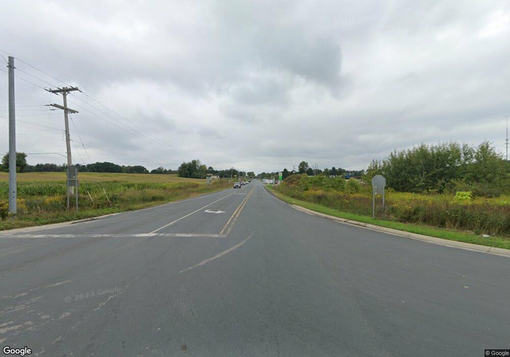
0 N 12th St Unit 66016000569 Kalamazoo, MI 49009
Estimated Value: $462,391
--
Bed
--
Bath
--
Sq Ft
6
Acres
About This Home
This home is located at 0 N 12th St Unit 66016000569, Kalamazoo, MI 49009 and is currently estimated at $462,391. 0 N 12th St Unit 66016000569 is a home located in Kalamazoo County with nearby schools including Plainwell High School.
Ownership History
Date
Name
Owned For
Owner Type
Purchase Details
Closed on
Nov 5, 2014
Sold by
B&S Property Management Llc
Bought by
Kalamazoo County Road Commission
Current Estimated Value
Purchase Details
Closed on
Dec 28, 2012
Sold by
Cedar 234
Bought by
B & S Property Management Llc
Purchase Details
Closed on
Sep 7, 2012
Sold by
Riddeerman Jack J and Ridderman Gena N
Bought by
234 Cedar Inc
Purchase Details
Closed on
Aug 21, 2006
Sold by
Ridderman Jack J and Ridderman Gena N
Bought by
234 Cedar Inc
Create a Home Valuation Report for This Property
The Home Valuation Report is an in-depth analysis detailing your home's value as well as a comparison with similar homes in the area
Home Values in the Area
Average Home Value in this Area
Purchase History
| Date | Buyer | Sale Price | Title Company |
|---|---|---|---|
| Kalamazoo County Road Commission | $244 | None Available | |
| B & S Property Management Llc | -- | Chicago Title Company | |
| 234 Cedar Inc | $190,000 | None Available | |
| 234 Cedar Inc | -- | Chicago Title |
Source: Public Records
Tax History Compared to Growth
Tax History
| Year | Tax Paid | Tax Assessment Tax Assessment Total Assessment is a certain percentage of the fair market value that is determined by local assessors to be the total taxable value of land and additions on the property. | Land | Improvement |
|---|---|---|---|---|
| 2025 | $3,223 | $70,000 | $0 | $0 |
| 2024 | $592 | $71,300 | $0 | $0 |
| 2023 | $592 | $65,300 | $0 | $0 |
| 2022 | $592 | $61,900 | $0 | $0 |
| 2021 | $592 | $55,000 | $0 | $0 |
| 2020 | $2,222 | $55,000 | $0 | $0 |
| 2019 | $2,597 | $55,000 | $0 | $0 |
| 2018 | $0 | $55,000 | $0 | $0 |
| 2017 | $0 | $55,000 | $0 | $0 |
| 2016 | -- | $55,000 | $0 | $0 |
| 2015 | -- | $55,000 | $0 | $0 |
| 2014 | -- | $73,600 | $0 | $0 |
Source: Public Records
Map
Nearby Homes
- 0 W D Ave W Unit VL
- 8060 Hunters Crossing
- 8890 N 12th St
- 1 Millberg Ridge
- Parcel A D Ave W
- 6501 Knights Way
- 6812 N 14th St
- 5205 Kitz Way
- 7795 Douglas Ave
- 9585 Douglas Ave
- 7558 W D Ave
- V/L N 12th St
- VL Douglas Ave
- 1306 W B Ave
- 3706 Northview Dr
- 3521 Meadowcroft Ave
- 2649 Hickory Nut Ln
- 2932 Meadowcroft Ln
- 99 Fineview Ave
- 4886 Weston Ave Unit 26
- 0 N 12th St Unit 66016028267
- 0 N 12th St Unit 72020034539
- 0 N 12th St Unit B 66014043945
- 0 N 12th St Unit 66017000472
- 0 N 12th St Unit 66013002076
- 0 N 12th St Unit 66014043942
- 0 N 12th St Unit M13002076
- 0 N 12th St Unit M14043942
- 0 N 12th St Unit B M14043945
- 000 N 12th St
- 9165 N 12th St
- 13 N 12th St
- 25 N 12th St
- 8000 N 12th St
- 8300 N 12th St
- 6400 N 12th St
- 10000 N 12th St
- 0 N 12th St
- 4700 W D Ave
- 5010 W D Ave Unit MF
