
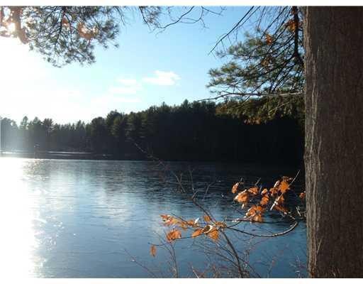
$219,000
- Land
- 53 Acres
- $4,147 per Acre
- R19-54E Mountain Rd
- Parsonsfield, ME
Super nice 52+- acre lot with lots of possibilities. Several very nice building sites offering views. Some timber. Great area!
Mark Floor Maine Real Estate Experts
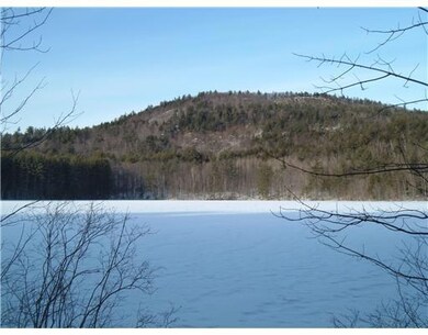
112 acres of land that includes approximately 6 acres on Randall Lake. A potential opportunity for development with some frontage on Randall Lake.
Property Type
Est. Annual Taxes
Lot Details
Parking
Utilities
Community Details
Listing and Financial Details
$219,000
Super nice 52+- acre lot with lots of possibilities. Several very nice building sites offering views. Some timber. Great area!
Mark Floor Maine Real Estate Experts
$239,000
Excellent super sized parcel on the high side of the road. Multiple nice building sites. Some timber. Great area!
Mark Floor Maine Real Estate Experts
$200,000
Imagine owning your very own breathtaking retreat nestled in a serene country setting. This exceptional property offers just under 46 acres of natural beauty, presenting a rare opportunity to build your dream home, a private estate, or a tranquil getaway. Some highlights that make this land so special include expansive acreage, forested landscape, convenient access to thousands of acres of public
Abigail Chessie Real Estate 2000 ME/NH
| Date | Event | Price | Change | Sq Ft Price |
|---|---|---|---|---|
| 05/17/2021 05/17/21 | Sold | $90,000 | +0.1% | -- |
| 03/04/2021 03/04/21 | Pending | -- | -- | -- |
| 11/13/2020 11/13/20 | For Sale | $89,900 | -61.7% | -- |
| 10/03/2019 10/03/19 | Sold | $235,000 | -16.0% | -- |
| 07/18/2019 07/18/19 | Pending | -- | -- | -- |
| 05/06/2019 05/06/19 | For Sale | $279,900 | -- | -- |
M
Seller's Agent in 2021
Michele Jordan
Badger Peabody & Smith Realty
Seller's Agent in 2019
Pamela Coyne
EXIT Oceanside Realty
(207) 251-2119
53 Total Sales
Source: Maine Listings
MLS Number: 1413121
Disclaimer: Certain information contained herein is derived from information provided by parties other than Homes.com. All information provided is deemed reliable, but is not guaranteed to be accurate and should be independently verified.
![]() Listing data is derived in whole or in part from Maine Real Estate Information System, Inc. (d/b/a Maine Listings) and is for consumers' personal, noncommercial use only. Dimensions are approximate and not guaranteed. All data should be independently verified.
Listing data is derived in whole or in part from Maine Real Estate Information System, Inc. (d/b/a Maine Listings) and is for consumers' personal, noncommercial use only. Dimensions are approximate and not guaranteed. All data should be independently verified.
© 2025 Maine Real Estate Information System, Inc. All Rights Reserved. Equal Housing Opportunity.
Homes.com, LLC, 17600 Laguna Canyon Rd Irvine, CA 92618 (888)-952-6393
![]()