


0 Shady Ln Unit 25-1204 Anderson, CA 96007
Balls Ferry Road NeighborhoodEstimated payment $3,791/month
About This Lot
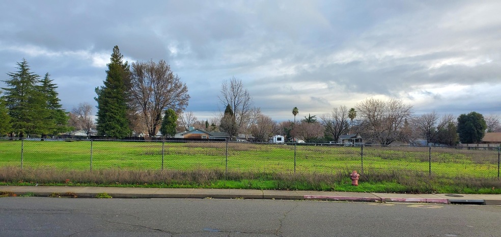
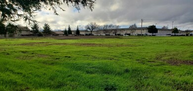
Prime location! 2.35 acre parcel of level land zoned Anderson R-3 High Density Residential. Sidewalk, curb, gutter and fire hydrant fronting on Shady Lane.
Property Details
Property Type
- Land
Lot Details
- 2.35 Acre Lot
- Zoning described as Anderson R-3 High Density Residential
Listing and Financial Details
- Assessor Parcel Number 052-340-067
Map
Home Values in the Area
Average Home Value in this Area
Property History
| Date | Event | Price | Change | Sq Ft Price |
|---|---|---|---|---|
| 03/26/2025 03/26/25 | For Sale | $599,000 | -- | -- |
Source: Shasta Association of REALTORS®
MLS Number: 25-1204
Disclaimer: Certain information contained herein is derived from information provided by parties other than Homes.com. All information provided is deemed reliable, but is not guaranteed to be accurate and should be independently verified.
![]() IDX information is provided exclusively for personal, non-commercial use, and may not be used for any purpose other than to identify prospective properties consumers may be interested in purchasing. Information is deemed reliable but not guaranteed.
IDX information is provided exclusively for personal, non-commercial use, and may not be used for any purpose other than to identify prospective properties consumers may be interested in purchasing. Information is deemed reliable but not guaranteed.
- 21133 Ronald St
- 2857 Pinto Ln
- 2867 Pinto Ln
- 2827 Stingy Ln
- 0 Balls Ferry Rd Unit 25-2445
- 2325 North St
- 3081 Sharon Ave
- 2648 Tremonto Rd
- 0 Deschutes Unit 25-3489
- 2616 W Hillside Dr
- 2576 W Hillside Dr
- 0 Stingy Ln
- 15.79 Stingy Ln
- 3006 Joyce Dr
- 3284 W Bailey Dr
- 2904 Silver St
- 0000 Frontier Trail
- 3065 Silver St
- 3008 Church St
- 1621&1625 Ferry
- 2510 Jason Ct Unit B
- 6920 Riverland Dr Unit 4
- 683 Joaquin Ave
- 3700 Churn Creek Rd
- 1671 Bramble Place Unit Downstairs
- 2684 Wilson Ave
- 2372 Shining Star Way
- 1215 Industrial St
- 1090 Dusty Ln Unit 1
- 1765 Laurel Ave Unit Condo A
- 1765 Laurel Ave Unit Condo A
- 1714 Milo Ave
- 925 Parkview Ave
- 540 South St
- 1230 Canby Rd
- 2172 West St
- 910 Canby Rd
- 1624 Verda St
- 1551 Market St
- 1559 Willis St
