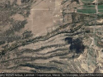
0 Shavano Rd Unit 7530011 Nathrop, CO 81236
Estimated Value: $716,182 - $890,000
3
Beds
2
Baths
1,920
Sq Ft
$420/Sq Ft
Est. Value
About This Home
This home is located at 0 Shavano Rd Unit 7530011, Nathrop, CO 81236 and is currently estimated at $807,046, approximately $420 per square foot. 0 Shavano Rd Unit 7530011 is a home located in Chaffee County with nearby schools including Avery/Parsons Elementary School, Buena Vista Middle School, and Buena Vista High School.
Ownership History
Date
Name
Owned For
Owner Type
Purchase Details
Closed on
Mar 31, 2021
Sold by
Woronoff David S and Woronoff Karen G
Bought by
Wiechelman Kathleen J and Wiechelman David A
Current Estimated Value
Home Financials for this Owner
Home Financials are based on the most recent Mortgage that was taken out on this home.
Original Mortgage
$486,000
Outstanding Balance
$443,187
Interest Rate
2.8%
Mortgage Type
New Conventional
Estimated Equity
$393,834
Purchase Details
Closed on
Nov 21, 2017
Sold by
Ferraro Frank O and Ferraro Glnnean F
Bought by
Woronoff David S and Woronoff Karen G
Create a Home Valuation Report for This Property
The Home Valuation Report is an in-depth analysis detailing your home's value as well as a comparison with similar homes in the area
Home Values in the Area
Average Home Value in this Area
Purchase History
| Date | Buyer | Sale Price | Title Company |
|---|---|---|---|
| Wiechelman Kathleen J | $607,500 | None Available | |
| Woronoff David S | $77,000 | First American Title Insuran |
Source: Public Records
Mortgage History
| Date | Status | Borrower | Loan Amount |
|---|---|---|---|
| Open | Wiechelman Kathleen J | $486,000 | |
| Previous Owner | Woronoff David S | $259,129 | |
| Previous Owner | Woronott David S | $228,000 | |
| Previous Owner | Woronoff David S | $225,000 | |
| Previous Owner | Woronoff David S | $75,000 |
Source: Public Records
Tax History Compared to Growth
Tax History
| Year | Tax Paid | Tax Assessment Tax Assessment Total Assessment is a certain percentage of the fair market value that is determined by local assessors to be the total taxable value of land and additions on the property. | Land | Improvement |
|---|---|---|---|---|
| 2024 | $2,448 | $48,690 | $13,050 | $35,640 |
| 2023 | $2,311 | $48,690 | $13,050 | $35,640 |
| 2022 | $1,830 | $34,770 | $5,910 | $28,860 |
| 2021 | $1,844 | $35,770 | $6,080 | $29,690 |
| 2020 | $1,698 | $31,230 | $5,360 | $25,870 |
| 2019 | $1,308 | $24,030 | $5,360 | $18,670 |
| 2018 | $938 | $16,100 | $16,100 | $0 |
| 2017 | $853 | $16,100 | $16,100 | $0 |
| 2016 | $1,054 | $22,330 | $22,330 | $0 |
| 2015 | $1,159 | $22,330 | $22,330 | $0 |
| 2014 | $1,159 | $22,480 | $0 | $0 |
Source: Public Records
Map
Nearby Homes
- 13321 County Road 261
- 13083 County Road 261p
- 17665 County Road 260
- 12904 County Road 258a Unit a
- 12904 County Road 258a
- 20155 Hideout Ln
- 10246 Rawhide Creek Rd Unit 18
- 12098 County Road 258a
- 19500 Us Highway 285
- 10118 Rawhide Creek Rd Unit 12
- 15573 County Road 260
- 10333 Outpost Ln Unit 44
- 00 County Road 280
- 11905 Highland Cir
- 13101 Us Highway 285
- 0 Tbd Highway 285
- 21261 Broadview Rd
- 12905 Bronco Ln
- 15194 Heywood Ln
- 15270 Chimney Rock Rd
