NOT LISTED FOR SALE

0 Township Road 655 Montgomery Township, OH 44805

Estimated Value: $434,496

7.44 Acres
$58,400 Price per Acre
324,086 Sq Ft Lot

Last Sold July 03, 2017

Last sale price $54,000

Est. 705% increase in value since last sale

Current estimated payment $2,731/month

4 Days on Market

Highlights

  • Landscaped with Trees
  • Open Lot
  • Gentle Sloping Lot

About This Lot

As of July 2017

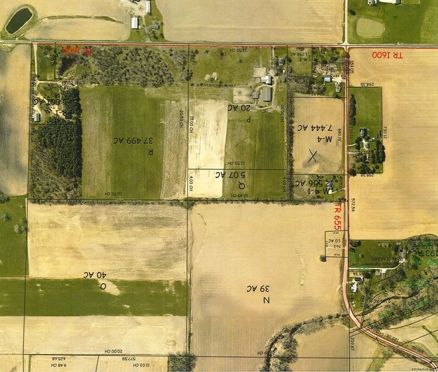
Nice building lot close to I71 and town. 880 ft. road frontage with tree row to back and south.

Last Agent to Sell the Property

Janet Enzor

Coldwell Banker Ward Real Estate Brokerage Phone: 4192812000 License #SAL.0000387917 Listed on: 06/02/2017

Coldwell Banker Ward Real Estate

Last Buyer's Agent

Lisa Lang

Coldwell Banker Ward Real Estate License #SAL.2013001571

Coldwell Banker Ward Real Estate

Property Details

Property Type

  • Land

Est. Annual Taxes

  • $552

Lot Details

  • 7.44 Acre Lot
  • Lot Dimensions are 880 x 495
  • Open Lot
  • Gentle Sloping Lot
  • Landscaped with Trees

Farming

  • Tillable Land

Utilities

  • No Utilities
  • Well
  • Cable TV Available

Listing and Financial Details

  • Tax Lot Sec 26, M-4 7.44 acres
  • Assessor Parcel Number I250260001302

Property Details

Property Type

Land

Est. Annual Taxes

$552

Lot Details

0

Listing Details

  • Property Sub Type: Unimproved Land
  • Prop. Type: Land
  • Lot Size Acres: 7.44
  • Lot Size: 880 x 495
  • Directions: US 250 East from Ashland to right on Twp. Rd. 1575 (before I71) to right on Twp. Rd. 655. Property approx 3/4 mile on left.
  • Attribution Contact: 4192812000
  • Special Features: None

Interior Features

  • Possible Use: Residential, Construction Lot, Farm

Exterior Features

  • Lot Features: Construction Lot, Tillable, Open, Trees, Open Lot
  • Topography: Gently Rolling
  • Disclosures: Property Disclosure

Utilities

  • Electric: Firelands
  • Sewer: Septic
  • Utilities: None, Cable Available, Electricity Available
  • Water Source: Well

Condo/Co-op/Association

  • Association Fee Frequency: Annually

Schools

  • Junior High Dist: Ashland City

Lot Info

  • Lot Size Sq Ft: 324086.4
  • Farm Land Area Units: Square Feet
  • Parcel #: I250260001302
  • Zoning Description: Twp-Township Zoning
  • ResoLotSizeUnits: Acres

Green Features

Multi Family

Tax Info

  • Tax Annual Amount: 551.78
  • Tax Lot: Sec 26, M-4 7.44 acres

Ownership History

Date Name Owned For Owner Type

Purchase Details

Closed on
Mar 28, 2023
Sold by
Wright William C
Bought by
William Charles Wright Revocable Trust
Current Estimated Value
$434,496

Purchase Details

Listed on
Jun 2, 2017
Closed on
Jun 29, 2017
Sold by
Mckernan Matthew J
Bought by
Wright William C
Seller's Agent
Janet Enzor
Coldwell Banker Ward Real Estate
Buyer's Agent
Lisa Lang
Coldwell Banker Ward Real Estate
List Price
$52,900
Sold Price
$54,000
Premium/Discount to List
$1,100
2.08%

Home Financials for this Owner

Home Financials are based on the most recent Mortgage that was taken out on this home.
Avg. Annual Appreciation
28.44%

Purchase Details

Closed on
Oct 23, 1990
Bought by
Mckernan Robert C
Source: Public Records

Range of Values:

Collateral Analytics

Collateral Analytics Collateral Analytics AVMs (Automated Valuation Model) employ a number of statistical approaches combined with neighborhood-specific comparable selection guarantees the most up-to-date and precise valuations.

Not Available

Collateral Analytics does not have data for the current month. Please view the chart for historical values.

ICE

ICE Mortgage Technology ICE Mortgage Technology’s AVM (Automated Valuation Model) is a state-of-the-art online residential property valuation tool that provides a quick and accurate estimate of the value of almost any home in the U.S.

Not Available

ICE Mortgage Technology does not have data for the current month. Please view the chart for historical values.

First American

First American First American Data & Analytics’ next-generation AVM combines unrivaled data assets with a blended ensemble of valuation models to produce highly accurate, reliable valuations you can trust.

Not Available

First American does not have data for the current month. Please view the chart for historical values.

Quantarium

Quantarium Quantarium’s valuation service, repeatedly proven the industry’s most accurate and comprehensive, is supercharged with a self-learning and auto-tuning AI engine that continually becomes smarter and more accurate as it processes daily inputs from the industry’s leading RE data lake.

Not Available

Quantarium does not have data for the current month. Please view the chart for historical values.

Average Value
Not Available
List Price
Sold Price
Create a Home Valuation Report for This Property
The Home Valuation Report is an in-depth analysis detailing your home's value as well as a comparison with similar homes in the area

Home Values in the Area

Source: Public Records

Average Home Value in this Area


Source: Public Records

Purchase History

Date Buyer Sale Price Title Company
William Charles Wright Revocable Trust -- None Listed On Document
Wright William C $54,000 Barrister Ashland Title
Mckernan Robert C $16,000 --
Source: Public Records

Property History

Date Event Price List to Sale Price per Sq Ft Prior Sale
07/03/2017 07/03/17 Sold $54,000 +2.1% --
06/12/2017 06/12/17 Pending -- -- --
06/07/2017 06/07/17 For Sale $52,900 +46.9% --
05/31/2012 05/31/12 Sold $36,000 -9.8% -- View Prior Sale
05/22/2012 05/22/12 Pending -- -- --
05/06/2011 05/06/11 For Sale $39,900 -- --
Source: Ashland Board of REALTORS®

Tax History Compared to Growth

Source: Public Records

Tax History

Year Tax Paid Tax Assessment Tax Assessment Total Assessment is a certain percentage of the fair market value that is determined by local assessors to be the total taxable value of land and additions on the property. Land Improvement
2024 $5,286 $148,150 $24,750 $123,400
2023 $5,286 $148,150 $24,750 $123,400
2022 $4,831 $105,820 $17,680 $88,140
2021 $4,850 $105,820 $17,680 $88,140
2020 $4,603 $105,820 $17,680 $88,140
2019 $4,265 $90,630 $17,570 $73,060
2018 $614 $12,610 $12,610 $0
2017 $552 $12,610 $12,610 $0
2016 $552 $11,160 $11,160 $0
2015 $547 $11,160 $11,160 $0
2013 $527 $10,470 $10,470 $0
Source: Public Records

Agents Affiliated with this Home

  • Section Image
  • Section Image
See All Agents

Map

Source: Ashland Board of REALTORS®

MLS Number: 219833

APN: I25-026-0-0013-02