P
Seller's Agent in 2016
Patrick Hackley
Fountains Land Inc.
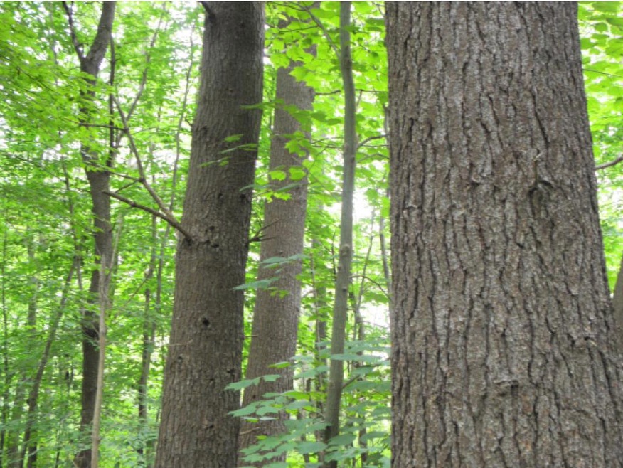
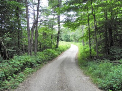

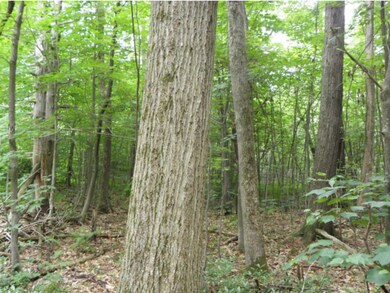

A well-stocked, conserved property offering a seasonal camp right, hunting lease income, and adjacency to the Appalachian Trail. The forest consists of two non-contiguous parcels along Webster Road. The northern parcel is nearly flat with a gentle westerly slope that forms the headwaters of Webster Brook. The southern parcels flat terrain along the road frontage gradually slopes upward to a small table before sloping steeply to the southeast. Across both parcels, the soils appear very stony, conducive to growing good oak and pine. The forest supports a pine/hardwood species mix with white pine, red pine and hemlock comprising 60% of the total volume by species. Red maple, black cherry and red oak combine to make up 32%. Sawtimber quality is good to above average and most stands are amply stocked. The gentle terrain, well-drained soils and general accessibility of the forest allow abundant options to conduct small, cost-effective, thinning operations throughout the year.
Last Agent to Sell the Property
Patrick Hackley
Fountains Land Inc. Listed on: 09/21/2015
Last Buyer's Agent
Patrick Hackley
Fountains Land Inc. Listed on: 09/21/2015
| Date | Event | Price | List to Sale | Price per Sq Ft |
|---|---|---|---|---|
| 11/10/2016 11/10/16 | Sold | $150,000 | -3.2% | -- |
| 10/21/2016 10/21/16 | Pending | -- | -- | -- |
| 09/21/2015 09/21/15 | For Sale | $155,000 | -- | -- |
P
Seller's Agent in 2016
Patrick Hackley
Fountains Land Inc.
Source: PrimeMLS
MLS Number: 4452502
Disclaimer: Certain information contained herein is derived from information provided by parties other than Homes.com. All information provided is deemed reliable, but is not guaranteed to be accurate and should be independently verified.
![]() Copyright 2026 PrimeMLS, Inc. All rights reserved. This information is deemed reliable, but not guaranteed. The data relating to real estate displayed on this display comes in part from the IDX Program of PrimeMLS. The information being provided is for consumers’ personal, non-commercial use and may not be used for any purpose other than to identify prospective properties consumers may be interested in purchasing.
Copyright 2026 PrimeMLS, Inc. All rights reserved. This information is deemed reliable, but not guaranteed. The data relating to real estate displayed on this display comes in part from the IDX Program of PrimeMLS. The information being provided is for consumers’ personal, non-commercial use and may not be used for any purpose other than to identify prospective properties consumers may be interested in purchasing.
Ask me questions while you tour the home.