


000 Dean Falls Trail Franklin, NC 28734
Estimated Value: $35,000
4.6
Acres
$7,609
Price per Acre
200,376
Sq Ft Lot
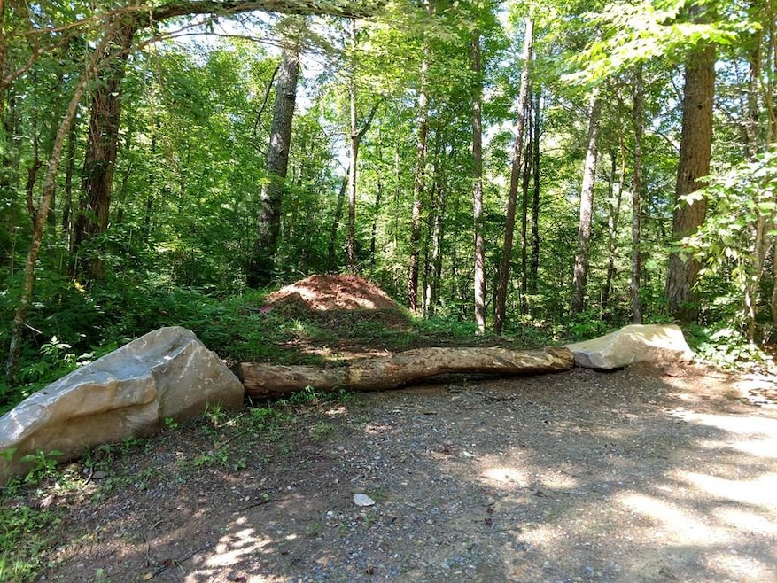
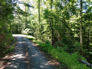
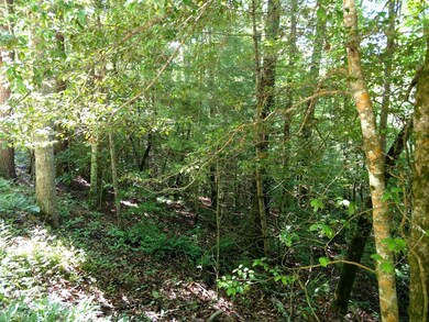
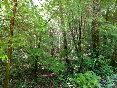
About This Lot
As of October 2023Great opportunity for lots to build your new home or tiny home. A builder / investor could buy all 3 lots and sell separately. Beautiful wooded lots with frontage on the Bryson City Rd and Dean Falls Trail. Lot #1 contains 1.75 acres reference PIN 6569120124 county taxes $130.21. Lot #2 contains 1.68 acres reference PIN 6569028126 county taxes $107.61. Lot #3 contains 1.17 acres reference PIN 6569026202 county taxes $86.67. Total county tax $324.49. Seller will consider selling each lot separately at a negotiated price. Pick one or all and make an offer.
Last Agent to Sell the Property
Keller Williams Realty Of Franklin Brokerage Phone: 8285240100 License #227512 Listed on: 06/12/2019
Last Buyer's Agent
Keller Williams Realty Of Franklin Brokerage Phone: 8285240100 License #227512 Listed on: 06/12/2019
Property Details
Property Type
- Land
Est. Annual Taxes
- $130
Lot Details
- 4.6 Acre Lot
- Property fronts a highway
- Heavily Wooded Lot
- Landscaped with Trees
- Subdivision Possible
Community Details
- No Home Owners Association
- Dean Falls Subdivision
Listing and Financial Details
- Assessor Parcel Number 6569120124
Ownership History
Date
Name
Owned For
Owner Type
Purchase Details
Closed on
Oct 23, 2018
Sold by
Bryant Elizabeth Anne and Bryant Nina
Bought by
Brown John A and Brown Pasty M
Total Days on Market
1562
Current Estimated Value
Similar Properties in Franklin, NC
Create a Home Valuation Report for This Property
The Home Valuation Report is an in-depth analysis detailing your home's value as well as a comparison with similar homes in the area
Home Values in the Area
Average Home Value in this Area
Purchase History
| Date | Buyer | Sale Price | Title Company |
|---|---|---|---|
| Brown John A | $20,000 | None Available |
Source: Public Records
Property History
| Date | Event | Price | Change | Sq Ft Price |
|---|---|---|---|---|
| 10/06/2023 10/06/23 | Sold | $38,000 | -5.0% | -- |
| 09/22/2023 09/22/23 | Pending | -- | -- | -- |
| 01/10/2023 01/10/23 | Price Changed | $40,000 | -20.0% | -- |
| 06/12/2019 06/12/19 | For Sale | $50,000 | -- | -- |
Source: Carolina Smokies Association of REALTORS®
Tax History Compared to Growth
Tax History
| Year | Tax Paid | Tax Assessment Tax Assessment Total Assessment is a certain percentage of the fair market value that is determined by local assessors to be the total taxable value of land and additions on the property. | Land | Improvement |
|---|---|---|---|---|
| 2024 | $140 | $40,160 | $40,160 | $0 |
| 2023 | $131 | $40,160 | $40,160 | $0 |
| 2022 | $131 | $25,520 | $25,520 | $0 |
| 2021 | $131 | $25,520 | $25,520 | $0 |
| 2020 | $125 | $25,520 | $25,520 | $0 |
| 2018 | $0 | $28,350 | $28,350 | $0 |
| 2017 | $130 | $28,350 | $28,350 | $0 |
| 2016 | $130 | $28,350 | $28,350 | $0 |
| 2015 | $130 | $28,350 | $28,350 | $0 |
| 2014 | $88 | $24,150 | $24,150 | $0 |
| 2013 | -- | $24,150 | $24,150 | $0 |
Source: Public Records
Agents Affiliated with this Home
-
Cheryl Keller
C
Seller's Agent in 2023
Cheryl Keller
Keller Williams Realty Of Franklin
(828) 421-3709
45 Total Sales
Map
Source: Carolina Smokies Association of REALTORS®
MLS Number: 26012484
APN: 6569120124
Nearby Homes
- 80 Breezewood Dr
- 288 Deer Path Trail
- 1943 Tellico Rd
- Lot 19 Luker Ln
- 0 Hickory Rock Rd Unit 11 CAR4156290
- Lot 11 Hickory Rock Rd
- 0 Indian Rock Ln Unit 7A&B CAR4221544
- Lot 7A&B Indian Rock Ln
- 0 Hickory Cove Preserve
- 25 Mallory Mountain
- Lot 36 Hickory Cove Rd
- 549 Moonlight Trail Unit 9 & 8
- 549 Moonlight Trail
- 1041 Fox Run Rd
- 414 Hickory Cove Rd
- 17 Moonlight Trail
- 790 Moonlight Trail
- 350 Hickory Springs Trail
- 524 Welch Rd
- 319 McGaha Rd
- 000 Dean Falls Trail
- 0 Dean Falls Rd
- Lot 23 Dean Falls Rd
- 12899 Bryson City Rd
- 63 Dean Falls Trail
- 48 Breezewood Dr
- 12740 Bryson City Rd
- 12659 Bryson City Rd
- 48 Breezewood Dr
- 12915 Bryson City Rd
- 150 Dean Falls Trail
- 12605 Bryson City Rd
- 13071 Bryson City Rd
- 0 Dean Falls Trail
- 12573 Bryson City Rd
- 12573 Bryson City Rd
- 84 Sheila Ln
- 154 Dean Falls Trail
- 182 Breeze Wood Dr
- 10 Dean Falls Trail