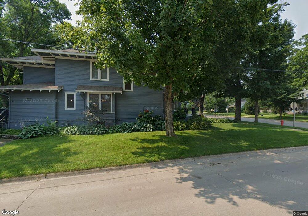
0000 No Address Disclosed Ave Cresco, IA 52136
Estimated Value: $632,000 - $925,000
2
Beds
3
Baths
2,341
Sq Ft
$351/Sq Ft
Est. Value
About This Home
This home is located at 0000 No Address Disclosed Ave, Cresco, IA 52136 and is currently estimated at $820,671, approximately $350 per square foot. 0000 No Address Disclosed Ave is a home located in Winneshiek County with nearby schools including Crestwood High School.
Ownership History
Date
Name
Owned For
Owner Type
Purchase Details
Closed on
Aug 27, 2025
Sold by
Steven L Rieger Revocable Trust and Rieger Steven L
Bought by
Patrick L Johnson And Sue A Johnson Revocable and Johnson
Current Estimated Value
Purchase Details
Closed on
May 29, 2024
Sold by
Amsbaugh Angelika and Harold R Amsbaugh 1996 Revocable Trust
Bought by
Steven L Rieger Revocable Trust
Create a Home Valuation Report for This Property
The Home Valuation Report is an in-depth analysis detailing your home's value as well as a comparison with similar homes in the area
Home Values in the Area
Average Home Value in this Area
Purchase History
| Date | Buyer | Sale Price | Title Company |
|---|---|---|---|
| Patrick L Johnson And Sue A Johnson Revocable | $900,000 | None Listed On Document | |
| Steven L Rieger Revocable Trust | $800,000 | None Listed On Document |
Source: Public Records
Tax History Compared to Growth
Tax History
| Year | Tax Paid | Tax Assessment Tax Assessment Total Assessment is a certain percentage of the fair market value that is determined by local assessors to be the total taxable value of land and additions on the property. | Land | Improvement |
|---|---|---|---|---|
| 2025 | $8,156 | $819,020 | $80,750 | $738,270 |
| 2024 | $8,156 | $676,900 | $17,700 | $659,200 |
| 2023 | $7,830 | $676,900 | $17,700 | $659,200 |
| 2022 | $7,608 | $592,370 | $14,260 | $578,110 |
| 2021 | $7,274 | $590,320 | $14,260 | $576,060 |
| 2020 | $7,274 | $546,290 | $15,280 | $531,010 |
| 2019 | $7,290 | $555,420 | $0 | $0 |
| 2018 | $6,998 | $555,420 | $0 | $0 |
| 2017 | $6,810 | $525,830 | $0 | $0 |
| 2016 | $6,572 | $525,830 | $0 | $0 |
| 2015 | $6,312 | $503,290 | $0 | $0 |
| 2014 | $6,312 | $503,290 | $0 | $0 |
Source: Public Records
Map
Nearby Homes
- 0 Co Rd A23 Unit NOC6333468
- 3447 303rd Ave
- Tbd
- 545 1st Ave SW
- 540 Main Ave S
- 1014 Division St
- 211 Royal Oaks Dr
- 440 1st Ave SE
- TBD ( Lot 6, Blk 2) 3rd Ave SE
- TBD (Lot 4 Blk2 ) 3rd Ave SE
- TBD ( Lot 2, Blk 2) 3rd Ave SE
- TBD (Lot 3, Blk 1) 3rd Ave SE
- TBD ( Lot 4, Blk 1) 3rd Ave SE
- TBD ( Lot 3, Blk 2) 3rd Ave SE
- TBD ( Lot 1, Blk 1) 3rd Ave SE
- 347 5th Ave SE Unit A
- 732 N Elm St
- 716 6th Ave E
- 106 6th Ave W
- 205 6th Ave W