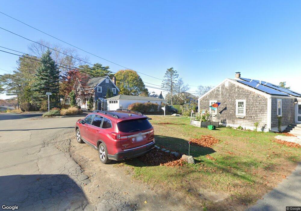
09 Cedar Ln Gloucester, MA 01930
Riverview NeighborhoodEstimated Value: $902,000 - $932,000
4
Beds
2
Baths
2,400
Sq Ft
$382/Sq Ft
Est. Value
About This Home
This home is located at 09 Cedar Ln, Gloucester, MA 01930 and is currently estimated at $917,149, approximately $382 per square foot. 09 Cedar Ln is a home located in Essex County with nearby schools including Beeman Memorial, Ralph B O'maley Middle School, and Gloucester High School.
Ownership History
Date
Name
Owned For
Owner Type
Purchase Details
Closed on
Apr 2, 2019
Sold by
Shea Steven P
Bought by
Oshea Catherine A and Oshea Timothy C
Current Estimated Value
Purchase Details
Closed on
Jan 13, 2015
Sold by
Oshea Timothy C and Oshea Catherine A
Bought by
Catherine A Oshea Ft
Purchase Details
Closed on
Mar 27, 2014
Sold by
Rossa Catherine A
Bought by
Oshea Timothy C and Oshea Catherien A
Purchase Details
Closed on
Jan 30, 2003
Sold by
Oshea Catherine A
Bought by
Catherine A Oshea 9 Ce
Purchase Details
Closed on
Jun 1, 1977
Bought by
Oshea Timothy C and Oshea Catherien A
Create a Home Valuation Report for This Property
The Home Valuation Report is an in-depth analysis detailing your home's value as well as a comparison with similar homes in the area
Home Values in the Area
Average Home Value in this Area
Purchase History
| Date | Buyer | Sale Price | Title Company |
|---|---|---|---|
| Oshea Catherine A | -- | -- | |
| Sherry L Ranta 2019 Ret | -- | -- | |
| Catherine A Oshea Ft | -- | -- | |
| Oshea Timothy C | -- | -- | |
| Rossa Catherine A | -- | -- | |
| Catherine A Oshea 9 Ce | -- | -- | |
| Timothy C Oshea 9 Ceda | -- | -- | |
| Oshea Timothy C | -- | -- | |
| Oshea Timothy C | $29,000 | -- |
Source: Public Records
Mortgage History
| Date | Status | Borrower | Loan Amount |
|---|---|---|---|
| Previous Owner | Oshea Timothy C | $100,000 | |
| Previous Owner | Oshea Timothy C | $25,000 |
Source: Public Records
Tax History
| Year | Tax Paid | Tax Assessment Tax Assessment Total Assessment is a certain percentage of the fair market value that is determined by local assessors to be the total taxable value of land and additions on the property. | Land | Improvement |
|---|---|---|---|---|
| 2025 | $7,338 | $754,900 | $307,700 | $447,200 |
| 2024 | $7,203 | $740,300 | $293,100 | $447,200 |
| 2023 | $6,918 | $653,300 | $261,700 | $391,600 |
| 2022 | $6,643 | $566,300 | $222,400 | $343,900 |
| 2021 | $6,418 | $515,900 | $202,200 | $313,700 |
| 2020 | $6,354 | $515,300 | $202,200 | $313,100 |
| 2019 | $6,127 | $482,800 | $202,200 | $280,600 |
| 2018 | $5,950 | $460,200 | $202,200 | $258,000 |
| 2017 | $5,772 | $437,600 | $192,600 | $245,000 |
| 2016 | $5,630 | $413,700 | $193,300 | $220,400 |
| 2015 | $5,682 | $416,300 | $200,000 | $216,300 |
Source: Public Records
Map
Nearby Homes
- 13 Honeysuckle Rd
- 2 Breezy Point Rd
- 31 Echo Ave
- 2 Finch Ln
- 167 Atlantic St
- 672 Washington St
- 226 Atlantic St
- 13 Mystic Ave
- 6 Monroe Ct
- 98 Maplewood Ave
- 5 Samoset Rd Unit B
- 40 Sargent St
- 15 Harvard St
- 5 Lepage Ln
- 84 Centennial Ave
- 19 Trask St Unit 2
- 33 Maplewood Ave Unit 16
- 113 Pleasant St
- 20 Beacon St Unit 2
- 20 Beacon St Unit 1
Your Personal Tour Guide
Ask me questions while you tour the home.