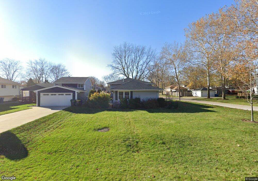
0N490 Evans Ave Wheaton, IL 60187
Northside-Wheaton NeighborhoodEstimated Value: $554,665 - $697,000
3
Beds
2
Baths
2,412
Sq Ft
$245/Sq Ft
Est. Value
About This Home
This home is located at 0N490 Evans Ave, Wheaton, IL 60187 and is currently estimated at $591,916, approximately $245 per square foot. 0N490 Evans Ave is a home with nearby schools including Carl Sandburg Elementary School, Monroe Middle School, and Wheaton North High School.
Ownership History
Date
Name
Owned For
Owner Type
Purchase Details
Closed on
May 10, 2021
Sold by
Schroeder Carol J
Bought by
Carol J Schroeder Trust and Schroeder
Current Estimated Value
Home Financials for this Owner
Home Financials are based on the most recent Mortgage that was taken out on this home.
Original Mortgage
$230,000
Outstanding Balance
$209,332
Interest Rate
3.38%
Mortgage Type
New Conventional
Estimated Equity
$382,584
Purchase Details
Closed on
Nov 6, 1994
Sold by
Schroeder Lawrence J
Bought by
Schroeder Lawrence J and Schroeder Carol J
Home Financials for this Owner
Home Financials are based on the most recent Mortgage that was taken out on this home.
Original Mortgage
$200,000
Interest Rate
8.75%
Create a Home Valuation Report for This Property
The Home Valuation Report is an in-depth analysis detailing your home's value as well as a comparison with similar homes in the area
Home Values in the Area
Average Home Value in this Area
Purchase History
| Date | Buyer | Sale Price | Title Company |
|---|---|---|---|
| Carol J Schroeder Trust | -- | Ravenswood Title | |
| Schroeder Lawrence J | -- | -- |
Source: Public Records
Mortgage History
| Date | Status | Borrower | Loan Amount |
|---|---|---|---|
| Open | Carol J Schroeder Trust | $230,000 | |
| Previous Owner | Schroeder Lawrence J | $200,000 |
Source: Public Records
Tax History
| Year | Tax Paid | Tax Assessment Tax Assessment Total Assessment is a certain percentage of the fair market value that is determined by local assessors to be the total taxable value of land and additions on the property. | Land | Improvement |
|---|---|---|---|---|
| 2024 | $11,040 | $184,232 | $44,999 | $139,233 |
| 2023 | $10,577 | $169,580 | $41,420 | $128,160 |
| 2022 | $10,285 | $160,260 | $39,140 | $121,120 |
| 2021 | $9,938 | $156,460 | $38,210 | $118,250 |
| 2020 | $9,889 | $155,000 | $37,850 | $117,150 |
| 2019 | $9,639 | $150,910 | $36,850 | $114,060 |
| 2018 | $9,032 | $140,520 | $34,730 | $105,790 |
| 2017 | $8,886 | $135,340 | $33,450 | $101,890 |
| 2016 | $8,767 | $129,930 | $32,110 | $97,820 |
| 2015 | $8,707 | $123,950 | $30,630 | $93,320 |
| 2014 | $8,402 | $117,750 | $20,490 | $97,260 |
| 2013 | $8,143 | $118,100 | $20,550 | $97,550 |
Source: Public Records
Map
Nearby Homes
- 26W181 Grand Ave
- 26W237 Parkway Dr
- 1N049 Mission Ct
- 1327 Shagbark Ln
- 1N118 Mission Ct
- 1561 N Gary Ave
- 1037 Wheaton Oaks Dr
- 933 Wheaton Oaks Dr
- 0N112 Leonard St
- 26W524 Jewell Rd
- 1310 N Carlton Ave
- N405 Gary Ave
- 26W401 Torrey Pines Ct Unit 1C
- 26W548 Prairie Ave
- 27W214 Heather Ln
- 0 Ellis Ave
- 2018 N West St
- 524 Western Ave
- 25W275 Doris Ave
- Lot 11 Ellis Ave
- 0N510 Evans Ave
- 26W076 Thomas Rd
- 0N522 Evans Ave
- 0N509 Evans Ave
- 26W065 Thomas Rd
- 26W051 Thomas Rd
- 26W033 Thomas Rd
- 0N523 Evans Ave
- 26W104 Thomas Rd
- 0N538 Evans Ave
- 0N537 Evans Ave
- 26W103 Grand Ave
- 26W109 Thomas Rd
- 0N511 Beverly St
- 26W046 Armbrust Ave
- 26W040 Armbrust Ave
- 0N550 Evans Ave
- 26W030 Armbrust Ave
- 26W115 Grand Ave
- 26W064 Armbrust Ave
Your Personal Tour Guide
Ask me questions while you tour the home.