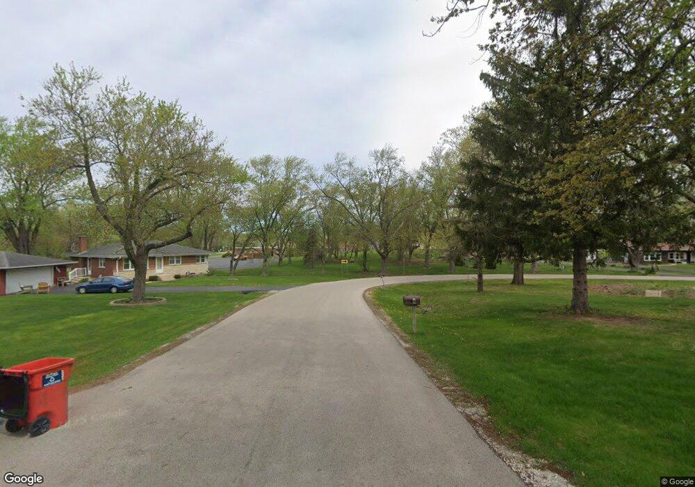
0N654 Peter Rd Wheaton, IL 60187
Northside-Wheaton NeighborhoodEstimated Value: $410,590 - $485,000
Studio
--
Bath
1,500
Sq Ft
$297/Sq Ft
Est. Value
About This Home
This home is located at 0N654 Peter Rd, Wheaton, IL 60187 and is currently estimated at $445,148, approximately $296 per square foot. 0N654 Peter Rd is a home located in DuPage County with nearby schools including Pleasant Hill Elementary School, Monroe Middle School, and Wheaton North High School.
Ownership History
Date
Name
Owned For
Owner Type
Purchase Details
Closed on
Apr 26, 2013
Sold by
Vermillion Cheryl L
Bought by
Vermillion Cheryl L and Cheryl L Vermillion Revocable Living Tru
Current Estimated Value
Purchase Details
Closed on
Dec 10, 2004
Sold by
Vermillion Dale and Vermillion Cheryl L
Bought by
Vermillion Cheryl L
Home Financials for this Owner
Home Financials are based on the most recent Mortgage that was taken out on this home.
Original Mortgage
$195,000
Interest Rate
5.84%
Mortgage Type
Stand Alone Refi Refinance Of Original Loan
Purchase Details
Closed on
May 19, 1997
Sold by
American National Bk & Tr Co Of Chicago
Bought by
Vermillion Dale and Vermillion Cheryl
Home Financials for this Owner
Home Financials are based on the most recent Mortgage that was taken out on this home.
Original Mortgage
$156,700
Interest Rate
8.01%
Create a Home Valuation Report for This Property
The Home Valuation Report is an in-depth analysis detailing your home's value as well as a comparison with similar homes in the area
Home Values in the Area
Average Home Value in this Area
Purchase History
| Date | Buyer | Sale Price | Title Company |
|---|---|---|---|
| Vermillion Cheryl L | -- | None Available | |
| Vermillion Cheryl L | -- | Ctic | |
| Vermillion Dale | $196,000 | -- |
Source: Public Records
Mortgage History
| Date | Status | Borrower | Loan Amount |
|---|---|---|---|
| Closed | Vermillion Cheryl L | $195,000 | |
| Closed | Vermillion Dale | $156,700 |
Source: Public Records
Tax History
| Year | Tax Paid | Tax Assessment Tax Assessment Total Assessment is a certain percentage of the fair market value that is determined by local assessors to be the total taxable value of land and additions on the property. | Land | Improvement |
|---|---|---|---|---|
| 2024 | $7,888 | $133,920 | $41,424 | $92,496 |
| 2023 | $7,545 | $123,270 | $38,130 | $85,140 |
| 2022 | $7,367 | $116,500 | $36,040 | $80,460 |
| 2021 | $7,116 | $113,730 | $35,180 | $78,550 |
| 2020 | $7,079 | $112,670 | $34,850 | $77,820 |
| 2019 | $6,898 | $109,700 | $33,930 | $75,770 |
| 2018 | $6,651 | $105,060 | $31,970 | $73,090 |
| 2017 | $6,539 | $101,180 | $30,790 | $70,390 |
| 2016 | $6,448 | $97,140 | $29,560 | $67,580 |
| 2015 | $6,398 | $92,670 | $28,200 | $64,470 |
| 2014 | $6,622 | $94,080 | $20,100 | $73,980 |
| 2013 | $6,419 | $94,360 | $20,160 | $74,200 |
Source: Public Records
Map
Nearby Homes
- 26W181 Grand Ave
- 26W185 Meadowview Ct
- 1N020 Prairie Path Ln
- 27W210 Providence Ln Unit 1
- 27W125 Chestnut Ln
- 27W266 Oakwood St
- n 071 Stanley St
- 0N700 Concord Ln
- 27W300 Melrose Ln
- 27W439 Chartwell Dr
- 27W073 Jewell Rd
- 0S064 Calvin Ct
- 27W180 Cooley Ave
- 27W145 Cooley Ave
- 27W225 Ash Ct
- 27W705 Grasmere Dr Unit 1702
- 0N155 Windermere Rd Unit 1005
- 0N018 Windermere Rd Unit 301
- 27W130 W Street Charles Rd
- 570 Amy Ln
- 0N640 Peter Rd
- 0N668 Peter Rd
- 26W376 Jerome Ave
- 0N680 Peter Rd
- 0N647 Peter Rd
- 26W416 Grand Ave
- 26W341 Bud Ct
- 0N669 Barry Ave
- 0N708 Peter Rd
- 0N701 Barry Ave
- 26W413 Grand Ave
- 26W325 Bud Ct
- 0N681 Barry Ave
- 26W340 Jerome Ave
- 26W405 Grand Ave
- 26W355 Jerome Ave
- N730 Barry Ave
- N757 Barry Ave
- 26W342 Bud Ct
- 26W320 Jerome Ave
