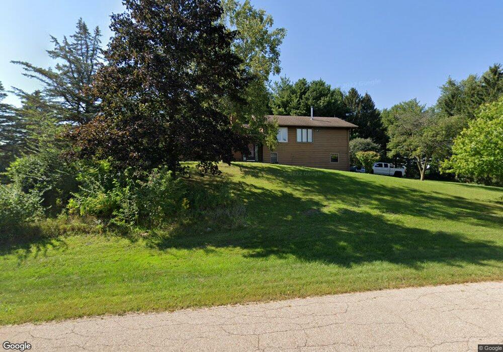
0S172 Rowe Rd Elburn, IL 60119
Estimated Value: $478,000 - $536,000
4
Beds
3
Baths
2,400
Sq Ft
$212/Sq Ft
Est. Value
About This Home
This home is located at 0S172 Rowe Rd, Elburn, IL 60119 and is currently estimated at $508,738, approximately $211 per square foot. 0S172 Rowe Rd is a home with nearby schools including Kaneland Blackberry Creek Elementary School, Harter Middle School, and Kaneland High School.
Ownership History
Date
Name
Owned For
Owner Type
Purchase Details
Closed on
Oct 21, 1998
Sold by
Ybanez Joseph A
Bought by
Maras Paul E and Maras Jill Ann
Current Estimated Value
Home Financials for this Owner
Home Financials are based on the most recent Mortgage that was taken out on this home.
Original Mortgage
$33,500
Interest Rate
6.78%
Purchase Details
Closed on
Mar 20, 1996
Sold by
Hannigan Robert K
Bought by
Ybanez Joseph
Home Financials for this Owner
Home Financials are based on the most recent Mortgage that was taken out on this home.
Original Mortgage
$33,000
Interest Rate
7.46%
Create a Home Valuation Report for This Property
The Home Valuation Report is an in-depth analysis detailing your home's value as well as a comparison with similar homes in the area
Home Values in the Area
Average Home Value in this Area
Purchase History
| Date | Buyer | Sale Price | Title Company |
|---|---|---|---|
| Maras Paul E | $45,000 | -- | |
| Ybanez Joseph | $45,000 | Standard Title |
Source: Public Records
Mortgage History
| Date | Status | Borrower | Loan Amount |
|---|---|---|---|
| Closed | Maras Paul E | $33,500 | |
| Previous Owner | Ybanez Joseph | $33,000 |
Source: Public Records
Tax History
| Year | Tax Paid | Tax Assessment Tax Assessment Total Assessment is a certain percentage of the fair market value that is determined by local assessors to be the total taxable value of land and additions on the property. | Land | Improvement |
|---|---|---|---|---|
| 2024 | $9,793 | $130,070 | $21,880 | $108,190 |
| 2023 | $9,445 | $117,391 | $19,747 | $97,644 |
| 2022 | $8,135 | $97,307 | $18,123 | $79,184 |
| 2021 | $7,871 | $93,135 | $17,346 | $75,789 |
| 2020 | $7,738 | $90,952 | $16,939 | $74,013 |
| 2019 | $7,753 | $89,616 | $16,690 | $72,926 |
| 2018 | $7,429 | $84,487 | $16,690 | $67,797 |
| 2017 | $7,438 | $83,526 | $16,500 | $67,026 |
| 2016 | $8,008 | $87,009 | $19,171 | $67,838 |
| 2015 | -- | $80,803 | $18,423 | $62,380 |
| 2014 | -- | $84,472 | $20,500 | $63,972 |
| 2013 | -- | $84,472 | $20,500 | $63,972 |
Source: Public Records
Map
Nearby Homes
- 0S790 Rowe Rd
- Lot 9 Rowe Rd
- 765 Carolyn Ct
- 1557 Melbourne St
- 00 Rt 38 Rd
- 16 Derek Dr
- Lot #11 Derek Dr
- Lot #12 Derek Dr
- Lot #5 Derek Dr
- Lot #6 Derek Dr
- Lot #4 Derek Dr
- Lot #7 Derek Dr
- 1029 Wise St
- 931 Patriot Pkwy
- 1171 Souders Ave
- 1383 Dodson Ave
- 0S955 Thorndon Ridge Dr Unit 2
- 1155 Corrigan St
- 815 Kindberg Ct
- 1038 Veteran Ave
- 0S163 Surrey Dr
- 0S156 Rowe Rd
- 0S185 Rowe Rd
- 143 Rowe Rd
- 0S145 Surrey Dr
- 43W760 Rowe Rd Unit 3
- 0S190 Surrey Dr
- 43W747 Kenmar Dr
- 43W723 Kenmar Dr
- 43W771 Kenmar Dr
- 0S156 Surrey Dr
- 0S123 Rowe Rd
- 0S129 Surrey Dr
- 43W770 Rowe Rd
- 0S668 Derek Dr
- 0S810 Autumn Woods Ln
- 42 W Main Street Rd
- 0S219 Rowe Rd
- 0S131 Rowe Rd
- 0S140 Surrey Dr
Your Personal Tour Guide
Ask me questions while you tour the home.