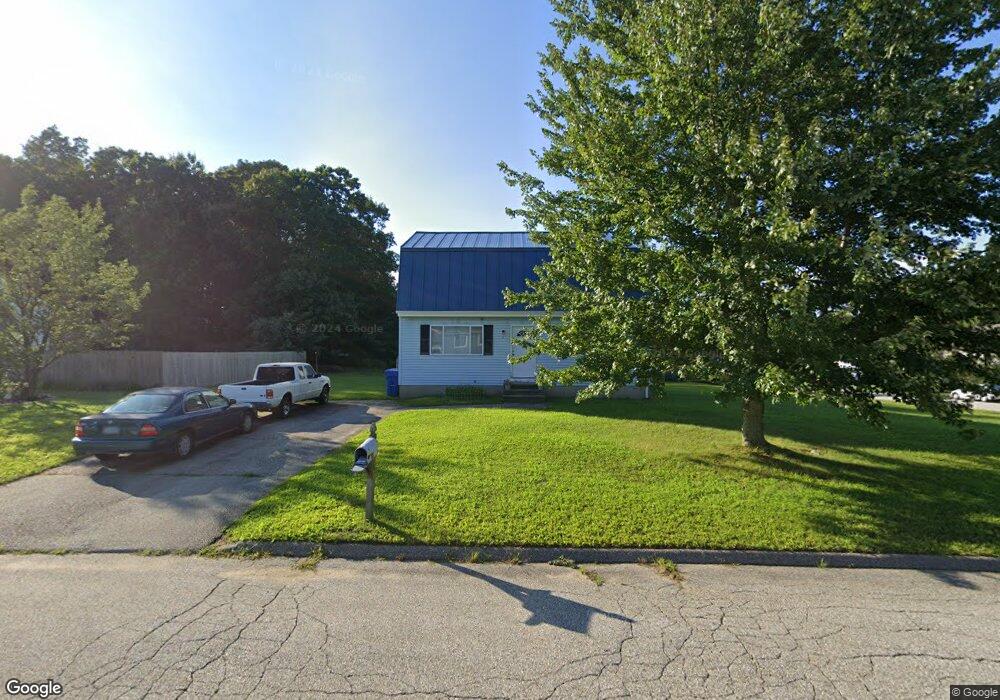
1 Amanda Ct Uncasville, CT 06382
Estimated Value: $306,104 - $369,000
2
Beds
2
Baths
1,587
Sq Ft
$213/Sq Ft
Est. Value
About This Home
This home is located at 1 Amanda Ct, Uncasville, CT 06382 and is currently estimated at $337,776, approximately $212 per square foot. 1 Amanda Ct is a home located in New London County with nearby schools including Leonard J. Tyl Middle School, Montville High School, and Bradley School-New London Regional.
Ownership History
Date
Name
Owned For
Owner Type
Purchase Details
Closed on
May 29, 1992
Sold by
Damato Milford Lp
Bought by
Corson Brian
Current Estimated Value
Home Financials for this Owner
Home Financials are based on the most recent Mortgage that was taken out on this home.
Original Mortgage
$90,000
Interest Rate
8.7%
Mortgage Type
Unknown
Create a Home Valuation Report for This Property
The Home Valuation Report is an in-depth analysis detailing your home's value as well as a comparison with similar homes in the area
Home Values in the Area
Average Home Value in this Area
Purchase History
| Date | Buyer | Sale Price | Title Company |
|---|---|---|---|
| Corson Brian | $95,400 | -- | |
| Corson Brian | $95,400 | -- |
Source: Public Records
Mortgage History
| Date | Status | Borrower | Loan Amount |
|---|---|---|---|
| Closed | Corson Brian | $72,000 | |
| Closed | Corson Brian | $90,000 |
Source: Public Records
Tax History Compared to Growth
Tax History
| Year | Tax Paid | Tax Assessment Tax Assessment Total Assessment is a certain percentage of the fair market value that is determined by local assessors to be the total taxable value of land and additions on the property. | Land | Improvement |
|---|---|---|---|---|
| 2025 | $3,927 | $136,010 | $31,500 | $104,510 |
| 2024 | $3,777 | $136,010 | $31,500 | $104,510 |
| 2023 | $3,777 | $136,010 | $31,500 | $104,510 |
| 2022 | $3,633 | $136,010 | $31,500 | $104,510 |
| 2021 | $3,632 | $114,400 | $32,960 | $81,440 |
| 2020 | $3,704 | $114,400 | $32,960 | $81,440 |
| 2019 | $3,719 | $114,400 | $32,960 | $81,440 |
| 2018 | $3,630 | $114,400 | $32,960 | $81,440 |
| 2017 | $3,626 | $114,400 | $32,960 | $81,440 |
| 2016 | $3,614 | $118,070 | $42,360 | $75,710 |
| 2015 | $3,614 | $118,070 | $42,360 | $75,710 |
| 2014 | $3,468 | $118,070 | $42,360 | $75,710 |
Source: Public Records
Map
Nearby Homes
- 2 Chesterfield Rd
- 79 Cottonwood Ln
- 727 Old Colchester Rd
- 82C Pires Dr
- 320 Maple Ave
- 505 Old Colchester Rd
- 636 Connecticut 163
- 72 Pheasant Run
- 465 Gay Hill Rd
- 270 Gay Hill Rd
- 230 Gay Hill Rd
- 0 Monahan Dr
- 63 Velgouse Rd
- 1 High Ridge Cir
- 7 Pennsylvania Ave
- 5 Mountain Laurel Ridge
- 57 Roselund Hill Rd
- 17 Manor Rd
- 19 Wyndwood Rd
- 197 Connecticut Blvd
- 140 Cottonwood Ln
- 5 Amanda Ct
- 4 Amanda Ct
- 144 Cottonwood Ln
- 9 Amanda Ct
- 131 Cottonwood Ln
- 135 Cottonwood Ln
- 148 Cottonwood Ln
- 8 Amanda Ct
- 127 Cottonwood Ln
- 139 Cottonwood Ln
- 122 Cottonwood Ln
- 143 Cottonwood Ln
- 123 Cottonwood Ln
- 152 Cottonwood Ln
- 54 Chesterfield Rd
- 147 Cottonwood Ln
- 13 Amanda Ct
- 119 Cottonwood Ln
- 54 Joy Ln