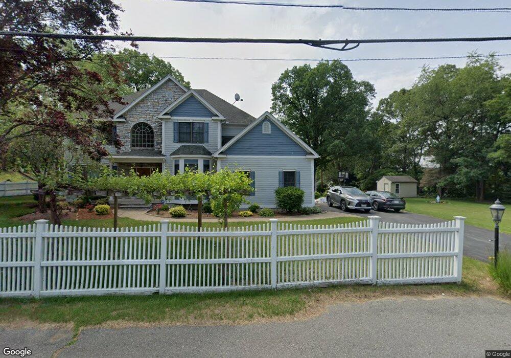
1 Audubon Dr Shrewsbury, MA 01545
Estimated Value: $842,000 - $1,042,000
4
Beds
3
Baths
2,906
Sq Ft
$330/Sq Ft
Est. Value
About This Home
This home is located at 1 Audubon Dr, Shrewsbury, MA 01545 and is currently estimated at $958,864, approximately $329 per square foot. 1 Audubon Dr is a home located in Worcester County with nearby schools including Sherwood Middle School, Calvin Coolidge Elementary School, and Oak Middle School.
Ownership History
Date
Name
Owned For
Owner Type
Purchase Details
Closed on
Apr 21, 2021
Sold by
Mendilian Norma
Bought by
Mendilian Norma and Mendilian Serge
Current Estimated Value
Home Financials for this Owner
Home Financials are based on the most recent Mortgage that was taken out on this home.
Original Mortgage
$201,000
Outstanding Balance
$149,065
Interest Rate
2.38%
Mortgage Type
New Conventional
Estimated Equity
$809,799
Purchase Details
Closed on
Aug 23, 1993
Sold by
Menicutch J Est
Bought by
Kassis Norma
Create a Home Valuation Report for This Property
The Home Valuation Report is an in-depth analysis detailing your home's value as well as a comparison with similar homes in the area
Home Values in the Area
Average Home Value in this Area
Purchase History
| Date | Buyer | Sale Price | Title Company |
|---|---|---|---|
| Mendilian Norma | -- | Metropolitan Title Agency | |
| Mendilian Norma | -- | None Available | |
| Mendilian Norma | -- | Metropolitan Title Agency | |
| Kassis Norma | $97,500 | -- | |
| Kassis Norma | $97,500 | -- |
Source: Public Records
Mortgage History
| Date | Status | Borrower | Loan Amount |
|---|---|---|---|
| Open | Mendilian Norma | $201,000 | |
| Closed | Mendilian Norma | $201,000 |
Source: Public Records
Tax History Compared to Growth
Tax History
| Year | Tax Paid | Tax Assessment Tax Assessment Total Assessment is a certain percentage of the fair market value that is determined by local assessors to be the total taxable value of land and additions on the property. | Land | Improvement |
|---|---|---|---|---|
| 2025 | $112 | $928,500 | $224,800 | $703,700 |
| 2024 | $11,300 | $912,800 | $214,100 | $698,700 |
| 2023 | $10,420 | $794,200 | $214,100 | $580,100 |
| 2022 | $9,699 | $687,400 | $190,100 | $497,300 |
| 2021 | $8,477 | $642,700 | $180,100 | $462,600 |
| 2020 | $7,566 | $606,700 | $180,100 | $426,600 |
| 2019 | $7,190 | $572,000 | $172,800 | $399,200 |
| 2018 | $7,297 | $576,400 | $159,200 | $417,200 |
| 2017 | $7,032 | $548,100 | $144,100 | $404,000 |
| 2016 | $7,059 | $543,000 | $135,100 | $407,900 |
| 2015 | $7,030 | $532,600 | $124,700 | $407,900 |
Source: Public Records
Map
Nearby Homes
- 7 Tern Dr
- 15 Eagle Dr
- 10 Crane Cir
- 40 Phillips Ave
- 6 Selina St
- 5 Fyrbeck Ave
- 15 Eaglehead Terrace Unit 5
- 19 Eaglehead Terrace Unit 2
- 19 Eaglehead Terrace Unit 4
- 8 Beach Rd
- 307 Main St
- 315 Maple Ave
- 67 N Quinsigamond Ave Unit 23
- 46 N Quinsigamond Ave
- 163 N Lake Ave Unit A
- 163 N Lake Ave
- 10 Gleason Rd
- 56 Ireta Rd
- 52 Fairlawn Cir
- 31 Oak St