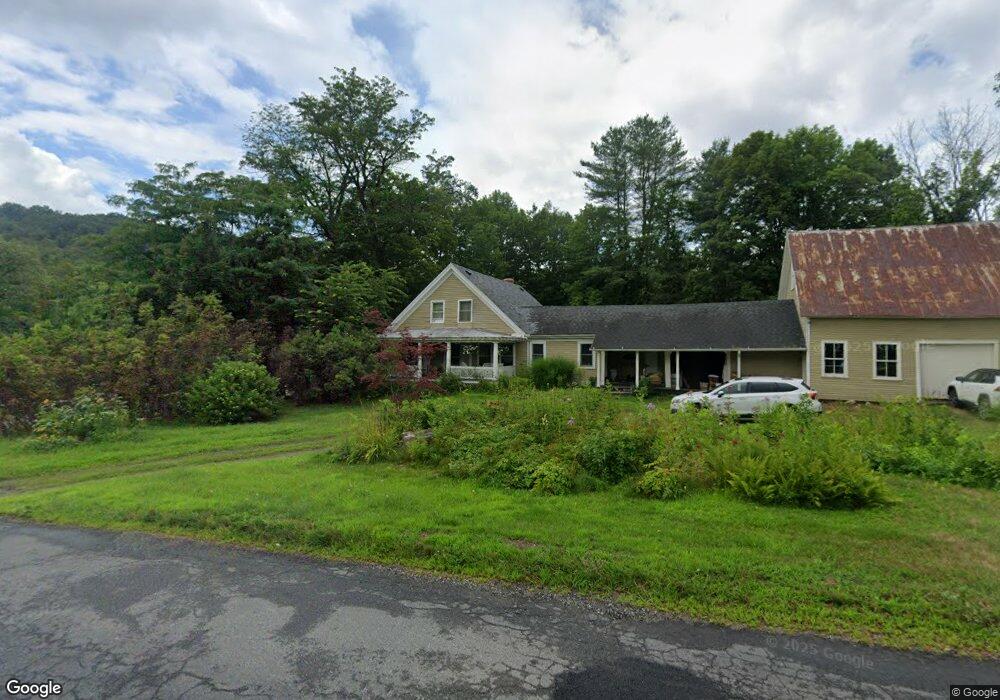
#1 Avery Brook Rd Charlemont, MA 01339
Estimated Value: $156,642
Studio
--
Bath
--
Sq Ft
92
Acres
About This Home
This home is located at #1 Avery Brook Rd, Charlemont, MA 01339 and is currently priced at $156,642. #1 Avery Brook Rd is a home located in Franklin County with nearby schools including Hawlemont Regional, Mohawk Trail Regional High School, and The Academy At Charlemont.
Ownership History
Date
Name
Owned For
Owner Type
Purchase Details
Closed on
May 5, 2023
Sold by
Austin Bayard C
Bought by
Moseley Steven G
Current Estimated Value
Purchase Details
Closed on
May 18, 2021
Sold by
Juckett Ft and Juckett
Bought by
Austin Bayard C
Purchase Details
Closed on
Feb 20, 2019
Sold by
Raymond D Hanson Int D and Raymond Audette
Bought by
Hearion-Lacasse Heather
Purchase Details
Closed on
Aug 31, 2018
Sold by
Juckett Kenneth G and Juckett Jeanie M
Bought by
Juckett Ft and Juckett
Purchase Details
Closed on
Aug 7, 2003
Sold by
Ts Mann Lumber Co Inc
Bought by
Cashin Jacqueline Mary and Cashin Thomas James
Purchase Details
Closed on
May 15, 2002
Sold by
Howland David F and Howland Margaret Ec
Bought by
Freeman Donald Cary and Freeman Margaret Helen
Home Financials for this Owner
Home Financials are based on the most recent Mortgage that was taken out on this home.
Original Mortgage
$340,800
Interest Rate
7.15%
Mortgage Type
Purchase Money Mortgage
Create a Home Valuation Report for This Property
The Home Valuation Report is an in-depth analysis detailing your home's value as well as a comparison with similar homes in the area
Home Values in the Area
Average Home Value in this Area
Purchase History
| Date | Buyer | Sale Price | Title Company |
|---|---|---|---|
| Moseley Steven G | $180,000 | None Available | |
| Moseley Steven G | $180,000 | None Available | |
| Moseley Steven G | $180,000 | None Available | |
| Austin Bayard C | $150,000 | None Available | |
| Austin Bayard C | $150,000 | None Available | |
| Austin Bayard C | $150,000 | None Available | |
| Hearion-Lacasse Heather | -- | -- | |
| Hearion-Lacasse Heather | -- | -- | |
| Juckett Ft | -- | -- | |
| Juckett Ft | -- | -- | |
| Cashin Jacqueline Mary | $75,000 | -- | |
| Cashin Jacqueline Mary | $75,000 | -- | |
| Freeman Donald Cary | $426,000 | -- | |
| Freeman Donald Cary | $426,000 | -- |
Source: Public Records
Mortgage History
| Date | Status | Borrower | Loan Amount |
|---|---|---|---|
| Previous Owner | Freeman Donald Cary | $340,800 | |
| Previous Owner | Freeman Donald Cary | $70,000 |
Source: Public Records
Tax History
| Year | Tax Paid | Tax Assessment Tax Assessment Total Assessment is a certain percentage of the fair market value that is determined by local assessors to be the total taxable value of land and additions on the property. | Land | Improvement |
|---|---|---|---|---|
| 2025 | $1 | $6,484 | $6,484 | $0 |
| 2024 | $160 | $7,719 | $7,719 | $0 |
| 2023 | $172 | $8,337 | $8,337 | $0 |
| 2022 | $186 | $8,954 | $8,954 | $0 |
| 2021 | $191 | $9,339 | $9,339 | $0 |
| 2020 | $181 | $9,300 | $9,300 | $0 |
| 2019 | $150 | $7,600 | $7,600 | $0 |
| 2018 | $139 | $6,800 | $6,800 | $0 |
| 2017 | $117 | $5,800 | $5,800 | $0 |
| 2016 | $110 | $5,600 | $5,600 | $0 |
| 2015 | -- | $5,500 | $5,500 | $0 |
Source: Public Records
Map
Nearby Homes
- 0 Schaefer Way
- 2153 Massachusetts 2
- 63 W Hawley Rd
- 559 Tea St
- 0 Potters Rd Unit 248445
- 0 Potters Rd Unit 73439831
- 0 E Hawley Rd Unit 73456358
- 0 Warfield Rd
- 168 Main St
- 49 East Rd
- 0, Lot 7 East Rd
- Lot 3.2 East Rd
- 1451 Route 2 E
- 1451 Massachusetts 2
- 132 Harwood Rd
- Lot 121 Davis Mine Rd
- 127 County Rd
- 292 E Hawley Rd
- 0 Tunnel Rd
- 201 Ford Hill Rd
Your Personal Tour Guide
Ask me questions while you tour the home.