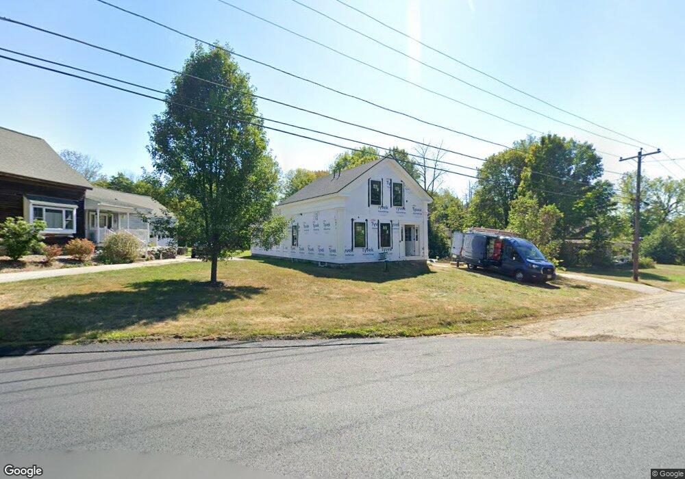
1 Barre Rd Hubbardston, MA 01452
Estimated Value: $132,000 - $305,000
2
Beds
1
Bath
1,297
Sq Ft
$160/Sq Ft
Est. Value
About This Home
This home is located at 1 Barre Rd, Hubbardston, MA 01452 and is currently estimated at $206,935, approximately $159 per square foot. 1 Barre Rd is a home located in Worcester County with nearby schools including Quabbin Regional Middle School and Quabbin Regional High School.
Ownership History
Date
Name
Owned For
Owner Type
Purchase Details
Closed on
Aug 7, 2025
Sold by
Pollard Matthew
Bought by
Mck Estates Llc
Current Estimated Value
Purchase Details
Closed on
Apr 29, 2024
Sold by
Hubbard Robert L
Bought by
Hubbard-Kelley Carol and Hubbard-Ward June
Purchase Details
Closed on
Sep 22, 1995
Sold by
Devonshire Dev Inc
Bought by
Pond Michael
Purchase Details
Closed on
Aug 16, 1995
Sold by
Fdic and Richardson Mary A
Bought by
Devonshire Dev Inc
Create a Home Valuation Report for This Property
The Home Valuation Report is an in-depth analysis detailing your home's value as well as a comparison with similar homes in the area
Home Values in the Area
Average Home Value in this Area
Purchase History
| Date | Buyer | Sale Price | Title Company |
|---|---|---|---|
| Mck Estates Llc | -- | -- | |
| Mck Estates Llc | -- | -- | |
| Hubbard-Kelley Carol | -- | None Available | |
| Hubbard-Kelley Carol | -- | None Available | |
| Hubbard-Kelley Carol | -- | None Available | |
| Pond Michael | $22,000 | -- | |
| Pond Michael | $22,000 | -- | |
| Devonshire Dev Inc | $20,000 | -- |
Source: Public Records
Mortgage History
| Date | Status | Borrower | Loan Amount |
|---|---|---|---|
| Previous Owner | Devonshire Dev Inc | $130,000 | |
| Previous Owner | Devonshire Dev Inc | $109,000 |
Source: Public Records
Tax History Compared to Growth
Tax History
| Year | Tax Paid | Tax Assessment Tax Assessment Total Assessment is a certain percentage of the fair market value that is determined by local assessors to be the total taxable value of land and additions on the property. | Land | Improvement |
|---|---|---|---|---|
| 2025 | $2,422 | $207,400 | $29,800 | $177,600 |
| 2024 | $1,803 | $152,900 | $28,400 | $124,500 |
| 2023 | $1,544 | $118,500 | $24,800 | $93,700 |
| 2022 | $1,659 | $118,500 | $24,800 | $93,700 |
| 2021 | $1,733 | $117,000 | $24,800 | $92,200 |
| 2020 | $1,734 | $117,000 | $24,800 | $92,200 |
| 2019 | $1,778 | $116,800 | $42,500 | $74,300 |
| 2018 | $1,702 | $112,500 | $42,500 | $70,000 |
| 2017 | $1,713 | $112,500 | $42,500 | $70,000 |
| 2016 | $1,663 | $104,600 | $42,500 | $62,100 |
| 2015 | $1,871 | $125,400 | $42,500 | $82,900 |
| 2014 | $1,821 | $125,400 | $42,500 | $82,900 |
Source: Public Records
Map
Nearby Homes
- 1 Barre Road Cut Off
- 7 Williamsville Rd
- 75 Barre Rd
- 63 Gardner Rd
- 105 Hale Rd
- Lot 0 Old Westminster Rd
- 45 Old Colony Rd
- 85 Marsh Rd
- 0 Williamsville Rd
- 56 Hubbardston Rd
- 5 Kurikka Place
- 65 Victoria Ln
- 3 Gary Rd
- 277 Lovewell St
- 81 Glenwood Place
- 2 Simon Davis Dr
- 474 Valley Rd
- 0 Minott Rd
- 35 Brintnal Dr
- 198 School St N