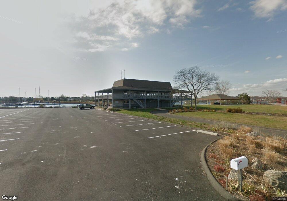
1 Bluff Point Westport, CT 06880
Saugatuck NeighborhoodEstimated Value: $3,972,000 - $4,322,812
4
Beds
2
Baths
4,160
Sq Ft
$997/Sq Ft
Est. Value
About This Home
This home is located at 1 Bluff Point, Westport, CT 06880 and is currently estimated at $4,147,406, approximately $996 per square foot. 1 Bluff Point is a home located in Fairfield County with nearby schools including King's Highway Elementary School, Coleytown Middle School, and Staples High School.
Ownership History
Date
Name
Owned For
Owner Type
Purchase Details
Closed on
Jul 16, 1965
Bought by
Cedar Pt Yacht Club Inc
Current Estimated Value
Create a Home Valuation Report for This Property
The Home Valuation Report is an in-depth analysis detailing your home's value as well as a comparison with similar homes in the area
Home Values in the Area
Average Home Value in this Area
Purchase History
| Date | Buyer | Sale Price | Title Company |
|---|---|---|---|
| Cedar Pt Yacht Club Inc | -- | -- |
Source: Public Records
Mortgage History
| Date | Status | Borrower | Loan Amount |
|---|---|---|---|
| Closed | Cedar Pt Yacht Club Inc | $800,000 |
Source: Public Records
Tax History Compared to Growth
Tax History
| Year | Tax Paid | Tax Assessment Tax Assessment Total Assessment is a certain percentage of the fair market value that is determined by local assessors to be the total taxable value of land and additions on the property. | Land | Improvement |
|---|---|---|---|---|
| 2025 | $81,000 | $4,294,800 | $3,157,700 | $1,137,100 |
| 2024 | $79,969 | $4,294,800 | $3,157,700 | $1,137,100 |
| 2023 | $78,810 | $4,294,800 | $3,157,700 | $1,137,100 |
| 2022 | $77,607 | $4,294,800 | $3,157,700 | $1,137,100 |
| 2021 | $77,607 | $4,294,800 | $3,157,700 | $1,137,100 |
| 2020 | $72,115 | $4,315,700 | $3,493,700 | $822,000 |
| 2019 | $72,763 | $4,315,700 | $3,493,700 | $822,000 |
| 2018 | $72,763 | $4,315,700 | $3,493,700 | $822,000 |
| 2017 | $72,763 | $4,315,700 | $3,493,700 | $822,000 |
| 2016 | $72,763 | $4,315,700 | $3,493,700 | $822,000 |
| 2015 | $80,540 | $4,452,200 | $3,744,800 | $707,400 |
| 2014 | $79,872 | $4,452,200 | $3,744,800 | $707,400 |
Source: Public Records
Map
Nearby Homes
- 8 Canal Rd
- 3 Nassau Rd
- 14 Owenoke Park
- 5 Minard Dr
- 34 Shorehaven Rd
- 11 Manitou Ct
- 5 Hidden Hill Rd
- 6 Stony Point Rd
- 24 Compo Pkwy
- 260 Hillspoint Rd
- 39 Compo Pkwy
- 11 Sterling Dr
- 33 Burnham Hill
- 216 Hillspoint Rd
- 1 Island Dr Unit 18
- 48 Compo Mill Cove
- 12 Pine Hill Ave
- 18 Roxbury Rd
- 46 Compo Mill Cove
- 46 Compo Mill Cove