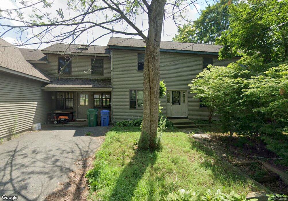
1 Bryant Rd East Hampton, CT 06424
Estimated Value: $358,000 - $593,000
3
Beds
2
Baths
2,800
Sq Ft
$169/Sq Ft
Est. Value
About This Home
This home is located at 1 Bryant Rd, East Hampton, CT 06424 and is currently estimated at $473,067, approximately $168 per square foot. 1 Bryant Rd is a home located in Middlesex County with nearby schools including Memorial School, Center Elementary School, and East Hampton Middle School.
Ownership History
Date
Name
Owned For
Owner Type
Purchase Details
Closed on
Dec 12, 1994
Sold by
Pawlich Mark N and Pawlich Scott J
Bought by
Giannotti Patricia A and Giannotti William F
Current Estimated Value
Purchase Details
Closed on
May 20, 1993
Sold by
Money Store Ct
Bought by
Pawlich Mark N and Pawlich Scott J
Create a Home Valuation Report for This Property
The Home Valuation Report is an in-depth analysis detailing your home's value as well as a comparison with similar homes in the area
Home Values in the Area
Average Home Value in this Area
Purchase History
| Date | Buyer | Sale Price | Title Company |
|---|---|---|---|
| Giannotti Patricia A | $105,000 | -- | |
| Giannotti Patricia A | $105,000 | -- | |
| Pawlich Mark N | $90,000 | -- | |
| Pawlich Mark N | $90,000 | -- |
Source: Public Records
Mortgage History
| Date | Status | Borrower | Loan Amount |
|---|---|---|---|
| Closed | Pawlich Mark N | $245,000 | |
| Closed | Pawlich Mark N | $171,000 |
Source: Public Records
Tax History Compared to Growth
Tax History
| Year | Tax Paid | Tax Assessment Tax Assessment Total Assessment is a certain percentage of the fair market value that is determined by local assessors to be the total taxable value of land and additions on the property. | Land | Improvement |
|---|---|---|---|---|
| 2025 | $7,763 | $195,480 | $54,120 | $141,360 |
| 2024 | $7,436 | $195,480 | $54,120 | $141,360 |
| 2023 | $7,049 | $195,480 | $54,120 | $141,360 |
| 2022 | $6,775 | $195,480 | $54,120 | $141,360 |
| 2021 | $6,750 | $195,480 | $54,120 | $141,360 |
| 2020 | $5,973 | $180,230 | $37,280 | $142,950 |
| 2019 | $6,195 | $186,940 | $42,090 | $144,850 |
| 2018 | $5,855 | $186,940 | $42,090 | $144,850 |
| 2017 | $5,855 | $186,940 | $42,090 | $144,850 |
| 2016 | $5,504 | $186,940 | $42,090 | $144,850 |
| 2015 | $5,541 | $199,450 | $49,520 | $149,930 |
| 2014 | $4,821 | $199,450 | $49,520 | $149,930 |
Source: Public Records
Map
Nearby Homes
- 0002-6 Edgewater Cir
- 0002-3 Edgewater Cir
- 0002-5 Edgewater Cir
- 00023 Edgewater Cir
- 00025 Edgewater Cir
- 00026 Edgewater Cir
- 22 Lakeview St
- Homesite 10 Quinns Way
- 60 Wangonk Trail
- 41 Mallard Cove
- 0 Island Unit 24106398
- 14 Daly Rd
- 27 N Main St
- 75 N Main St
- 18 Lake Blvd
- 17 Bevin Blvd
- 14 Main St
- 1 Watrous St
- 10 Railroad Ave
- 4 Watrous St
- 67 Old Marlborough Rd
- 6 Bryant Rd
- 9 Bryant Rd
- 5 Chaucer Rd
- 71 Old Marlborough Rd
- 65 Old Marlborough Rd
- 10 Bryant Rd
- 11 Bryant Rd
- 9 Chaucer Rd
- 8 Emerson Rd
- 7 Emerson Rd
- 57 Old Marlborough Rd
- 12 Stevenson Rd
- 13 Chaucer Rd
- 5 Mark Twain Dr
- 4 Chaucer Rd
- 8 Chaucer Rd
- 20 Stevenson Rd
- 7 Mark Twain Dr
- 11 Emerson Rd