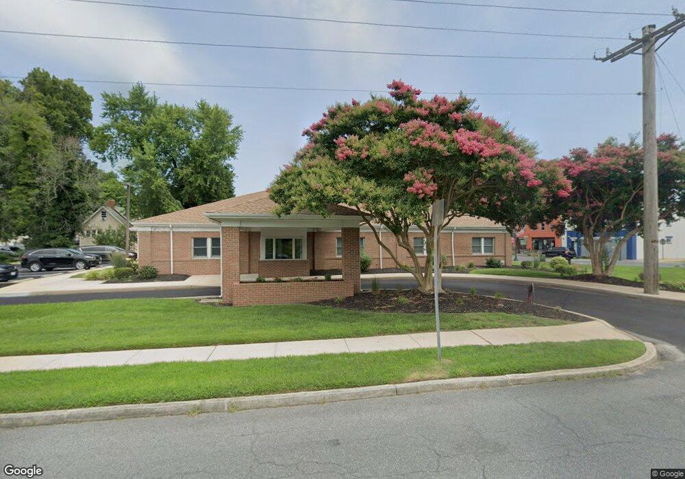
1 Cedar Ave Seaford, DE 19973
Estimated Value: $832,902
--
Bed
--
Bath
4,000
Sq Ft
$208/Sq Ft
Est. Value
About This Home
This home is located at 1 Cedar Ave, Seaford, DE 19973 and is currently estimated at $832,902, approximately $208 per square foot. 1 Cedar Ave is a home located in Sussex County with nearby schools including Seaford Central Elementary School, West Seaford Elementary School, and Seaford Middle School.
Ownership History
Date
Name
Owned For
Owner Type
Purchase Details
Closed on
Oct 10, 2023
Sold by
Rivershore Investments Llc
Bought by
Haven Way V Llc
Current Estimated Value
Purchase Details
Closed on
Jul 9, 2021
Sold by
Shat Llc
Bought by
Rivershore Inv Llc
Purchase Details
Closed on
Jul 14, 2017
Sold by
Wolfgang Md Marie C
Bought by
Marie C Wolg Rev Trust Dated Mar 10 2017
Purchase Details
Closed on
Dec 13, 1991
Bought by
Wolfgang Md Marie C
Create a Home Valuation Report for This Property
The Home Valuation Report is an in-depth analysis detailing your home's value as well as a comparison with similar homes in the area
Home Values in the Area
Average Home Value in this Area
Purchase History
| Date | Buyer | Sale Price | Title Company |
|---|---|---|---|
| Haven Way V Llc | $764,000 | None Listed On Document | |
| Rivershore Inv Llc | -- | None Available | |
| Shat Llc | $420,000 | None Available | |
| Marie C Wolg Rev Trust Dated Mar 10 2017 | -- | None Available | |
| Wolfgang Md Marie C | -- | -- |
Source: Public Records
Tax History Compared to Growth
Tax History
| Year | Tax Paid | Tax Assessment Tax Assessment Total Assessment is a certain percentage of the fair market value that is determined by local assessors to be the total taxable value of land and additions on the property. | Land | Improvement |
|---|---|---|---|---|
| 2025 | $1,639 | $56,550 | $3,250 | $53,300 |
| 2024 | $2,829 | $56,550 | $3,250 | $53,300 |
| 2023 | $2,826 | $56,550 | $3,250 | $53,300 |
| 2022 | $2,756 | $56,550 | $3,250 | $53,300 |
| 2021 | $2,767 | $56,550 | $3,250 | $53,300 |
| 2020 | $2,999 | $56,550 | $3,250 | $53,300 |
| 2019 | $2,626 | $56,550 | $3,250 | $53,300 |
| 2018 | $2,560 | $56,550 | $0 | $0 |
| 2017 | $2,429 | $56,550 | $0 | $0 |
| 2016 | $2,342 | $56,550 | $0 | $0 |
| 2015 | $2,338 | $56,550 | $0 | $0 |
| 2014 | $2,216 | $56,550 | $0 | $0 |
Source: Public Records
Map
Nearby Homes
- 121 S Conwell St
- 323 Pennsylvania Ave
- 300 N Porter St
- 322 N Pine St
- 314 N Porter St
- 131 4th St
- 416 Pennsylvania Ave
- 306 4th St
- 421 N Porter St
- 533 E Poplar St
- Lot 1 Middleford Rd
- 531 Rust St
- 0 3rd St Lot 1
- 0 3rd St Lot 2
- 412 N Phillips St
- 12 Johnson Ave
- 113 E High St
- 100 Nylon Blvd
- ELLERBE Plan at Hooper's Landing
- HANOVER Plan at Hooper's Landing