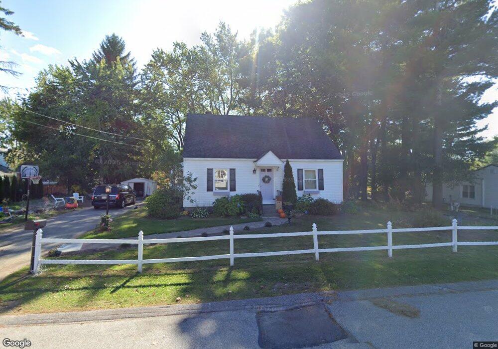
1 Clarendon Rd Auburn, MA 01501
Pakachoag NeighborhoodEstimated Value: $356,000 - $445,000
4
Beds
2
Baths
1,248
Sq Ft
$322/Sq Ft
Est. Value
About This Home
This home is located at 1 Clarendon Rd, Auburn, MA 01501 and is currently estimated at $402,138, approximately $322 per square foot. 1 Clarendon Rd is a home located in Worcester County with nearby schools including Auburn Senior High School and Shrewsbury Montessori School - Auburn Campus.
Ownership History
Date
Name
Owned For
Owner Type
Purchase Details
Closed on
Jul 29, 2008
Sold by
Polaski Joseph M and Polaski Mark
Bought by
Trilligan Bryan S and Trilligan Karen E
Current Estimated Value
Home Financials for this Owner
Home Financials are based on the most recent Mortgage that was taken out on this home.
Original Mortgage
$201,832
Outstanding Balance
$132,598
Interest Rate
6.35%
Mortgage Type
Purchase Money Mortgage
Estimated Equity
$269,540
Create a Home Valuation Report for This Property
The Home Valuation Report is an in-depth analysis detailing your home's value as well as a comparison with similar homes in the area
Home Values in the Area
Average Home Value in this Area
Purchase History
| Date | Buyer | Sale Price | Title Company |
|---|---|---|---|
| Trilligan Bryan S | $205,000 | -- |
Source: Public Records
Mortgage History
| Date | Status | Borrower | Loan Amount |
|---|---|---|---|
| Open | Trilligan Bryan S | $201,832 |
Source: Public Records
Tax History Compared to Growth
Tax History
| Year | Tax Paid | Tax Assessment Tax Assessment Total Assessment is a certain percentage of the fair market value that is determined by local assessors to be the total taxable value of land and additions on the property. | Land | Improvement |
|---|---|---|---|---|
| 2025 | $42 | $297,000 | $114,200 | $182,800 |
| 2024 | $4,270 | $286,000 | $108,500 | $177,500 |
| 2023 | $4,191 | $263,900 | $98,600 | $165,300 |
| 2022 | $3,944 | $234,500 | $98,600 | $135,900 |
| 2021 | $4,070 | $202,300 | $87,000 | $115,300 |
| 2020 | $13,650 | $197,600 | $87,000 | $110,600 |
| 2019 | $3,483 | $189,100 | $86,100 | $103,000 |
| 2018 | $3,255 | $176,500 | $80,500 | $96,000 |
| 2017 | $3,061 | $166,900 | $73,000 | $93,900 |
| 2016 | $2,979 | $164,700 | $76,800 | $87,900 |
| 2015 | $2,812 | $162,900 | $76,800 | $86,100 |
| 2014 | $2,749 | $159,000 | $73,100 | $85,900 |
Source: Public Records
Map
Nearby Homes
- 204-212 Hampton St
- 326 Pakachoag St
- 61 Elmwood St
- 31 Walsh Ave
- 33 Walsh Ave
- 31-33 Walsh Ave
- 52 Harrison Ave
- 37 Elmwood St
- 2 Victoria Dr Unit 1
- 2 Breezy Bend
- 34 Rockland Rd
- 25 Vinal St Unit 26
- 25 Vinal St Unit 29
- 25 Vinal St Unit 30
- 22 Lesley Ave
- 3 Lower Windbrook Dr
- 6 Newton St
- 5 Commonwealth Ave
- 47 Washington St Unit 26
- 177 Boyce St