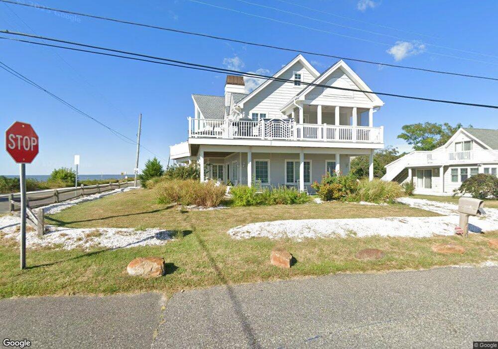
1 Cliffside Rd Cape May, NJ 08204
Estimated Value: $1,079,000 - $1,849,000
--
Bed
--
Bath
3,448
Sq Ft
$428/Sq Ft
Est. Value
About This Home
This home is located at 1 Cliffside Rd, Cape May, NJ 08204 and is currently estimated at $1,477,087, approximately $428 per square foot. 1 Cliffside Rd is a home located in Cape May County with nearby schools including Carl T. Mitnick School, David C. Douglass Veterans Memorial School, and Maud Abrams School.
Ownership History
Date
Name
Owned For
Owner Type
Purchase Details
Closed on
May 23, 2007
Sold by
Dragoni Michael J and Dragoni Gina Marie
Bought by
Seashore Property Llc
Current Estimated Value
Purchase Details
Closed on
Mar 25, 2002
Sold by
Dragoni James
Bought by
Dragoni Michael and Dragoni Gina
Purchase Details
Closed on
Dec 11, 1995
Sold by
Dragoni Michael
Bought by
Dragoni James
Home Financials for this Owner
Home Financials are based on the most recent Mortgage that was taken out on this home.
Original Mortgage
$87,000
Interest Rate
7.43%
Purchase Details
Closed on
Feb 10, 1995
Sold by
Bierbach Uster
Bought by
Dragani Michael J
Home Financials for this Owner
Home Financials are based on the most recent Mortgage that was taken out on this home.
Original Mortgage
$87,000
Interest Rate
9.18%
Create a Home Valuation Report for This Property
The Home Valuation Report is an in-depth analysis detailing your home's value as well as a comparison with similar homes in the area
Home Values in the Area
Average Home Value in this Area
Purchase History
| Date | Buyer | Sale Price | Title Company |
|---|---|---|---|
| Seashore Property Llc | -- | None Available | |
| Dragoni Michael | $86,000 | -- | |
| Dragoni James | $106,900 | -- | |
| Dragani Michael J | $104,900 | -- |
Source: Public Records
Mortgage History
| Date | Status | Borrower | Loan Amount |
|---|---|---|---|
| Previous Owner | Dragoni James | $87,000 | |
| Previous Owner | Dragani Michael J | $87,000 |
Source: Public Records
Tax History Compared to Growth
Tax History
| Year | Tax Paid | Tax Assessment Tax Assessment Total Assessment is a certain percentage of the fair market value that is determined by local assessors to be the total taxable value of land and additions on the property. | Land | Improvement |
|---|---|---|---|---|
| 2025 | $15,981 | $788,000 | $489,500 | $298,500 |
| 2024 | $15,981 | $788,000 | $489,500 | $298,500 |
| 2023 | $15,752 | $788,000 | $489,500 | $298,500 |
| 2022 | $15,271 | $788,000 | $489,500 | $298,500 |
| 2021 | $14,814 | $788,000 | $489,500 | $298,500 |
| 2020 | $14,578 | $788,000 | $489,500 | $298,500 |
| 2019 | $14,216 | $788,000 | $489,500 | $298,500 |
| 2018 | $13,877 | $788,000 | $489,500 | $298,500 |
| 2017 | $13,892 | $788,000 | $489,500 | $298,500 |
| 2016 | $13,680 | $788,000 | $489,500 | $298,500 |
| 2015 | $13,238 | $788,000 | $489,500 | $298,500 |
| 2014 | $12,805 | $788,000 | $489,500 | $298,500 |
Source: Public Records
Map
Nearby Homes
- 10 Folsom Ave
- 1607 Scott Ave
- 106 Racetrack Dr
- 1310 Browning Ave
- 111A Racetrack Dr
- 604 Lawnside Rd
- 2 Fernwood Rd
- 101 Avalon Rd
- 401 Beach Dr
- 66 Beachhurst Dr
- 18 Pinewood Rd
- 103 Fernwood Rd
- 113 Beachhurst Dr
- 503 Beach Dr
- 508 Adriatic Ave
- 702 Gordon Terrace
- 319 Roseann Ave
- 1500 Franklin Ave
- 1400 Franklin Ave
- 507 Scotty Blvd Unit 12