Estimated Value: $235,257 - $251,000
3
Beds
3
Baths
1,400
Sq Ft
$173/Sq Ft
Est. Value
About This Home
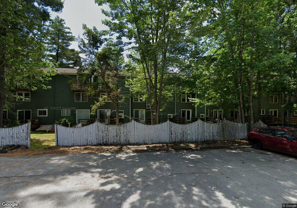
This home is located at 1 Colburn Dr Unit 17, Orono, ME 04473 and is currently estimated at $242,564, approximately $173 per square foot. 1 Colburn Dr Unit 17 is a home located in Penobscot County with nearby schools including Orono Middle School and Orono High School.
Ownership History
Date
Name
Owned For
Owner Type
Purchase Details
Closed on
Aug 13, 2021
Sold by
Ba Prop Llc
Bought by
Ts Prop Llc
Current Estimated Value
Home Financials for this Owner
Home Financials are based on the most recent Mortgage that was taken out on this home.
Original Mortgage
$122,000
Outstanding Balance
$110,936
Interest Rate
2.9%
Mortgage Type
Purchase Money Mortgage
Estimated Equity
$131,628
Purchase Details
Closed on
Jul 18, 2013
Sold by
Quinn Michael J and Quinn Jean L
Bought by
Ronan John K and Ronan Tracy L
Purchase Details
Closed on
Jul 16, 2007
Sold by
Beswick Gregory R
Bought by
Quinn Michael J and Quinn Jean L
Home Financials for this Owner
Home Financials are based on the most recent Mortgage that was taken out on this home.
Original Mortgage
$106,400
Interest Rate
6.48%
Mortgage Type
Unknown
Create a Home Valuation Report for This Property
The Home Valuation Report is an in-depth analysis detailing your home's value as well as a comparison with similar homes in the area
Home Values in the Area
Average Home Value in this Area
Purchase History
| Date | Buyer | Sale Price | Title Company |
|---|---|---|---|
| Ts Prop Llc | -- | None Available | |
| Ts Prop Llc | -- | None Available | |
| Ronan John K | -- | -- | |
| Quinn Michael J | -- | -- | |
| Quinn Michael J | -- | -- |
Source: Public Records
Mortgage History
| Date | Status | Borrower | Loan Amount |
|---|---|---|---|
| Open | Ts Prop Llc | $122,000 | |
| Closed | Ts Prop Llc | $122,000 | |
| Previous Owner | Quinn Michael J | $45,000 | |
| Previous Owner | Quinn Michael J | $106,400 |
Source: Public Records
Tax History Compared to Growth
Tax History
| Year | Tax Paid | Tax Assessment Tax Assessment Total Assessment is a certain percentage of the fair market value that is determined by local assessors to be the total taxable value of land and additions on the property. | Land | Improvement |
|---|---|---|---|---|
| 2024 | $2,966 | $138,900 | $0 | $138,900 |
| 2023 | $2,955 | $126,300 | $0 | $126,300 |
| 2022 | $3,006 | $126,300 | $0 | $126,300 |
| 2021 | $3,000 | $126,300 | $0 | $126,300 |
| 2020 | $2,860 | $101,800 | $19,000 | $82,800 |
| 2019 | $2,693 | $101,800 | $19,000 | $82,800 |
| 2018 | $2,749 | $101,800 | $19,000 | $82,800 |
| 2017 | $2,647 | $101,800 | $19,000 | $82,800 |
| 2016 | $2,530 | $101,800 | $19,000 | $82,800 |
| 2015 | $2,484 | $101,800 | $19,000 | $82,800 |
| 2014 | $2,428 | $101,800 | $19,000 | $82,800 |
| 2013 | $2,362 | $101,800 | $19,000 | $82,800 |
Source: Public Records
Map
Nearby Homes
- 1 Colburn Dr Unit 22
- 1 Colburn Dr Unit 21
- 1 Colburn Dr Unit 20
- 1 Colburn Dr Unit 19
- 1 Colburn Dr Unit 18
- 1 Colburn Dr Unit 17
- 1 Colburn Dr Unit 16
- 1 Colburn Dr Unit 14
- 1 Colburn Dr Unit 13
- 1 Colburn Dr Unit 12
- 1 Colburn Dr Unit 11
- 1 Colburn Dr
- 162 Park (Route 2)
- 162 Park St
- 164 Park St
- 3 Colburn Dr Unit 5
- 3 Colburn Dr Unit 4
- 3 Colburn Dr
- 3 Colburn Dr Unit 2
- 3 Colburn Dr Unit 1