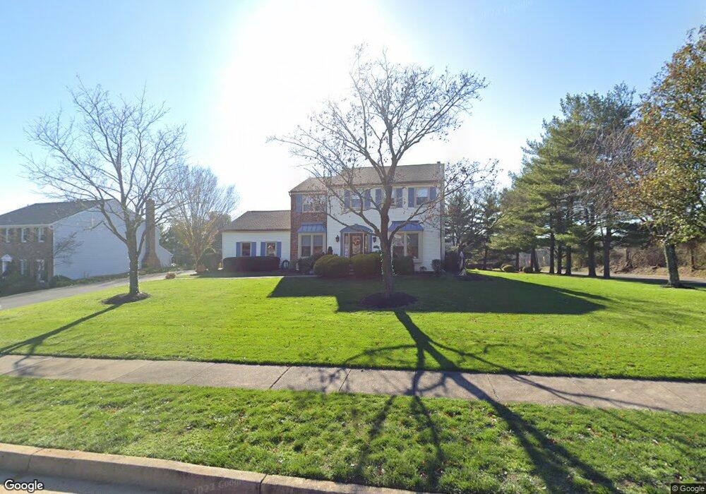
1 Colonial Dr Newtown, PA 18940
Estimated Value: $931,287 - $970,000
4
Beds
3
Baths
3,627
Sq Ft
$262/Sq Ft
Est. Value
About This Home
This home is located at 1 Colonial Dr, Newtown, PA 18940 and is currently estimated at $950,822, approximately $262 per square foot. 1 Colonial Dr is a home located in Bucks County with nearby schools including Wrightstown Elementary School, Newtown Middle School, and Council Rock High School North.
Ownership History
Date
Name
Owned For
Owner Type
Purchase Details
Closed on
Jul 15, 2010
Sold by
Barth Anneliese and Jaggard Linda
Bought by
Jaggard Linda and Jaggard Peter William
Current Estimated Value
Purchase Details
Closed on
May 31, 2007
Sold by
Cocca Mary Joan and Cocca John A
Bought by
Barth Anneliese and Jaggard Linda Ann
Purchase Details
Closed on
Jan 9, 2006
Sold by
Cocca Mary J and Cocca John A
Bought by
Cocca Mary Joan and Cocca John A
Purchase Details
Closed on
Jul 3, 2003
Sold by
Cocca Mary Joan and Furia Mary Joan
Bought by
Cocca Mary J
Home Financials for this Owner
Home Financials are based on the most recent Mortgage that was taken out on this home.
Original Mortgage
$245,000
Interest Rate
5.34%
Mortgage Type
Purchase Money Mortgage
Purchase Details
Closed on
Apr 26, 1999
Sold by
Furia Mary Joan and Smith Mary Joan
Bought by
Furia Mary Joan
Home Financials for this Owner
Home Financials are based on the most recent Mortgage that was taken out on this home.
Original Mortgage
$192,000
Interest Rate
7.37%
Purchase Details
Closed on
Dec 26, 1998
Sold by
Wood John J and Wood Ann H
Bought by
Smith Mary Joan
Create a Home Valuation Report for This Property
The Home Valuation Report is an in-depth analysis detailing your home's value as well as a comparison with similar homes in the area
Home Values in the Area
Average Home Value in this Area
Purchase History
| Date | Buyer | Sale Price | Title Company |
|---|---|---|---|
| Jaggard Linda | -- | None Available | |
| Barth Anneliese | $525,000 | None Available | |
| Cocca Mary Joan | -- | None Available | |
| Cocca Mary J | -- | -- | |
| Furia Mary Joan | -- | -- | |
| Smith Mary Joan | $256,000 | -- |
Source: Public Records
Mortgage History
| Date | Status | Borrower | Loan Amount |
|---|---|---|---|
| Previous Owner | Cocca Mary J | $245,000 | |
| Previous Owner | Furia Mary Joan | $192,000 |
Source: Public Records
Tax History Compared to Growth
Tax History
| Year | Tax Paid | Tax Assessment Tax Assessment Total Assessment is a certain percentage of the fair market value that is determined by local assessors to be the total taxable value of land and additions on the property. | Land | Improvement |
|---|---|---|---|---|
| 2025 | $9,583 | $53,920 | $14,240 | $39,680 |
| 2024 | $9,583 | $53,920 | $14,240 | $39,680 |
| 2023 | $9,168 | $53,920 | $14,240 | $39,680 |
| 2022 | $8,991 | $53,920 | $14,240 | $39,680 |
| 2021 | $8,851 | $53,920 | $14,240 | $39,680 |
| 2020 | $8,425 | $53,920 | $14,240 | $39,680 |
| 2019 | $8,226 | $53,920 | $14,240 | $39,680 |
| 2018 | $8,070 | $53,920 | $14,240 | $39,680 |
| 2017 | $7,790 | $53,920 | $14,240 | $39,680 |
| 2016 | $7,736 | $53,920 | $14,240 | $39,680 |
| 2015 | -- | $53,920 | $14,240 | $39,680 |
| 2014 | -- | $53,920 | $14,240 | $39,680 |
Source: Public Records
Map
Nearby Homes
- 97 Quaker Dr
- 10 Providence Ct
- 152 Twining Bridge Rd
- Rollins Plan at Lyondale Meadows
- Laney Plan at Lyondale Meadows
- Kingswood Plan at Lyondale Meadows
- Raintree Plan at Lyondale Meadows
- Mayweather Plan at Lyondale Meadows
- Cloverfield Plan at Lyondale Meadows
- 401 Society Place Unit A1
- 2204 Society Place Unit B2
- 95 Rittenhouse Cir Unit 92
- 35 Elfreths Ct
- 288 Jane Chapman Dr E Unit E
- 101 Laurel Cir
- 168 Lehigh Dr
- 69 Beth Dr
- 23 Hunters Way
- 291 Sequoia Dr
- 40 Hallowell Dr
- 7 Colonial Dr
- 2 Colonial Dr
- 21 Colonial Dr
- 12 Colonial Dr
- 20 Colonial Dr
- 29 Colonial Dr
- 26 Colonial Dr
- 35 Colonial Dr
- 34 Colonial Dr
- 46 Colonial Dr
- 44 Colonial Dr
- 43 Colonial Dr
- 28 Twining Bridge Rd
- 51 Colonial Dr
- 57 Colonial Dr
- 60 Colonial Dr
- 65 Colonial Dr
- 72 Colonial Dr
- 71 Colonial Dr
- 79 Colonial Dr