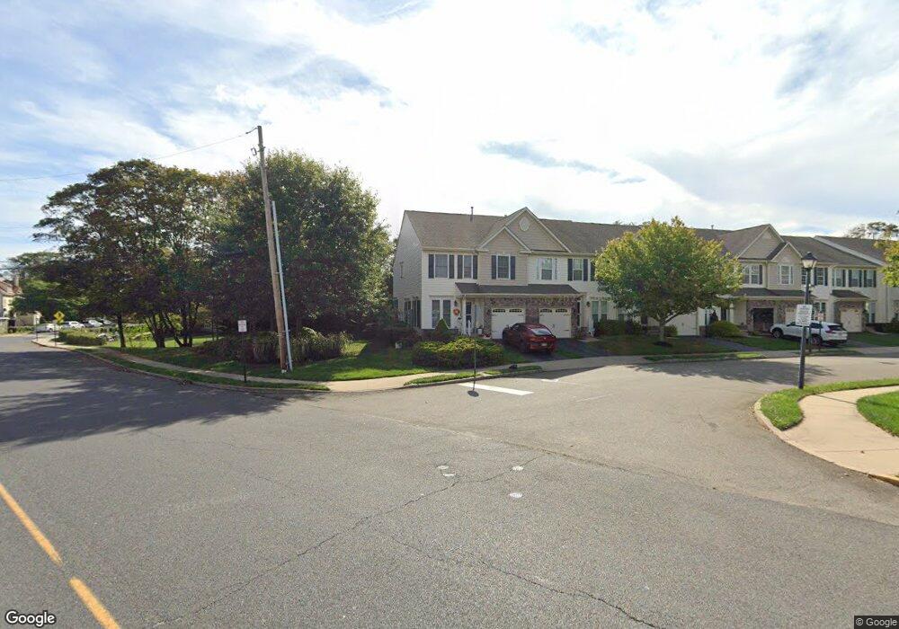
1 Coral Place Long Branch, NJ 07740
Estimated Value: $735,000 - $816,000
3
Beds
3
Baths
1,836
Sq Ft
$422/Sq Ft
Est. Value
About This Home
This home is located at 1 Coral Place, Long Branch, NJ 07740 and is currently estimated at $774,084, approximately $421 per square foot. 1 Coral Place is a home located in Monmouth County with nearby schools including Long Branch High School, Holy Trinity School, and Bet Yaakov of the Jersey Shore.
Ownership History
Date
Name
Owned For
Owner Type
Purchase Details
Closed on
Jun 1, 2006
Sold by
Nvr Inc
Bought by
Muir Bonnie and Fornwald Carol
Current Estimated Value
Home Financials for this Owner
Home Financials are based on the most recent Mortgage that was taken out on this home.
Original Mortgage
$210,000
Outstanding Balance
$123,808
Interest Rate
6.62%
Mortgage Type
New Conventional
Estimated Equity
$650,276
Purchase Details
Closed on
Dec 23, 2005
Sold by
Lb Shores Development Llc
Bought by
Nvr Inc
Create a Home Valuation Report for This Property
The Home Valuation Report is an in-depth analysis detailing your home's value as well as a comparison with similar homes in the area
Home Values in the Area
Average Home Value in this Area
Purchase History
| Date | Buyer | Sale Price | Title Company |
|---|---|---|---|
| Muir Bonnie | $489,190 | -- | |
| Nvr Inc | $165,000 | -- |
Source: Public Records
Mortgage History
| Date | Status | Borrower | Loan Amount |
|---|---|---|---|
| Open | Muir Bonnie | $210,000 |
Source: Public Records
Tax History Compared to Growth
Tax History
| Year | Tax Paid | Tax Assessment Tax Assessment Total Assessment is a certain percentage of the fair market value that is determined by local assessors to be the total taxable value of land and additions on the property. | Land | Improvement |
|---|---|---|---|---|
| 2025 | $9,532 | $675,200 | $360,000 | $315,200 |
| 2024 | $8,906 | $620,200 | $315,000 | $305,200 |
| 2023 | $8,906 | $573,500 | $275,000 | $298,500 |
| 2022 | $8,837 | $516,100 | $250,000 | $266,100 |
| 2021 | $8,837 | $441,700 | $190,000 | $251,700 |
| 2020 | $9,054 | $433,200 | $180,000 | $253,200 |
| 2019 | $8,696 | $413,700 | $165,000 | $248,700 |
| 2018 | $7,976 | $377,300 | $135,000 | $242,300 |
| 2017 | $7,325 | $355,400 | $115,000 | $240,400 |
| 2016 | $7,110 | $351,800 | $115,000 | $236,800 |
| 2015 | $7,558 | $339,400 | $100,000 | $239,400 |
| 2014 | $8,268 | $391,300 | $165,000 | $226,300 |
Source: Public Records
Map
Nearby Homes
- 17 Tower Rd Unit D2
- 14 Tower Rd
- 12 Seashore Dr
- 14 Seashore Dr
- 8 Seashore Dr
- 11 Seashore Dr
- 2 Seashore Dr
- 119 Avery Ave Unit H21
- 392 Ocean Ave Unit 1302
- 392 Ocean Ave Unit 1608
- 392 Ocean Ave Unit 1203
- 392 Ocean Ave Unit 1406
- 392 Ocean Ave Unit 1412
- 392 Ocean Ave Unit 1309
- 392 Ocean Ave Unit 1502
- 392 Ocean Ave Unit 1505
- 392 Ocean Ave Unit 1310
- 392 Ocean Ave Unit 1705
- 392 Ocean Ave Unit 1804
- 392 Ocean Ave Unit 1603
- 3 Coral Place
- 5 Coral Place
- 7 Coral Place Unit 4
- 11 Coral Place
- 13 Coral Place Unit 7
- 15 Coral Place
- 2 Coral Place
- 4 Coral Place
- 17 Coral Place
- 6 Coral Place
- 19 Coral Place
- 8 Coral Place
- 21 Coral Place
- 10 Coral Place Unit 26
- 396 2nd Ave
- 23 Coral Place
- 14 Coral Place
- 402 2nd Ave
- 25 Coral Place Unit 13
- 370 2nd Ave