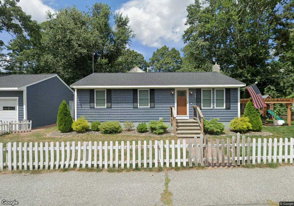
1 Daniels Rd Hudson, MA 01749
Estimated Value: $508,069 - $589,000
3
Beds
2
Baths
1,000
Sq Ft
$554/Sq Ft
Est. Value
About This Home
This home is located at 1 Daniels Rd, Hudson, MA 01749 and is currently estimated at $553,517, approximately $553 per square foot. 1 Daniels Rd is a home located in Middlesex County with nearby schools including David J. Quinn Middle School, Hudson High School, and First Steps Children's Center.
Ownership History
Date
Name
Owned For
Owner Type
Purchase Details
Closed on
Sep 11, 2013
Sold by
Boutin Joseph H
Bought by
Flynn Matthew R and Moleiro Arlene G
Current Estimated Value
Home Financials for this Owner
Home Financials are based on the most recent Mortgage that was taken out on this home.
Original Mortgage
$230,850
Outstanding Balance
$172,472
Interest Rate
4.43%
Mortgage Type
New Conventional
Estimated Equity
$381,045
Create a Home Valuation Report for This Property
The Home Valuation Report is an in-depth analysis detailing your home's value as well as a comparison with similar homes in the area
Home Values in the Area
Average Home Value in this Area
Purchase History
| Date | Buyer | Sale Price | Title Company |
|---|---|---|---|
| Flynn Matthew R | $243,000 | -- | |
| Flynn Matthew R | $243,000 | -- | |
| Flynn Matthew R | $243,000 | -- |
Source: Public Records
Mortgage History
| Date | Status | Borrower | Loan Amount |
|---|---|---|---|
| Open | Flynn Matthew R | $230,850 | |
| Closed | Flynn Matthew R | $230,850 | |
| Previous Owner | Flynn Matthew R | $57,000 | |
| Previous Owner | Flynn Matthew R | $60,000 |
Source: Public Records
Tax History
| Year | Tax Paid | Tax Assessment Tax Assessment Total Assessment is a certain percentage of the fair market value that is determined by local assessors to be the total taxable value of land and additions on the property. | Land | Improvement |
|---|---|---|---|---|
| 2025 | $6,456 | $465,100 | $155,800 | $309,300 |
| 2024 | $6,212 | $443,700 | $141,600 | $302,100 |
| 2023 | $5,646 | $386,700 | $136,200 | $250,500 |
| 2022 | $5,242 | $330,500 | $123,800 | $206,700 |
| 2021 | $5,113 | $308,200 | $117,900 | $190,300 |
| 2020 | $4,810 | $289,600 | $115,600 | $174,000 |
| 2019 | $3 | $282,600 | $115,600 | $167,000 |
| 2018 | $4,664 | $266,500 | $110,100 | $156,400 |
| 2017 | $4,554 | $260,200 | $104,900 | $155,300 |
| 2016 | $4,238 | $245,100 | $104,900 | $140,200 |
| 2015 | $3,849 | $222,900 | $104,900 | $118,000 |
| 2014 | $3,820 | $219,300 | $92,000 | $127,300 |
Source: Public Records
Map
Nearby Homes
- 18 Seneca Dr
- 24 Seneca Dr
- 30 Jewell Rd Unit Lot 2
- 48 Jewell Rd Unit Lot 6
- 23 Otsego Dr
- 68 Upland Rd
- 0 Oneida Place
- 239 Reservoir St
- 20 Beauregard Cir
- 2 Strawberry Ln Unit C
- 0 Stevens St
- 69 Johansen Dr
- 656 Bolton St
- 9 & 9A Abigail
- 84 Crosby Rd
- 0 Washington St
- 7 Old North Rd
- 38 Airport Blvd
- 37 Union St
- 34 Forest Ave
- 500 Indian Lake Shore Dr
- 72 Daniels Rd
- 330 Lakeshore Dr
- 502 Indian Lake Shore Dr
- 11 Elizabeth Rd
- 11 Elizabeth Rd Unit 11
- 13 Elizabeth Rd
- 501 Indian Lake Shore Dr
- 73 Daniels Rd
- 504 Indian Lake Shore Dr
- 506 Indian Lake Shore Dr
- 64 Daniels Rd
- 8 Parker Rd
- 503 Indian Lake Shore Dr
- 0 Indian Lake Shore Dr
- 4 Daniels Rd
- 324 Lakeshore Dr
- 70 Bruce Rd
- 5 Elizabeth Rd
- 317 Lakeshore Dr
Your Personal Tour Guide
Ask me questions while you tour the home.