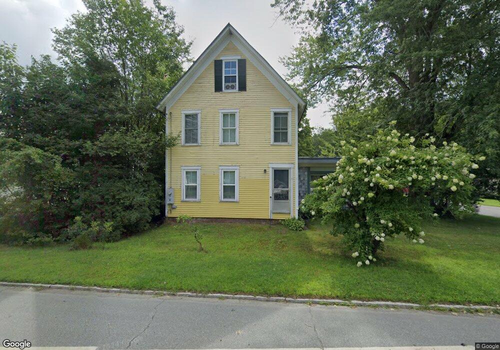
1 Daniels Rd Plainfield, NH 03781
Estimated Value: $552,514 - $624,000
3
Beds
3
Baths
2,640
Sq Ft
$224/Sq Ft
Est. Value
About This Home
This home is located at 1 Daniels Rd, Plainfield, NH 03781 and is currently estimated at $592,129, approximately $224 per square foot. 1 Daniels Rd is a home located in Sullivan County with nearby schools including Plainfield Elementary School, Lebanon High School, and Estabrook Christian School.
Ownership History
Date
Name
Owned For
Owner Type
Purchase Details
Closed on
Aug 31, 2022
Sold by
Ruppert Ruppertsberger H and Ruppert Birgit A
Bought by
Ruppertsberger Natalue and Ruppertsberger Johanna
Current Estimated Value
Purchase Details
Closed on
May 4, 2015
Sold by
Breese Robert B and Komska Yuliya H
Bought by
Komska Yuliya H
Purchase Details
Closed on
May 29, 2007
Sold by
Gray Mark R
Bought by
Breese Robert B
Purchase Details
Closed on
May 21, 2003
Sold by
Gray Kimberly B
Bought by
Gray Mark R
Create a Home Valuation Report for This Property
The Home Valuation Report is an in-depth analysis detailing your home's value as well as a comparison with similar homes in the area
Home Values in the Area
Average Home Value in this Area
Purchase History
| Date | Buyer | Sale Price | Title Company |
|---|---|---|---|
| Ruppertsberger Natalue | -- | None Available | |
| Ruppertsberger Ft | -- | None Available | |
| Ruppertsberger Natalue | -- | None Available | |
| Ruppertsberger Ft | -- | None Available | |
| Ruppertsberger Natalue | -- | None Available | |
| Komska Yuliya H | -- | -- | |
| Komska Yuliya H | -- | -- | |
| Breese Robert B | $312,000 | -- | |
| Breese Robert B | $312,000 | -- | |
| Gray Mark R | $116,000 | -- | |
| Gray Mark R | $116,000 | -- |
Source: Public Records
Mortgage History
| Date | Status | Borrower | Loan Amount |
|---|---|---|---|
| Previous Owner | Gray Mark R | $229,000 | |
| Previous Owner | Gray Mark R | $281,111 |
Source: Public Records
Tax History Compared to Growth
Tax History
| Year | Tax Paid | Tax Assessment Tax Assessment Total Assessment is a certain percentage of the fair market value that is determined by local assessors to be the total taxable value of land and additions on the property. | Land | Improvement |
|---|---|---|---|---|
| 2023 | $7,864 | $499,300 | $134,500 | $364,800 |
| 2022 | $7,684 | $308,600 | $68,500 | $240,100 |
| 2021 | $8,193 | $308,600 | $68,500 | $240,100 |
| 2020 | $7,838 | $308,600 | $68,500 | $240,100 |
| 2019 | $8,024 | $308,600 | $68,500 | $240,100 |
| 2018 | $7,771 | $308,600 | $68,500 | $240,100 |
| 2017 | $7,633 | $275,800 | $64,000 | $211,800 |
| 2016 | $7,819 | $275,800 | $64,000 | $211,800 |
| 2015 | $7,516 | $275,800 | $64,000 | $211,800 |
| 2014 | $7,585 | $275,800 | $64,000 | $211,800 |
| 2013 | $7,585 | $275,800 | $64,000 | $211,800 |
Source: Public Records
Map
Nearby Homes
- 1118 New Hampshire 12a
- 0 Freeman Rd Unit 22
- 846 New Hampshire 12a
- 1507 Route 12a
- 16 Nh Route 12a
- 6 Blodgett Ln
- 00 Nh Route 12a Unit 7
- 1041 Stage Rd
- 161 Saint Gaudens Rd
- 10 Bischoff Ln
- 56 Mount Hunger Rd
- 149 Old County Rd
- 14 Summarsell Dr Unit 16
- 89 Route 12
- 22 King Dr
- 58 Morningside Dr
- 152 Webster Rd
- 282 Penniman Rd
- 3 MacE Hill Rd
- 40 Mill St
- 1089 Route 12a
- 2 Daniels Rd
- 1093 Route 12a
- 8 Daniels Rd
- 1067 Route 12a
- 1097 Route 12a
- 1103 Route 12a
- 1078 Route 12a
- 1100 Route 12a
- 1059 New Hampshire 12a
- 1059 Route 12a
- 1111 Route 12a
- 1132 Route 12a
- 14 Lawton Ln
- 1106 Route 12a
- 1092 Route 12a
- 26 Daniels Rd
- 1121 Route 12a
- 1108 Route 12a
- 13 Peterson Rd