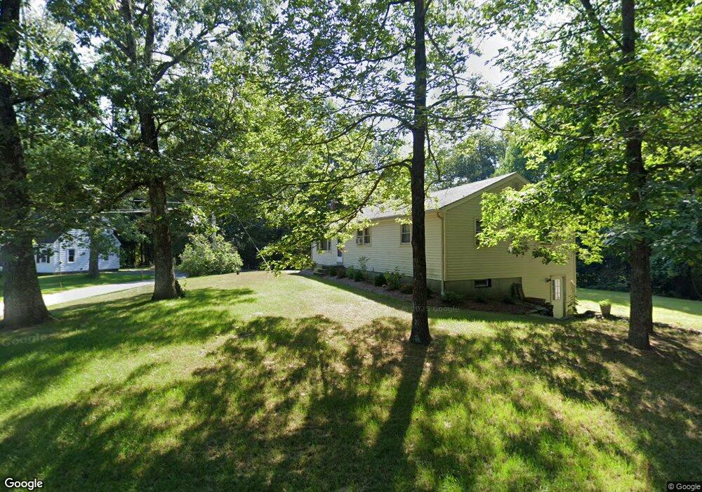
1 Douty Rd Fiskdale, MA 01518
Estimated Value: $456,799 - $509,000
3
Beds
2
Baths
1,905
Sq Ft
$255/Sq Ft
Est. Value
About This Home
This home is located at 1 Douty Rd, Fiskdale, MA 01518 and is currently estimated at $485,200, approximately $254 per square foot. 1 Douty Rd is a home located in Worcester County with nearby schools including Burgess Elementary School, Tantasqua Regional Junior High School, and Tantasqua Regional High School.
Ownership History
Date
Name
Owned For
Owner Type
Purchase Details
Closed on
Mar 29, 1990
Sold by
Pease Donna L
Bought by
Wetherbee Richard J
Current Estimated Value
Home Financials for this Owner
Home Financials are based on the most recent Mortgage that was taken out on this home.
Original Mortgage
$112,950
Interest Rate
9.96%
Mortgage Type
Purchase Money Mortgage
Create a Home Valuation Report for This Property
The Home Valuation Report is an in-depth analysis detailing your home's value as well as a comparison with similar homes in the area
Home Values in the Area
Average Home Value in this Area
Purchase History
| Date | Buyer | Sale Price | Title Company |
|---|---|---|---|
| Wetherbee Richard J | $125,500 | -- |
Source: Public Records
Mortgage History
| Date | Status | Borrower | Loan Amount |
|---|---|---|---|
| Open | Wetherbee Richard J | $188,000 | |
| Closed | Wetherbee Richard J | $105,000 | |
| Closed | Wetherbee Richard J | $112,950 |
Source: Public Records
Tax History Compared to Growth
Tax History
| Year | Tax Paid | Tax Assessment Tax Assessment Total Assessment is a certain percentage of the fair market value that is determined by local assessors to be the total taxable value of land and additions on the property. | Land | Improvement |
|---|---|---|---|---|
| 2025 | $6,367 | $399,700 | $84,500 | $315,200 |
| 2024 | $5,770 | $349,900 | $82,800 | $267,100 |
| 2023 | $5,448 | $301,500 | $71,900 | $229,600 |
| 2022 | $5,238 | $273,500 | $64,900 | $208,600 |
| 2021 | $4,755 | $250,000 | $61,900 | $188,100 |
| 2020 | $4,755 | $250,000 | $61,900 | $188,100 |
| 2019 | $4,548 | $237,500 | $63,600 | $173,900 |
| 2018 | $4,374 | $225,000 | $60,500 | $164,500 |
| 2017 | $4,173 | $215,100 | $58,400 | $156,700 |
| 2016 | $4,290 | $223,300 | $56,600 | $166,700 |
| 2015 | $4,202 | $218,400 | $56,600 | $161,800 |
Source: Public Records
Map
Nearby Homes
- 87 Holland Rd
- 16 Summit Ave
- 504 Main St
- 537 Main St
- 5 Hinman St Unit 4
- 7 Crescent Way Unit 105
- 7 Crescent Way Unit 315
- Lot B-6 River Rd
- 26 Cedar Lake Dr
- 266 Holland Rd
- 368 Main St
- 6 Cedar Pond Dr
- 9 Haynes St
- 7 Haynes St
- 51-A Seneca Ln
- 10 Maple St
- 43 Mountain Brook Rd
- 8 Blueberry Ln
- 74 River Rd
- 43 Park Ave
- 162 Leadmine Rd
- 3 Douty Rd
- 159 Stallion Hill Rd
- 161 Leadmine Rd
- 165 Leadmine Rd
- 2 Shumway Hill Rd
- 169 Leadmine Rd
- 5 Douty Rd
- 151 Stallion Hill Rd
- 136 Stallion Hill Rd
- 175 Leadmine Rd
- 176 Leadmine Rd
- 4 Shumway Hill Rd
- 10 Douty Rd
- 177 Leadmine Rd
- 143 Stallion Hill Rd
- 139 Stallion Hill Rd
- 135 Stallion Hill Rd
- A LOT Douty Rd
- Lot-D Douty Rd