1 E Battery St Unit A Charleston, SC 29401
South of Broad Neighborhood
1
Bed
1.5
Baths
1,800
Sq Ft
6,403
Sq Ft Lot
Highlights
- Furnished
- Hardwood Floors
- Fireplace
- Fenced Lot
- Security System
About This Home
Property Id: 1486126
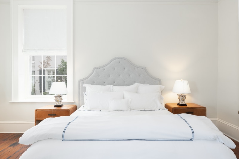
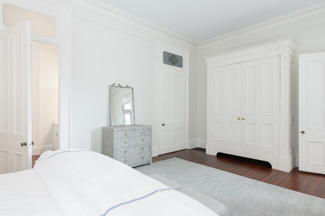
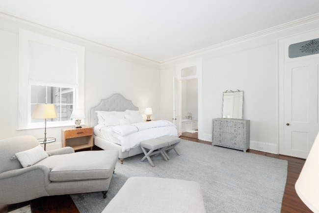
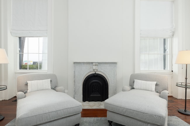
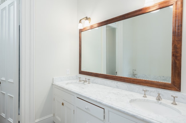
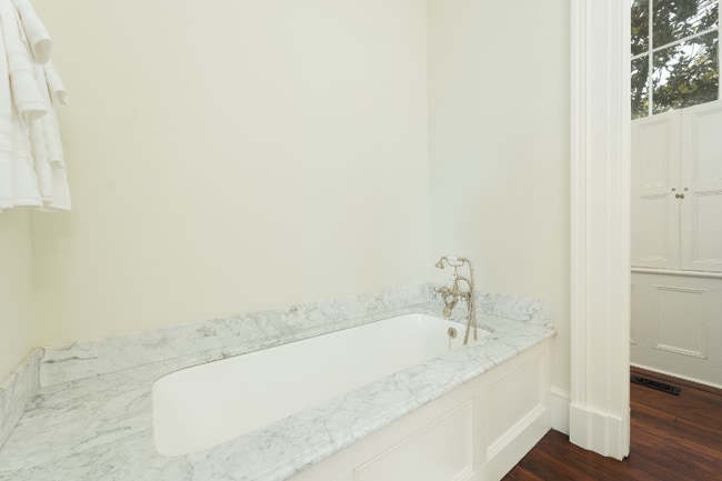
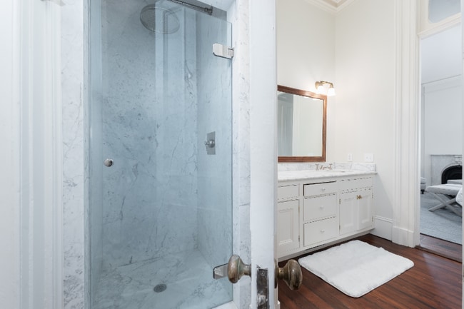
This beautiful home, built in 1858, has been updated and outfitted with modern conveniences but still remains one of our city's most magnificent homes that had a front row seat to the beginning of the Civil War! Enter from East Battery or South Battery. This first floor apartment has a large porch that spans the length of the house. Door and window open to allow for the breeze from the harbor. The very spacious drawing room, dining room, and primary bedroom all have spectacular views of White Point Gardens and the harbor. Spacious kitchen, laundry and half bath. One off street parking space provided. Pets are negotiable.
Listing Provided By

Map
Property History
| Date | Event | Price | List to Sale | Price per Sq Ft |
|---|---|---|---|---|
| 01/22/2026 01/22/26 | For Rent | $10,000 | 0.0% | -- |
| 01/09/2026 01/09/26 | Off Market | $10,000 | -- | -- |
| 12/06/2025 12/06/25 | For Rent | $10,000 | 0.0% | -- |
| 10/09/2025 10/09/25 | Off Market | $10,000 | -- | -- |
| 08/06/2025 08/06/25 | For Rent | $10,000 | 0.0% | -- |
| 03/31/2025 03/31/25 | Off Market | $10,000 | -- | -- |
| 02/25/2025 02/25/25 | For Rent | $10,000 | 0.0% | -- |
| 10/07/2024 10/07/24 | For Rent | $10,000 | -- | -- |
Nearby Homes
- 25 E Battery St
- 46 Church St
- 3 King St
- 1 King St Unit 704
- 42 S Battery St
- 54 Church St
- 60 Church St
- 52 S Battery St Unit E
- 14 1/2 Murray Blvd
- 73 Church St
- 5 Legare St Unit C
- 79 Church St
- 2 Lenwood Blvd
- 12 Bedons Aly
- 15 N Adgers Wharf
- 103 Church St Unit A
- 6 Saint Michaels Aly
- 64 Lenwood Blvd Unit C
- 109 E Bay St Unit 2D
- 125 Tradd St
- 1 E Battery St Unit B
- 28 Broad St Unit 304
- 3 Exchange St
- 3 Queen St Unit 313
- 85 Cumberland St Unit 17
- 15 Horlbeck Aly Unit 7
- 164 Broad St Unit C
- 3 Franklin St
- 23 Archdale St Unit J
- 79 Gibbes St
- 17 West St
- 4 Beaufain St Unit 202
- 4 Beaufain St Unit 205
- 19 Smith St Unit A
- 6 Kirkland Ln
- 6 Kirkland Ln
- 259 E Bay St Unit 9C
- 7 Pitt St Unit A
- 82 Wentworth St Unit C
- 82 Wentworth St
Your Personal Tour Guide
Ask me questions while you tour the home.