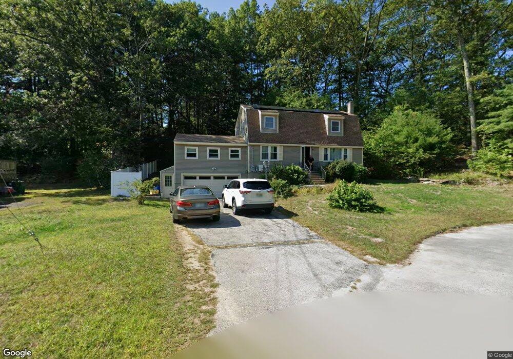
1 Echo Ave Nashua, NH 03062
West Hollis NeighborhoodEstimated Value: $607,620 - $637,000
4
Beds
2
Baths
2,300
Sq Ft
$272/Sq Ft
Est. Value
About This Home
This home is located at 1 Echo Ave, Nashua, NH 03062 and is currently estimated at $624,655, approximately $271 per square foot. 1 Echo Ave is a home located in Hillsborough County with nearby schools including Main Dunstable School, Elm Street Middle School, and Nashua High School South.
Ownership History
Date
Name
Owned For
Owner Type
Purchase Details
Closed on
Nov 2, 2010
Sold by
Merchant Siraj E and Merchant Sabiha S
Bought by
Compoh Edwige
Current Estimated Value
Home Financials for this Owner
Home Financials are based on the most recent Mortgage that was taken out on this home.
Original Mortgage
$244,704
Outstanding Balance
$161,807
Interest Rate
4.39%
Mortgage Type
Purchase Money Mortgage
Estimated Equity
$462,848
Create a Home Valuation Report for This Property
The Home Valuation Report is an in-depth analysis detailing your home's value as well as a comparison with similar homes in the area
Home Values in the Area
Average Home Value in this Area
Purchase History
| Date | Buyer | Sale Price | Title Company |
|---|---|---|---|
| Compoh Edwige | $248,000 | -- |
Source: Public Records
Mortgage History
| Date | Status | Borrower | Loan Amount |
|---|---|---|---|
| Open | Compoh Edwige | $244,704 | |
| Previous Owner | Compoh Edwige | $150,000 | |
| Previous Owner | Compoh Edwige | $98,200 |
Source: Public Records
Tax History
| Year | Tax Paid | Tax Assessment Tax Assessment Total Assessment is a certain percentage of the fair market value that is determined by local assessors to be the total taxable value of land and additions on the property. | Land | Improvement |
|---|---|---|---|---|
| 2024 | $8,171 | $513,900 | $173,700 | $340,200 |
| 2023 | $7,928 | $434,900 | $138,900 | $296,000 |
| 2022 | $7,859 | $434,900 | $138,900 | $296,000 |
| 2021 | $6,769 | $291,500 | $92,600 | $198,900 |
| 2020 | $6,632 | $293,300 | $92,600 | $200,700 |
| 2019 | $6,382 | $293,300 | $92,600 | $200,700 |
| 2018 | $6,221 | $293,300 | $92,600 | $200,700 |
| 2017 | $6,543 | $253,700 | $74,200 | $179,500 |
| 2016 | $6,360 | $253,700 | $74,200 | $179,500 |
| 2015 | $6,223 | $253,700 | $74,200 | $179,500 |
| 2014 | $6,075 | $252,600 | $74,200 | $178,400 |
Source: Public Records
Map
Nearby Homes
- 33 Valencia Dr Unit U33
- 17 Twilight Dr
- 25 Silverton Dr Unit U73
- 26 Old Coach Rd
- 4 Heather Ct Unit U34
- 30 Ledgewood Hills Dr Unit 104
- 47 Dogwood Dr Unit U205
- 47 Dogwood Dr Unit U202
- 12 Ledgewood Hills Dr Unit 105
- 12 Ledgewood Hills Dr Unit 302
- 4 Portchester Dr
- 14 Millbrook Dr
- 288 Main Dunstable Rd
- 244 Harris Rd
- 19 Pioneer Dr
- 4 Henry David Dr Unit 203
- 4 Henry David Dr Unit 202
- 64 Mckenna Dr
- 668 W Hollis St
- 5 Wilderness Dr
- 14 Redwood Cir Unit U14
- 3 Echo Ave
- 15 Redwood Cir Unit U15
- 2 Echo Ave
- 16 Redwood Cir Unit U16
- 17 Redwood Cir Unit U17
- 12 Redwood Cir Unit U12
- 6 Echo Ave
- 11 Redwood Cir Unit U11
- 10 Redwood Cir Unit U10
- 5 Echo Ave
- 4 Echo Ave
- 4 Echo Ave Unit D-265-2
- 9 Redwood Cir Unit U9
- 8 Echo Ave
- 8 Redwood Cir Unit U8
- 1 Teak Dr
- 3 Teak Dr
- 7 Redwood Cir Unit U7
- 6 Redwood Cir Unit U6