
Seller's Agent in 2025
Kristie Belmont
Here Realty LLC
(401) 663-9664
1 in this area
60 Total Sales
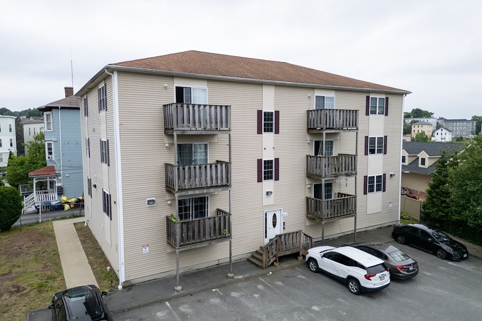
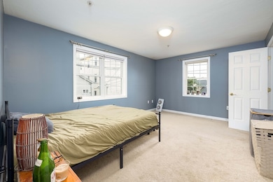
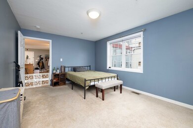
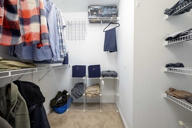
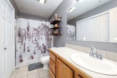
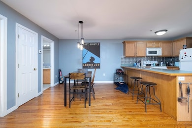
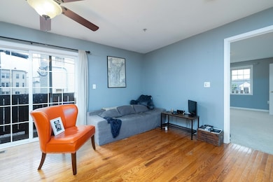
Welcome to 1 Fay Street, Unit 2—a modern 1-bedroom, 1-bath condo offering 719 square feet of comfortable living in the heart of Worcester’s vibrant Union Hill neighborhood. Built in 2006, this well-maintained unit features an open-concept layout that seamlessly connects the living and dining areas, perfect for everyday living or entertaining. The spacious bedroom includes a large walk-in closet, and the convenience of in-unit laundry and central air conditioning ensures year-round comfort. Enjoy your own private balcony, ideal for morning coffee or a peaceful evening unwind. Located just 0.6 miles from Worcester Union Station, the property offers easy access to the commuter rail with travel times to Boston around one hour, making it an excellent option for city professionals. Quick access to I-290 adds to the appeal, providing flexibility for regional travel. Experience the best of city energy and modern convenience—your new home at 1 Fay Street is ready to welcome you.
| Date | Type | Sale Price | Title Company |
|---|---|---|---|
| Quit Claim Deed | -- | -- | |
| Deed | $180,000 | -- | |
| Quit Claim Deed | -- | -- | |
| Quit Claim Deed | -- | -- | |
| Deed | $133,500 | -- | |
| Deed | $133,500 | -- |
| Date | Status | Loan Amount | Loan Type |
|---|---|---|---|
| Previous Owner | $133,500 | Purchase Money Mortgage |
| Date | Event | Price | List to Sale | Price per Sq Ft |
|---|---|---|---|---|
| 08/20/2025 08/20/25 | Sold | $180,000 | -12.2% | $250 / Sq Ft |
| 07/29/2025 07/29/25 | Pending | -- | -- | -- |
| 06/23/2025 06/23/25 | For Sale | $205,000 | -- | $285 / Sq Ft |
| Year | Tax Paid | Tax Assessment Tax Assessment Total Assessment is a certain percentage of the fair market value that is determined by local assessors to be the total taxable value of land and additions on the property. | Land | Improvement |
|---|---|---|---|---|
| 2025 | $2,394 | $181,500 | $0 | $181,500 |
| 2024 | $2,339 | $170,100 | $0 | $170,100 |
| 2023 | $2,108 | $147,000 | $0 | $147,000 |
| 2022 | $1,942 | $127,700 | $0 | $127,700 |
| 2021 | $2,007 | $123,300 | $0 | $123,300 |
| 2020 | $1,938 | $114,000 | $0 | $114,000 |
| 2019 | $2,002 | $111,200 | $0 | $111,200 |
| 2018 | $1,965 | $103,900 | $0 | $103,900 |
| 2017 | $1,955 | $101,700 | $0 | $101,700 |
| 2016 | $2,096 | $101,700 | $0 | $101,700 |
| 2015 | $2,041 | $101,700 | $0 | $101,700 |
| 2014 | $1,987 | $101,700 | $0 | $101,700 |
Seller's Agent in 2025
Kristie Belmont
Here Realty LLC
(401) 663-9664
1 in this area
60 Total Sales
Buyer's Agent in 2025
Nicholas Maruca
Castinetti Realty Group
(508) 735-5100
1 in this area
26 Total Sales
Source: MLS Property Information Network (MLS PIN)
MLS Number: 73395135
APN: WORC-000004-000013-000001-000002
Disclaimer: Certain information contained herein is derived from information provided by parties other than Homes.com. All information provided is deemed reliable, but is not guaranteed to be accurate and should be independently verified.
![]() The property listing data and information, or the Images, set forth herein were provided to MLS Property Information Network, Inc. from third party sources, including sellers, lessors and public records, and were compiled by MLS Property Information Network, Inc. The property listing data and information, and the Images, are for the personal, non-commercial use of consumers having a good faith interest in purchasing or leasing listed properties of the type displayed to them and may not be used for any purpose other than to identify prospective properties which such consumers may have a good faith interest in purchasing or leasing. MLS Property Information Network, Inc. and its subscribers disclaim any and all representations and warranties as to the accuracy of the property listing data and information, or as to the accuracy of any of the Images, set forth herein.
The property listing data and information, or the Images, set forth herein were provided to MLS Property Information Network, Inc. from third party sources, including sellers, lessors and public records, and were compiled by MLS Property Information Network, Inc. The property listing data and information, and the Images, are for the personal, non-commercial use of consumers having a good faith interest in purchasing or leasing listed properties of the type displayed to them and may not be used for any purpose other than to identify prospective properties which such consumers may have a good faith interest in purchasing or leasing. MLS Property Information Network, Inc. and its subscribers disclaim any and all representations and warranties as to the accuracy of the property listing data and information, or as to the accuracy of any of the Images, set forth herein.