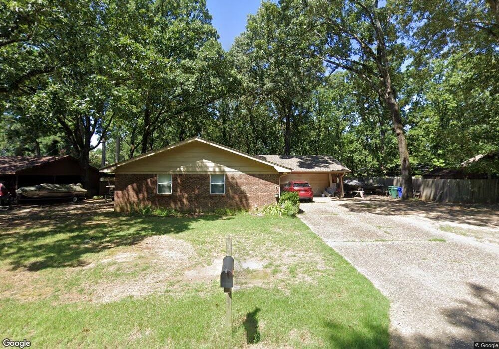
1 Forrest Ln Conway, AR 72034
Downtown Conway NeighborhoodEstimated Value: $253,000 - $292,000
--
Bed
2
Baths
1,824
Sq Ft
$145/Sq Ft
Est. Value
About This Home
This home is located at 1 Forrest Ln, Conway, AR 72034 and is currently estimated at $265,106, approximately $145 per square foot. 1 Forrest Ln is a home located in Faulkner County with nearby schools including Julia Lee Moore Elementary School, Conway Junior High School, and Conway High School.
Ownership History
Date
Name
Owned For
Owner Type
Purchase Details
Closed on
Jun 17, 2009
Bought by
Watson
Current Estimated Value
Home Financials for this Owner
Home Financials are based on the most recent Mortgage that was taken out on this home.
Original Mortgage
$134,838
Outstanding Balance
$85,514
Interest Rate
4.84%
Mortgage Type
VA
Estimated Equity
$179,592
Purchase Details
Closed on
Jan 13, 2004
Bought by
Carlson
Purchase Details
Closed on
Jul 13, 2001
Bought by
Porter
Purchase Details
Closed on
Sep 5, 1996
Bought by
Arey
Purchase Details
Closed on
Apr 22, 1993
Bought by
Amy Fraser
Purchase Details
Closed on
Jul 17, 1991
Bought by
N and Fraser
Purchase Details
Closed on
Jul 17, 1990
Bought by
R and Pardue
Purchase Details
Closed on
Jul 7, 1989
Bought by
D and Fouts
Create a Home Valuation Report for This Property
The Home Valuation Report is an in-depth analysis detailing your home's value as well as a comparison with similar homes in the area
Home Values in the Area
Average Home Value in this Area
Purchase History
| Date | Buyer | Sale Price | Title Company |
|---|---|---|---|
| Watson | $132,000 | -- | |
| Watson Jonathan Robert | $132,000 | Conway Title Svcs & Escrow I | |
| Carlson | $100,000 | -- | |
| Sirva Relocation | $100,000 | -- | |
| Porter | $95,000 | -- | |
| Arey | $88,000 | -- | |
| Amy Fraser | $6,000 | -- | |
| N | $78,000 | -- | |
| R | $71,000 | -- | |
| D | $70,000 | -- |
Source: Public Records
Mortgage History
| Date | Status | Borrower | Loan Amount |
|---|---|---|---|
| Open | Watson Jonathan Robert | $134,838 |
Source: Public Records
Tax History Compared to Growth
Tax History
| Year | Tax Paid | Tax Assessment Tax Assessment Total Assessment is a certain percentage of the fair market value that is determined by local assessors to be the total taxable value of land and additions on the property. | Land | Improvement |
|---|---|---|---|---|
| 2025 | $1,724 | $44,920 | $3,600 | $41,320 |
| 2024 | $1,646 | $44,920 | $3,600 | $41,320 |
| 2023 | $1,567 | $37,680 | $3,600 | $34,080 |
| 2022 | $1,124 | $37,680 | $3,600 | $34,080 |
| 2021 | $1,055 | $37,680 | $3,600 | $34,080 |
| 2020 | $987 | $26,920 | $3,600 | $23,320 |
| 2019 | $987 | $26,920 | $3,600 | $23,320 |
| 2018 | $1,012 | $26,920 | $3,600 | $23,320 |
| 2017 | $1,012 | $26,920 | $3,600 | $23,320 |
| 2016 | $1,012 | $26,920 | $3,600 | $23,320 |
| 2015 | $1,343 | $26,550 | $3,600 | $22,950 |
| 2014 | $993 | $26,550 | $3,600 | $22,950 |
Source: Public Records
Map
Nearby Homes
- 1145 Salem Rd
- 1205 Salem Rd
- 1240 Salem Rd
- 8 Smoking Oaks Rd
- 2850 Carmichael Dr
- 11 Red Oak Dr
- 10 W Post Oak Dr
- 26 Covewood Dr
- 2860 Broadmoor Dr
- 1715 Royal Dr
- 3115 Tyler St
- 1810 Royal Dr
- 3115 Baxter Dr
- 2585 Adamsbrooke Dr
- 879 Heather Cir
- 50 White Oak Dr
- 2550 Adamsbrooke Dr
- 1840 Drury Ln
- 1308 Hillcrest Dr
- 1130 Applewood Dr