
Seller's Agent in 2016
Mark Ford
RE/MAX
5 Total Sales

Estimated Value: $1,386,000 - $2,054,291
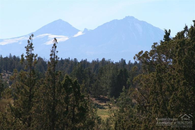
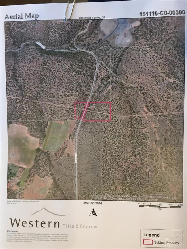
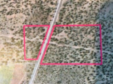
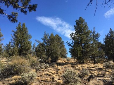
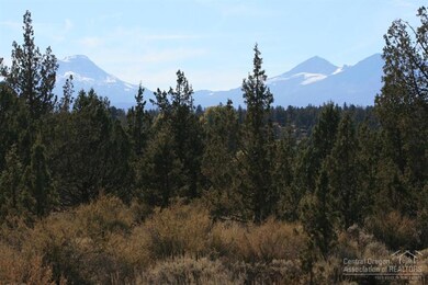
Cascade Mountain Views! Elevated up on a hill, tranquil seclusion on your property, 18.42 acres, adjacent to BLM/Public lands. Near Fryrear Trailhead. Ride your horse, hike and enjoy the open space. Power on the property. Septic feasibility & CUP expired, buyer to renew. Well irrigation rights may be available to purchase from Seller outside of escrow. Buyer to do their own due diligence for their intended use. Near Bend, Sisters and Redmond, trees & natural beauty.
Last Agent to Sell the Property
RE/MAX Key Properties License #900500060 Listed on: 09/25/2015
Last Buyer's Agent
Geffrey Kinnaman
Coldwell Banker Reed Bros Rlty License #201209064
Property Type
Est. Annual Taxes
Lot Details
Property Views
Schools
Community Details
Listing and Financial Details
| Date | Buyer | Sale Price | Title Company |
|---|---|---|---|
| Lilly Edward P | $269,000 | Western Title & Escrow |
| Date | Status | Borrower | Loan Amount |
|---|---|---|---|
| Open | Lily Edward P | $836,860 |
| Date | Event | Price | Change | Sq Ft Price |
|---|---|---|---|---|
| 04/08/2016 04/08/16 | Sold | $269,000 | -5.6% | -- |
| 10/25/2015 10/25/15 | Pending | -- | -- | -- |
| 09/25/2015 09/25/15 | For Sale | $284,900 | -- | -- |
| Year | Tax Paid | Tax Assessment Tax Assessment Total Assessment is a certain percentage of the fair market value that is determined by local assessors to be the total taxable value of land and additions on the property. | Land | Improvement |
|---|---|---|---|---|
| 2024 | $5,754 | $389,270 | -- | -- |
| 2023 | $5,587 | $377,940 | $0 | $0 |
| 2022 | $5,136 | $356,260 | $0 | $0 |
| 2021 | $4,906 | $345,890 | $0 | $0 |
| 2020 | $4,651 | $345,890 | $0 | $0 |
| 2019 | $3,169 | $234,480 | $0 | $0 |
| 2018 | $1,248 | $92,020 | $0 | $0 |
| 2017 | $1,204 | $89,340 | $0 | $0 |
| 2016 | $1,152 | $86,740 | $0 | $0 |
| 2015 | $1,091 | $84,220 | $0 | $0 |
| 2014 | $994 | $81,770 | $0 | $0 |
Seller's Agent in 2016
Mark Ford
RE/MAX
5 Total Sales
G
Buyer's Agent in 2016
Geffrey Kinnaman
Coldwell Banker Reed Bros Rlty
Source: Oregon Datashare
MLS Number: 201509606
APN: 266117
Disclaimer: Certain information contained herein is derived from information provided by parties other than Homes.com. All information provided is deemed reliable, but is not guaranteed to be accurate and should be independently verified.
![]() © 2025 Oregon Datashare (KCAR | MLSCO | SOMLS). All rights reserved. The data relating to real estate for sale on this web site comes in part from the Internet Data Exchange Program of the Oregon Datashare. Real estate listings held by IDX Brokerage firms other than Ten-X are marked with the Internet Data Exchange logo or the Internet Data Exchange thumbnail logo and detailed information about them includes the name of the listing Brokers. Information provided is for consumers' personal, non-commercial use and may not be used for any purpose other than to identify prospective properties the viewer may be interested in purchasing. The consumer will not copy, retransmit nor redistribute any of the content from this website. Information provided is deemed reliable, but not guaranteed.
© 2025 Oregon Datashare (KCAR | MLSCO | SOMLS). All rights reserved. The data relating to real estate for sale on this web site comes in part from the Internet Data Exchange Program of the Oregon Datashare. Real estate listings held by IDX Brokerage firms other than Ten-X are marked with the Internet Data Exchange logo or the Internet Data Exchange thumbnail logo and detailed information about them includes the name of the listing Brokers. Information provided is for consumers' personal, non-commercial use and may not be used for any purpose other than to identify prospective properties the viewer may be interested in purchasing. The consumer will not copy, retransmit nor redistribute any of the content from this website. Information provided is deemed reliable, but not guaranteed.