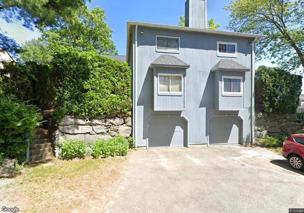
1 Gentry Ln Uxbridge, MA 01569
Estimated Value: $370,000 - $420,000
2
Beds
3
Baths
2,020
Sq Ft
$195/Sq Ft
Est. Value
About This Home
This home is located at 1 Gentry Ln, Uxbridge, MA 01569 and is currently estimated at $393,929, approximately $195 per square foot. 1 Gentry Ln is a home located in Worcester County with nearby schools including Uxbridge High School and Our Lady of the Valley Regional School.
Ownership History
Date
Name
Owned For
Owner Type
Purchase Details
Closed on
Mar 29, 1993
Sold by
Fnma
Bought by
King Karen E
Current Estimated Value
Home Financials for this Owner
Home Financials are based on the most recent Mortgage that was taken out on this home.
Original Mortgage
$67,410
Interest Rate
7.73%
Mortgage Type
Purchase Money Mortgage
Purchase Details
Closed on
Dec 31, 1992
Sold by
Dafonte Mario N
Bought by
Gmac Mtg Corp Iowa
Create a Home Valuation Report for This Property
The Home Valuation Report is an in-depth analysis detailing your home's value as well as a comparison with similar homes in the area
Home Values in the Area
Average Home Value in this Area
Purchase History
| Date | Buyer | Sale Price | Title Company |
|---|---|---|---|
| King Karen E | $74,900 | -- | |
| Gmac Mtg Corp Iowa | $156,106 | -- |
Source: Public Records
Mortgage History
| Date | Status | Borrower | Loan Amount |
|---|---|---|---|
| Open | Gmac Mtg Corp Iowa | $48,500 | |
| Closed | Gmac Mtg Corp Iowa | $62,200 | |
| Closed | Gmac Mtg Corp Iowa | $67,410 |
Source: Public Records
Tax History Compared to Growth
Tax History
| Year | Tax Paid | Tax Assessment Tax Assessment Total Assessment is a certain percentage of the fair market value that is determined by local assessors to be the total taxable value of land and additions on the property. | Land | Improvement |
|---|---|---|---|---|
| 2025 | $45 | $345,200 | $0 | $345,200 |
| 2024 | $4,447 | $344,200 | $0 | $344,200 |
| 2023 | $3,984 | $285,600 | $0 | $285,600 |
| 2022 | $3,409 | $224,900 | $0 | $224,900 |
| 2021 | $3,593 | $227,100 | $0 | $227,100 |
| 2020 | $3,624 | $216,500 | $0 | $216,500 |
| 2019 | $3,413 | $196,700 | $0 | $196,700 |
| 2018 | $3,625 | $211,100 | $0 | $211,100 |
| 2017 | $3,139 | $185,100 | $0 | $185,100 |
| 2016 | $3,164 | $180,100 | $0 | $180,100 |
| 2015 | $3,134 | $180,100 | $0 | $180,100 |
Source: Public Records
Map
Nearby Homes
- The Contemporary Villager Plan at Patriot's Landing
- Karenrose Sunnery Plan at Patriot's Landing
- 129 Quaker Hwy Unit 6
- 24 Road Ahr
- 328 Millville Rd
- 346 Millville Rd
- 288 High St
- 128 Mantell Rd
- 100 Spring Hill Dr Unit 100
- 395 High St
- Layla Plan at Pine Ridge
- Ashley Plan at Pine Ridge
- Lily Plan at Pine Ridge
- Brooklyn Plan at Pine Ridge
- Tucker Plan at Pine Ridge
- Everleigh Plan at Pine Ridge
- 104 Eber Taft Rd
- 23 Rifleman Way
- 37 Elizabeth St
- 286 Blackstone St
- 2 Duchess Path
- 6 Duchess Path
- 4 Duchess Path
- 4 Duchess Path Unit 9
- 3 Gentry Ln
- 7 Gentry Ln
- 5 Gentry Ln
- 5 Gentry Ln Unit 5
- 5 Gentry Ln Unit A
- 5 Gentry Ln Unit 10 a,10
- 7 Gentry Ln Unit 7
- 8 Duchess Path
- 1 Ascot Ln
- 3 Duchess Path
- 1 Duchess Path
- 1 Ascot Ln Unit 1
- 1 Ascot Ln Unit 8D
- 1 Duchess Path Unit 1
- 3 Duchess Path Unit 3
- 3 Ascot Ln