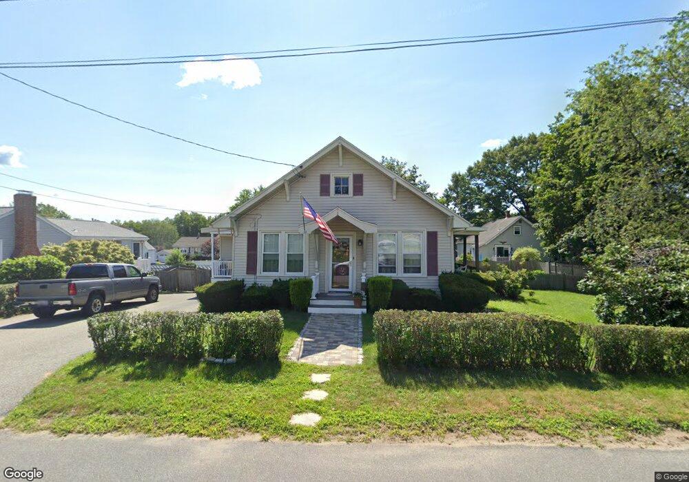
1 Greenway Cir Stoneham, MA 02180
Lindenwood NeighborhoodEstimated Value: $676,000 - $817,000
2
Beds
1
Bath
1,313
Sq Ft
$556/Sq Ft
Est. Value
About This Home
This home is located at 1 Greenway Cir, Stoneham, MA 02180 and is currently estimated at $729,640, approximately $555 per square foot. 1 Greenway Cir is a home located in Middlesex County with nearby schools including Stoneham High School, St. Patrick Elementary School, and Greater Boston Academy.
Ownership History
Date
Name
Owned For
Owner Type
Purchase Details
Closed on
Jan 9, 2025
Sold by
Mccarthy William J and Mccarthy Elizabeth A
Bought by
Mccarthy Elizabeth A
Current Estimated Value
Purchase Details
Closed on
May 16, 1991
Sold by
Quk Loretta C Est
Bought by
Mccarthy William J and Mccarthy Eliz A
Create a Home Valuation Report for This Property
The Home Valuation Report is an in-depth analysis detailing your home's value as well as a comparison with similar homes in the area
Home Values in the Area
Average Home Value in this Area
Purchase History
| Date | Buyer | Sale Price | Title Company |
|---|---|---|---|
| Mccarthy Elizabeth A | -- | Stewart Title | |
| Mccarthy Elizabeth A | -- | Stewart Title | |
| Mccarthy William J | $136,000 | -- | |
| Mccarthy William J | $136,000 | -- |
Source: Public Records
Mortgage History
| Date | Status | Borrower | Loan Amount |
|---|---|---|---|
| Previous Owner | Mccarthy William J | $176,000 | |
| Previous Owner | Mccarthy William J | $175,000 | |
| Previous Owner | Mccarthy William J | $108,000 |
Source: Public Records
Tax History Compared to Growth
Tax History
| Year | Tax Paid | Tax Assessment Tax Assessment Total Assessment is a certain percentage of the fair market value that is determined by local assessors to be the total taxable value of land and additions on the property. | Land | Improvement |
|---|---|---|---|---|
| 2025 | $6,340 | $619,700 | $400,000 | $219,700 |
| 2024 | $6,196 | $585,100 | $370,000 | $215,100 |
| 2023 | $6,162 | $555,100 | $340,000 | $215,100 |
| 2022 | $5,447 | $523,200 | $320,000 | $203,200 |
| 2021 | $5,386 | $497,800 | $300,000 | $197,800 |
| 2020 | $5,397 | $500,200 | $300,000 | $200,200 |
| 2019 | $5,087 | $453,400 | $270,000 | $183,400 |
| 2018 | $4,869 | $415,800 | $250,000 | $165,800 |
| 2017 | $4,993 | $403,000 | $240,000 | $163,000 |
| 2016 | $4,412 | $347,400 | $230,000 | $117,400 |
| 2015 | $4,399 | $339,400 | $230,000 | $109,400 |
| 2014 | $4,414 | $327,200 | $210,000 | $117,200 |
Source: Public Records
Map
Nearby Homes
- 20 Oak St
- 405 William St
- 159 Main St Unit 41C
- 12 Cottage St
- 1 Tremont St
- 8 Steele St
- 200 Ledgewood Dr Unit 505
- 100 Ledgewood Dr Unit 417
- 100 Ledgewood Dr Unit 618
- 97 Oak St
- 10 Pomeworth St Unit H
- 21 Tremont St Unit A
- 68 Main St Unit 36C
- 43 Pomeworth St Unit 44
- 62 High St Unit 4
- 62 High St Unit 3
- 62 High St Unit Lot 12
- 62 High St Unit Lot 2
- 62 High St Unit Lot 7
- 62 High St Unit Lot 9
- 301 William St
- 2 Christine Ave
- 3 Greenway Cir
- 291 William St
- 4 Christine Ave
- 32 Sunrise Ave
- 311 William St
- 31 Sunrise Ave
- 8 Christine Ave
- 5 Greenway Cir
- 290 William St
- 294 William St
- 302 William St
- 314 William St
- 325 William St
- 3 Christine Ave
- 29 Sunrise Ave
- 10 Christine Ave
- 30 Sunrise Ave
- 7 Greenway Cir