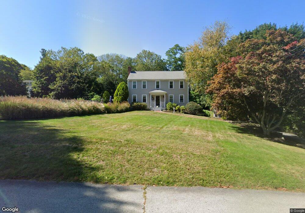
1 Gridley Bryant Rd Scituate, MA 02066
Estimated Value: $1,057,861 - $1,150,000
4
Beds
3
Baths
2,477
Sq Ft
$447/Sq Ft
Est. Value
About This Home
This home is located at 1 Gridley Bryant Rd, Scituate, MA 02066 and is currently estimated at $1,106,715, approximately $446 per square foot. 1 Gridley Bryant Rd is a home located in Plymouth County with nearby schools including Hatherly Elementary School, Lester J. Gates Middle School, and Scituate High School.
Ownership History
Date
Name
Owned For
Owner Type
Purchase Details
Closed on
Oct 25, 2018
Sold by
Dehn Arthur R and Dehn Pamela A
Bought by
Dehn Leaving T
Current Estimated Value
Purchase Details
Closed on
Aug 5, 1983
Bought by
Dehn Arthur R and Dehn Pamela
Create a Home Valuation Report for This Property
The Home Valuation Report is an in-depth analysis detailing your home's value as well as a comparison with similar homes in the area
Home Values in the Area
Average Home Value in this Area
Purchase History
| Date | Buyer | Sale Price | Title Company |
|---|---|---|---|
| Dehn Leaving T | -- | -- | |
| Dehn Arthur R | $129,900 | -- |
Source: Public Records
Mortgage History
| Date | Status | Borrower | Loan Amount |
|---|---|---|---|
| Previous Owner | Dehn Arthur R | $100,000 | |
| Previous Owner | Dehn Arthur R | $88,700 | |
| Previous Owner | Dehn Arthur R | $25,000 |
Source: Public Records
Tax History Compared to Growth
Tax History
| Year | Tax Paid | Tax Assessment Tax Assessment Total Assessment is a certain percentage of the fair market value that is determined by local assessors to be the total taxable value of land and additions on the property. | Land | Improvement |
|---|---|---|---|---|
| 2025 | $8,704 | $871,300 | $353,700 | $517,600 |
| 2024 | $8,591 | $829,200 | $321,600 | $507,600 |
| 2023 | $8,792 | $780,600 | $309,500 | $471,100 |
| 2022 | $8,792 | $696,700 | $295,500 | $401,200 |
| 2021 | $8,505 | $638,000 | $281,400 | $356,600 |
| 2020 | $8,249 | $611,000 | $270,600 | $340,400 |
| 2019 | $8,126 | $591,400 | $265,300 | $326,100 |
| 2018 | $8,053 | $577,300 | $276,500 | $300,800 |
| 2017 | $7,823 | $555,200 | $265,400 | $289,800 |
| 2016 | $7,538 | $533,100 | $243,300 | $289,800 |
| 2015 | $6,838 | $522,000 | $232,200 | $289,800 |
Source: Public Records
Map
Nearby Homes
- 26 Mordecai Lincoln Rd
- 16 3 Ring Rd
- 11 Forest Ln
- 9 Forest Ln Unit 9
- 84 Booth Hill Rd
- 817 Country Way
- 112 Hollett St
- 8 Trudys Ln
- 392 S Main St
- 7 Border St
- 9 Kyle Path
- 40 Brewster Rd
- 309 S Main St
- 14 Aberdeen Dr
- 59 Captain Peirce Rd
- 29 Country Club Cir
- 70 Black Horse Ln
- 68 Black Horse Ln
- 0 Bates Ln (Lot E Kevin's Way) Unit 73419598
- 212 S Main St
- 3 Gridley Bryant Rd
- 720 Country Way
- 4 Gridley Bryant Rd
- 724 Country Way
- 5 Gridley Bryant Rd
- 5 Gridley Bryant Rd
- 5 Gridley Bryant Rd
- 12 Wade St
- 8 Gridley Bryant Rd
- 728 Country Way
- 712 Country Way
- 719 Country Way
- 12 Gridley Bryant Rd
- 7 Gridley Bryant Rd
- 16 Wade St
- 723 Country Way
- 9 Wade St
- 9 Gridley Bryant Rd
- 717 Country Way
- 708 Country Way