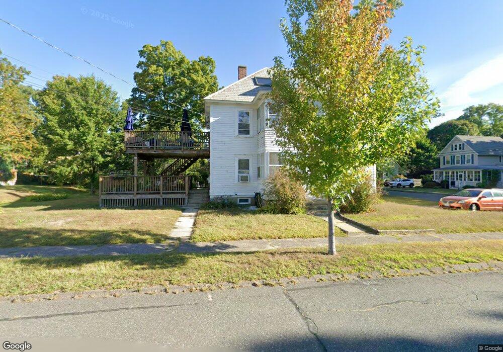
1 High St Florence, MA 01062
Florence NeighborhoodEstimated Value: $461,000 - $822,000
3
Beds
2
Baths
3,174
Sq Ft
$209/Sq Ft
Est. Value
About This Home
This home is located at 1 High St, Florence, MA 01062 and is currently estimated at $664,688, approximately $209 per square foot. 1 High St is a home located in Hampshire County with nearby schools including Northampton High School, The Montessori School of Northampton, and Lander Grinspoon Academy.
Create a Home Valuation Report for This Property
The Home Valuation Report is an in-depth analysis detailing your home's value as well as a comparison with similar homes in the area
Home Values in the Area
Average Home Value in this Area
Tax History Compared to Growth
Tax History
| Year | Tax Paid | Tax Assessment Tax Assessment Total Assessment is a certain percentage of the fair market value that is determined by local assessors to be the total taxable value of land and additions on the property. | Land | Improvement |
|---|---|---|---|---|
| 2025 | $9,407 | $495,900 | $94,300 | $401,600 |
| 2024 | $8,742 | $483,000 | $94,300 | $388,700 |
| 2023 | $8,681 | $442,000 | $94,300 | $347,700 |
| 2022 | $8,594 | $442,100 | $91,900 | $350,200 |
| 2021 | $8,491 | $404,900 | $91,900 | $313,000 |
| 2019 | $7,574 | $382,500 | $91,600 | $290,900 |
| 2018 | $7,377 | $382,500 | $91,600 | $290,900 |
| 2017 | $7,336 | $382,500 | $91,600 | $290,900 |
| 2016 | $7,172 | $382,500 | $91,600 | $290,900 |
| 2015 | $6,971 | $387,500 | $96,600 | $290,900 |
| 2014 | $6,731 | $387,500 | $96,600 | $290,900 |
Source: Public Records
Map
Nearby Homes
- 152 S Main St Unit 4
- 76 Maple St
- 67 Park St Unit A
- 67 Park St Unit B
- 67 Park St Unit D
- 0 Terrace Ln
- 84 N Main St
- 37 Landy Ave
- 225 Nonotuck St Unit C
- 63 Riverside Dr
- 96 Rick Dr
- 11 Norwood Ave
- 76 Cooke Ave
- 325 Riverside Dr
- 321 Riverside Dr
- 61 Woodlawn Ave
- 74 Barrett St Unit 105
- 14 Arlington St
- 218 Elm St
- 49 Kensington Ave