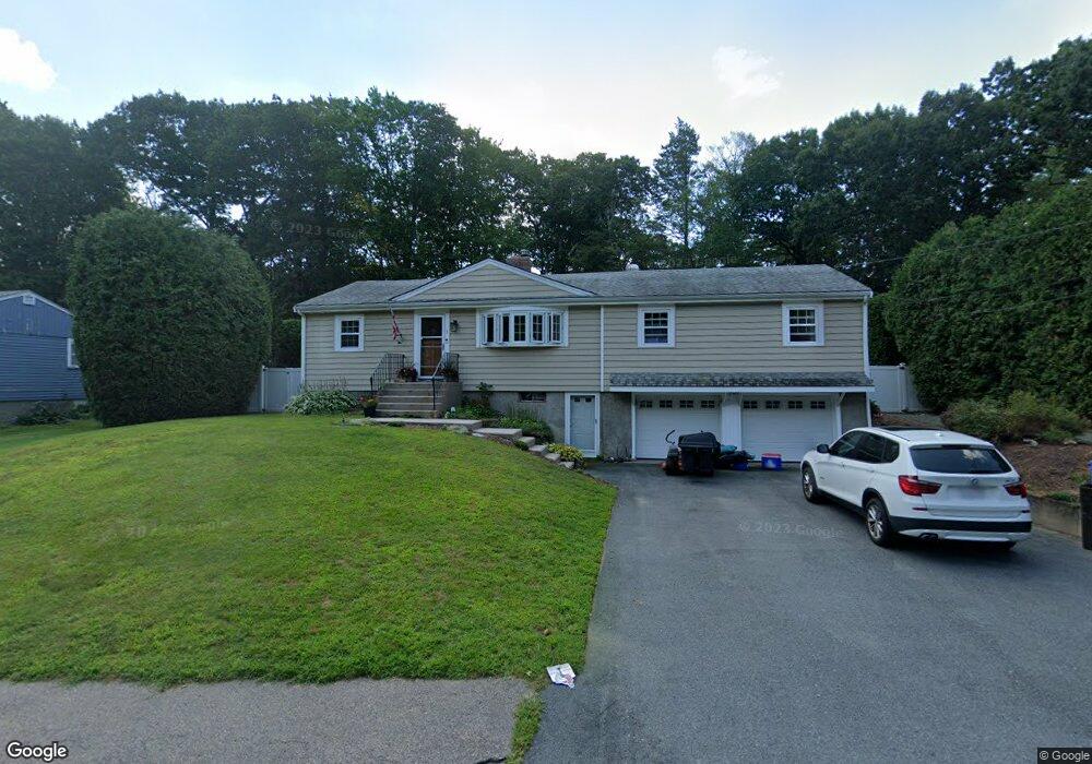
1 Jean Rd Walpole, MA 02081
Estimated Value: $591,000 - $643,335
3
Beds
2
Baths
1,320
Sq Ft
$471/Sq Ft
Est. Value
About This Home
This home is located at 1 Jean Rd, Walpole, MA 02081 and is currently estimated at $621,084, approximately $470 per square foot. 1 Jean Rd is a home located in Norfolk County with nearby schools including Boyden School, Eleanor N. Johnson Middle School, and Walpole High School.
Ownership History
Date
Name
Owned For
Owner Type
Purchase Details
Closed on
Dec 15, 1999
Sold by
Sullivan Maureen T
Bought by
Sntonitis Robert F and Antonitis Maureen C
Current Estimated Value
Home Financials for this Owner
Home Financials are based on the most recent Mortgage that was taken out on this home.
Original Mortgage
$180,500
Interest Rate
7.81%
Mortgage Type
Purchase Money Mortgage
Create a Home Valuation Report for This Property
The Home Valuation Report is an in-depth analysis detailing your home's value as well as a comparison with similar homes in the area
Home Values in the Area
Average Home Value in this Area
Purchase History
| Date | Buyer | Sale Price | Title Company |
|---|---|---|---|
| Sntonitis Robert F | $190,000 | -- |
Source: Public Records
Mortgage History
| Date | Status | Borrower | Loan Amount |
|---|---|---|---|
| Open | Sntonitis Robert F | $211,000 | |
| Closed | Sntonitis Robert F | $180,500 | |
| Previous Owner | Sntonitis Robert F | $82,000 |
Source: Public Records
Tax History
| Year | Tax Paid | Tax Assessment Tax Assessment Total Assessment is a certain percentage of the fair market value that is determined by local assessors to be the total taxable value of land and additions on the property. | Land | Improvement |
|---|---|---|---|---|
| 2025 | $7,132 | $555,900 | $291,800 | $264,100 |
| 2024 | $6,878 | $520,300 | $280,600 | $239,700 |
| 2023 | $6,684 | $481,200 | $244,000 | $237,200 |
| 2022 | $6,322 | $437,200 | $226,000 | $211,200 |
| 2021 | $5,917 | $398,700 | $213,200 | $185,500 |
| 2020 | $5,872 | $391,700 | $201,100 | $190,600 |
| 2019 | $5,711 | $378,200 | $193,400 | $184,800 |
| 2018 | $5,180 | $339,200 | $186,400 | $152,800 |
| 2017 | $5,027 | $327,900 | $179,200 | $148,700 |
| 2016 | $4,959 | $318,700 | $172,300 | $146,400 |
| 2015 | $4,834 | $307,900 | $164,100 | $143,800 |
| 2014 | $4,488 | $284,800 | $164,100 | $120,700 |
Source: Public Records
Map
Nearby Homes
- 375 Winter St
- 16R Eldor Dr
- 4 Haydn Ln
- 5 Jackson Dr
- 260 Summer St
- 1187 West St
- 9 Pearl St
- 38 Irving Dr
- 7 Hill St Unit 12
- 7 Hill St Unit 16
- 3 Stone Hill Terrace
- 1549 Washington St Unit A
- 3 Weathervane Dr Unit 1
- 10 Weathervane Dr Unit 20
- 465 Lincoln Rd
- 533 Lincoln Rd
- 25 Sandtrap Cir Unit 8
- 29 Sandtrap Cir Unit 6
- 27 Sandtrap Cir Unit 7
- 21 Sandtrap Cir Unit 10
Your Personal Tour Guide
Ask me questions while you tour the home.