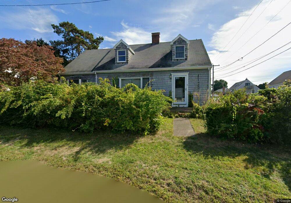
1 Juniper Rd Gloucester, MA 01930
Riverview NeighborhoodEstimated Value: $707,000 - $815,000
3
Beds
2
Baths
1,586
Sq Ft
$485/Sq Ft
Est. Value
About This Home
This home is located at 1 Juniper Rd, Gloucester, MA 01930 and is currently estimated at $768,514, approximately $484 per square foot. 1 Juniper Rd is a home located in Essex County with nearby schools including Beeman Memorial, Ralph B O'maley Middle School, and Gloucester High School.
Ownership History
Date
Name
Owned For
Owner Type
Purchase Details
Closed on
Nov 25, 2002
Sold by
Juniper 1 Rt
Bought by
Williams Brian C
Current Estimated Value
Home Financials for this Owner
Home Financials are based on the most recent Mortgage that was taken out on this home.
Original Mortgage
$147,000
Interest Rate
6.07%
Mortgage Type
Purchase Money Mortgage
Create a Home Valuation Report for This Property
The Home Valuation Report is an in-depth analysis detailing your home's value as well as a comparison with similar homes in the area
Home Values in the Area
Average Home Value in this Area
Purchase History
| Date | Buyer | Sale Price | Title Company |
|---|---|---|---|
| Williams Brian C | $309,000 | -- |
Source: Public Records
Mortgage History
| Date | Status | Borrower | Loan Amount |
|---|---|---|---|
| Open | Williams Brian C | $130,000 | |
| Closed | Williams Brian C | $147,000 |
Source: Public Records
Tax History
| Year | Tax Paid | Tax Assessment Tax Assessment Total Assessment is a certain percentage of the fair market value that is determined by local assessors to be the total taxable value of land and additions on the property. | Land | Improvement |
|---|---|---|---|---|
| 2025 | $5,897 | $606,700 | $243,300 | $363,400 |
| 2024 | $5,898 | $606,200 | $231,800 | $374,400 |
| 2023 | $5,721 | $540,200 | $206,900 | $333,300 |
| 2022 | $5,171 | $440,800 | $175,900 | $264,900 |
| 2021 | $5,200 | $418,000 | $160,000 | $258,000 |
| 2020 | $4,970 | $403,100 | $160,000 | $243,100 |
| 2019 | $4,933 | $388,700 | $160,000 | $228,700 |
| 2018 | $4,941 | $382,100 | $160,000 | $222,100 |
| 2017 | $4,750 | $360,100 | $152,300 | $207,800 |
| 2016 | $4,660 | $342,400 | $152,800 | $189,600 |
| 2015 | $4,479 | $328,100 | $152,800 | $175,300 |
Source: Public Records
Map
Nearby Homes
- 13 Honeysuckle Rd
- 3 Deacon Farm Ln
- 31 Echo Ave
- 2 Breezy Point Rd
- 167 Atlantic St
- 6 Monroe Ct
- 13 Mystic Ave
- 178 Atlantic St
- 8 Mystic Ave
- 98 Maplewood Ave
- 145 Essex Ave Unit 402
- 5 Samoset Rd Unit B
- 672 Washington St
- 24 Cobblestone Ln Unit 603
- 15 Harvard St
- 5 Lepage Ln
- 226 Atlantic St
- 9 Cleveland Place
- 12 Arthur St
- 40 Sargent St
Your Personal Tour Guide
Ask me questions while you tour the home.