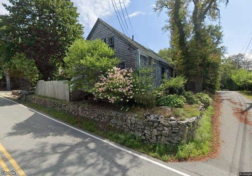
1 Keen Ave Kittery Point, ME 03905
Kittery Point NeighborhoodEstimated Value: $573,782 - $715,000
3
Beds
2
Baths
1,243
Sq Ft
$521/Sq Ft
Est. Value
About This Home
This home is located at 1 Keen Ave, Kittery Point, ME 03905 and is currently estimated at $647,946, approximately $521 per square foot. 1 Keen Ave is a home with nearby schools including Horace Mitchell Primary School, Shapleigh School, and Robert W Traip Academy.
Ownership History
Date
Name
Owned For
Owner Type
Purchase Details
Closed on
Nov 9, 2017
Sold by
Hill David B
Bought by
Kershaw Debbie M
Current Estimated Value
Home Financials for this Owner
Home Financials are based on the most recent Mortgage that was taken out on this home.
Original Mortgage
$196,377
Interest Rate
3.83%
Mortgage Type
FHA
Create a Home Valuation Report for This Property
The Home Valuation Report is an in-depth analysis detailing your home's value as well as a comparison with similar homes in the area
Home Values in the Area
Average Home Value in this Area
Purchase History
| Date | Buyer | Sale Price | Title Company |
|---|---|---|---|
| Kershaw Debbie M | -- | -- |
Source: Public Records
Mortgage History
| Date | Status | Borrower | Loan Amount |
|---|---|---|---|
| Closed | Kershaw Debbie M | $196,377 |
Source: Public Records
Tax History Compared to Growth
Tax History
| Year | Tax Paid | Tax Assessment Tax Assessment Total Assessment is a certain percentage of the fair market value that is determined by local assessors to be the total taxable value of land and additions on the property. | Land | Improvement |
|---|---|---|---|---|
| 2024 | $4,491 | $316,300 | $153,600 | $162,700 |
| 2023 | $4,305 | $316,300 | $153,600 | $162,700 |
| 2022 | $4,264 | $316,300 | $153,600 | $162,700 |
| 2021 | $4,099 | $315,300 | $153,600 | $161,700 |
| 2020 | $4,067 | $315,300 | $153,600 | $161,700 |
| 2019 | $3,548 | $203,900 | $78,000 | $125,900 |
| 2018 | $3,213 | $203,900 | $78,000 | $125,900 |
| 2017 | $2,130 | $203,900 | $78,000 | $125,900 |
| 2016 | $3,183 | $198,300 | $78,000 | $120,300 |
| 2015 | $3,107 | $198,300 | $78,000 | $120,300 |
| 2014 | $3,078 | $198,300 | $78,000 | $120,300 |
| 2013 | $3,018 | $198,300 | $78,000 | $120,300 |
Source: Public Records
Map
Nearby Homes
- 132 Pepperrell Rd
- 15 Foyes Ln
- 39 Tenney Hill Rd
- 58 Foyes Ln
- 72 Pepperrell Rd
- 24 Seabreeze Ln
- 205 Whipple Rd
- 15 Atkinson St
- 17 Elm Ct
- 25 Bartlett Rd
- 175 Wentworth Rd
- 14 Colonial Ln
- 2 Washburn Farm Ln Unit 1
- 7 Washburn Farm Ln Unit 9
- 12 Gillis Dr Unit 3
- 78 Norton Rd Unit 6
- 20 Washburn Farm Ln Unit 5
- 18 Washburn Farm Ln Unit 4
- 18 Mainmast Cir
- 116 Whipple Rd
- 17 Keene
- 172 Pepperrell Rd
- 182 Pepperrell Rd
- 000 Keen Ave
- 4 Keen Ave
- 175 Pepperrell Rd
- 177 Pepperrell Rd
- 179 Pepperrell Rd
- 169 Pepperrell Rd
- 167 Pepperrell Way(route 103)
- 6 Keen Ave
- 165 Pepperrell Rd
- 167 Pepperrell Rd
- 2 Chauncey Creek Rd
- 5 Keen Ave
- 3 Tenney Hill Rd
- 4A Chauncey Creek Rd
- 2 Tenney Hill Rd
- 163 Pepperrell Rd
- 4 Chauncey Creek Rd