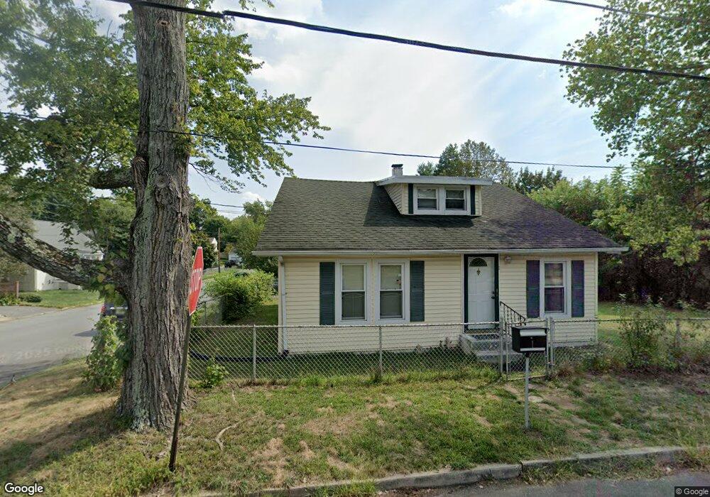
1 Kern Ave Ewing, NJ 08638
Braeburn Heights NeighborhoodEstimated Value: $276,658 - $404,000
--
Bed
--
Bath
1,653
Sq Ft
$208/Sq Ft
Est. Value
About This Home
This home is located at 1 Kern Ave, Ewing, NJ 08638 and is currently estimated at $343,165, approximately $207 per square foot. 1 Kern Ave is a home located in Mercer County with nearby schools including Ewing High School, Paul Robeson Charter School For The Humanities, and Trenton Stem-To-Civics Charter School.
Ownership History
Date
Name
Owned For
Owner Type
Purchase Details
Closed on
Oct 16, 2025
Sold by
Ikegwu Kate N and Ikegwu Albert
Bought by
Ikegwu Kate N
Current Estimated Value
Home Financials for this Owner
Home Financials are based on the most recent Mortgage that was taken out on this home.
Original Mortgage
$265,000
Outstanding Balance
$264,749
Interest Rate
6.26%
Mortgage Type
New Conventional
Estimated Equity
$78,416
Purchase Details
Closed on
Oct 23, 2001
Sold by
Pitonyak Lisa
Bought by
Ikegwu Kate
Purchase Details
Closed on
May 1, 1995
Sold by
Coleman David H
Bought by
Pietras Peter and Pationyak Lisa
Create a Home Valuation Report for This Property
The Home Valuation Report is an in-depth analysis detailing your home's value as well as a comparison with similar homes in the area
Home Values in the Area
Average Home Value in this Area
Purchase History
| Date | Buyer | Sale Price | Title Company |
|---|---|---|---|
| Ikegwu Kate N | -- | Monarch Title | |
| Ikegwu Kate | $52,000 | -- | |
| Pietras Peter | $45,000 | -- |
Source: Public Records
Mortgage History
| Date | Status | Borrower | Loan Amount |
|---|---|---|---|
| Open | Ikegwu Kate N | $265,000 |
Source: Public Records
Tax History Compared to Growth
Tax History
| Year | Tax Paid | Tax Assessment Tax Assessment Total Assessment is a certain percentage of the fair market value that is determined by local assessors to be the total taxable value of land and additions on the property. | Land | Improvement |
|---|---|---|---|---|
| 2025 | $6,128 | $155,800 | $48,300 | $107,500 |
| 2024 | $5,760 | $155,800 | $48,300 | $107,500 |
| 2023 | $5,760 | $155,800 | $48,300 | $107,500 |
| 2022 | $5,604 | $155,800 | $48,300 | $107,500 |
| 2021 | $5,467 | $155,800 | $48,300 | $107,500 |
| 2020 | $5,389 | $155,800 | $48,300 | $107,500 |
| 2019 | $5,249 | $155,800 | $48,300 | $107,500 |
| 2018 | $4,432 | $83,900 | $28,500 | $55,400 |
| 2017 | $4,535 | $83,900 | $28,500 | $55,400 |
| 2016 | $4,474 | $83,900 | $28,500 | $55,400 |
| 2015 | $4,414 | $83,900 | $28,500 | $55,400 |
| 2014 | $4,402 | $83,900 | $28,500 | $55,400 |
Source: Public Records
Map
Nearby Homes
- 91 Groveland Ave
- 17 Hillman Ave
- 50 Hillman Ave
- 50 Groveland Ave
- 9 Auburn Ave
- 14 Chesney Ave
- 107 Hawthorne Ave
- 1583 Pennington Rd
- 137 Ardsley Ave
- 1635 Ninth St
- 6 New Hillcrest Ave
- 1419 Pennington Rd
- 37 Hazelhurst Ave
- 7 Pershing Ave
- 194 Woodland Ave
- 644 Concord Cir
- 260 Weber Ave
- 41 Poland St
- 28 Brattle Ave
- 111 Louisiana Ave