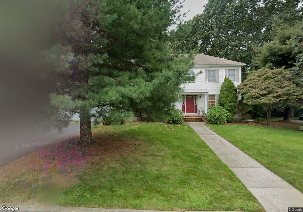
1 Lace Cir Cranston, RI 02921
Comstock Gardens NeighborhoodEstimated Value: $767,772 - $906,000
3
Beds
3
Baths
2,344
Sq Ft
$365/Sq Ft
Est. Value
About This Home
This home is located at 1 Lace Cir, Cranston, RI 02921 and is currently estimated at $855,443, approximately $364 per square foot. 1 Lace Cir is a home located in Providence County with nearby schools including Orchard Farms El. School, Western Hills Middle School, and Cranston High School West.
Ownership History
Date
Name
Owned For
Owner Type
Purchase Details
Closed on
Jan 30, 2019
Sold by
Weitzner Jonathan A
Bought by
Jonathan Weitzner Ret
Current Estimated Value
Purchase Details
Closed on
Aug 24, 2011
Sold by
Weitzner Jonathan A and Weitzner Lorraine
Bought by
Weitzner Jonathan A
Home Financials for this Owner
Home Financials are based on the most recent Mortgage that was taken out on this home.
Original Mortgage
$344,000
Interest Rate
4.53%
Purchase Details
Closed on
Oct 8, 1992
Sold by
Montaquila Thomas P and Montaquila Maria
Bought by
Weitzner Jonathan A and Weitzner Lorraine
Create a Home Valuation Report for This Property
The Home Valuation Report is an in-depth analysis detailing your home's value as well as a comparison with similar homes in the area
Home Values in the Area
Average Home Value in this Area
Purchase History
| Date | Buyer | Sale Price | Title Company |
|---|---|---|---|
| Jonathan Weitzner Ret | -- | -- | |
| Weitzner Jonathan A | -- | -- | |
| Weitzner Jonathan A | $248,500 | -- |
Source: Public Records
Mortgage History
| Date | Status | Borrower | Loan Amount |
|---|---|---|---|
| Previous Owner | Weitzner Jonathan A | $250,000 | |
| Previous Owner | Weitzner Jonathan A | $344,000 | |
| Previous Owner | Weitzner Jonathan A | $173,000 | |
| Previous Owner | Weitzner Jonathan A | $180,000 |
Source: Public Records
Tax History
| Year | Tax Paid | Tax Assessment Tax Assessment Total Assessment is a certain percentage of the fair market value that is determined by local assessors to be the total taxable value of land and additions on the property. | Land | Improvement |
|---|---|---|---|---|
| 2025 | $9,136 | $658,200 | $173,400 | $484,800 |
| 2024 | $8,958 | $658,200 | $173,400 | $484,800 |
| 2023 | $8,582 | $454,100 | $123,800 | $330,300 |
| 2022 | $8,405 | $454,100 | $123,800 | $330,300 |
| 2021 | $8,174 | $454,100 | $123,800 | $330,300 |
| 2020 | $8,516 | $410,000 | $145,100 | $264,900 |
| 2019 | $8,516 | $410,000 | $145,100 | $264,900 |
| 2018 | $8,319 | $410,000 | $145,100 | $264,900 |
| 2017 | $9,130 | $398,000 | $153,700 | $244,300 |
| 2016 | $8,935 | $398,000 | $153,700 | $244,300 |
| 2015 | $8,935 | $398,000 | $153,700 | $244,300 |
| 2014 | $8,535 | $373,700 | $128,100 | $245,600 |
Source: Public Records
Map
Nearby Homes
- 02 Paula Ln
- 01 Paula Ln
- 0 W Bluebird Ln
- 121 Ashbrook Dr
- 2073 Plainfield Pike
- 12 Beechwood Dr
- 7 Taylor Rd
- 191 Pippin Orchard Rd
- 5 Braeburn Cir
- 1 Alexandria Way
- 2202 Scituate Ave
- 154 Beechwood Dr
- 79 Taylor Rd
- 1275 Seven Mile Rd
- 1495 Pippin Orchard Rd
- 141 Fox Ridge Dr
- 1835 Plainfield Pike
- 102 Moccasin Trail
- 20 Doreen Ct
- 560 Seven Mile Rd
- 0 Lace Cir
- 7 Lace Cir
- 167 Lace Cir
- 2 Lace Cir
- 33 Belle Isle Way
- 10 Lace Cir
- 14 Lace Cir
- 25 Belle Isle Way
- 2 Pine Ridge Dr
- 36 Belle Isle Way
- 1 Pine Ridge Dr
- 41 Caraway Dr
- 19 Belle Isle Way
- 44 Sage Dr
- 0 Pine Ridge Dr Unit 636548
- 0 Pine Ridge Dr Unit 644712
- 0 Pine Ridge Dr Unit 734875
- 0 Pine Ridge Dr Unit 993143
- 33 Caraway Dr
- 40 Sage Dr
Your Personal Tour Guide
Ask me questions while you tour the home.